Top

2018 | Book

Geomatic Approaches for Modeling Land Change Scenarios

Editors: Dr. María Teresa Camacho Olmedo, Dr. Martin Paegelow, Dr. Jean-François  Mas, Dr. Francisco  Escobar

Publisher: Springer International Publishing

Book Series : Lecture Notes in Geoinformation and Cartography

insite
SEARCH

About this book

This book provides a detailed overview of the concepts, techniques, applications, and methodological approaches involved in land use and cover change (LUCC) modeling, also known simply as land change modeling. More than 40 international experts in this field have participated in this book, which illustrates recent advances in LUCC modeling with examples from North and South America, the Middle East, and Europe. Given the broad range of geomatic approaches available, it helps readers select the approach that best meets their needs. The book is structured into five parts preceded by a foreword written by Roger White and a general introduction. Part I consists of four chapters, each of which focuses on a specific stage in the modeling process: calibration, simulation, validation, and scenarios. It presents and explains the fundamental ideas and concepts underlying LUCC modeling. This is complemented by a comparative analysis of the selected software packages, practically applied in various case studies in Part II and Part III. Part II discusses recently proposed methodological developments that have enhanced modeling procedures and results while Part III offers case studies as well as interesting, innovative methodological proposals. Part IV revises different fundamental techniques used in LUCC modeling and finally Part V describes the best-known software packages used in the applications presented in Parts II and III.
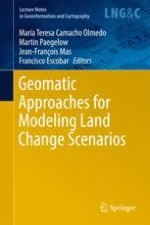
Table of Contents

Frontmatter
Chapter 1. Geomatic Approaches for Modeling Land Change Scenarios. An Introduction

Land change models can help scientists and users to understand change processes and design policies to reduce the negative impact of human activities on the earth system at scales ranging from global to local. With the development of increasingly large computing capacities, multiple computer-based models have been created, with the result that the specific domain covered by the umbrella term “modeling” has become rather vague. Even within the context of the spatiotemporal modeling of land use and cover changes (LUCC), the term “modeling” can have many different meanings. There is also an increasing interest in the literature in comparing the different land change models. One of the aims of this book is to contribute to these processes. We focus on geomatic modeling approaches applied in this context to land change, a term that has been used synonymously for a number of years with LUCC and seems to be overtaking it as the generally used term for this phenomenon. The objective of this book is also clear to see from the methods we have chosen and the subjects we address. This book deals first and foremost with spatially explicit data that can be mapped. However, its additional focus on land change and land change scenarios in the wider field of environmental and social dynamics give it a certain consistency with a view to practical applications.

M. T. Camacho Olmedo, M. Paegelow, J. F. Mas, F. Escobar

Concepts and Tools

Frontmatter
Chapter 2. LUCC Modeling Approaches to Calibration

In land change modeling, calibration enables the modeler to establish the parameters for the model in order to produce expected outcomes, similar to those observed for the study area over a period in the past or consistent with a given scenario. Depending on the modeling approach, the parameters are set using maps which describe past change or information obtained from experts or stakeholders. These parameters will control the behavior of the model during the simulation with regard to aspects such as the quantity and the spatiotemporal patterns of modeled change. This chapter focuses on different aspects of calibration, such as the selection and transformation of input variables and the different approaches for estimating the parameters of the most common pattern-based models (PBM) and constraint cellular automata-based models (CCAM).

J. F. Mas, M. Paegelow, M. T. Camacho Olmedo
Chapter 3. The Simulation Stage in LUCC Modeling

In land change modeling, the simulation stage uses parameters and processes to allocate changes by resolving competition between transitions. They are also used to reproduce spatiotemporal patterns of modeled change. There are also several advanced options that try to improve the simulation outputs. This chapter focuses on these simulation steps and on the different types of simulated maps (soft and hard outputs). A theoretical presentation of concepts and methods for each simulation step and simulation output is followed by a comparative analysis of the different approaches for estimating the parameters for the most common pattern-based models (PBM) and constraint cellular automata-based models (CCAM).

M. T. Camacho Olmedo, J. F. Mas, M. Paegelow
Chapter 4. Techniques for the Validation of LUCC Modeling Outputs

Validation is the third stage in the modeling process, after calibration and simulation, and also applies to scenarios. It is an essential part of the process in that the credibility of a model depends on the accuracy of its output. A large range of validation approaches and tools exist, many of which can also be used during the calibration stage. In this chapter we distinguish between purely quantitative validation techniques and those that also consider the spatial allocation of simulated land use/cover changes (LUCC). According to model outputs and objectives, simulation maps can be either hard-classified or soft-classified. While some validation techniques apply to both types of map (cross tabulation matrices and indices, congruence of model outputs), others are specific to one. Techniques such as LUCC indicators, feature and pattern recognition and error analysis are used to validate hard-classified simulation maps, while ROC is used to test soft-classified maps. We then look at a second validation approach based on LUCC dynamics such as LUCC components, intensity analysis, data uncertainty and the impact of spatial and temporal scales. Finally, we compare a group of the most common model software programs (those used by the contributors to parts II and III of this book), in order to list their validation capabilities.

M. Paegelow, M. T. Camacho Olmedo, J. F. Mas
Chapter 5. LUCC Scenarios

Since ancient times people have been curious to know more about how the future could unfold, and have proposed different scenarios as a tool for exploring the future of their societies. Examples abound, from Plato’s description of his ideal Republic to Orwell’s vision of 1984 in 1948. As a strategic planning tool, scenario techniques originated as a means of enhancing military strategies, first appearing in the form of war games. Today’s scenario techniques emerged after World War 2 and have a wide range of industrial and government applications. Concerns about the possible impacts of climate and global change have boosted studies in which scenarios play a key role as an analytical technique. Current development of modeling techniques within Geographic Information Systems (GIS) and the increasing availability of geospatial information have enabled the implementation of spatially-explicit scenarios of various kinds, including those on land-use cover change (LUCC) studied in this book. Such is the current popularity of scenario techniques in terms of the number of applications and users that the relevant literature reveals a wide array of different and often contradictory definitions and ideas about scenarios. These are accompanied by a large number of scenario planning techniques and models, leading some authors to describe the situation as “methodological chaos”. This chapter has two main objectives: firstly, to offer insights into the topic and to clarify some definitions of scenario-related terms and techniques, and secondly to serve as a guide for LUCC scenario planning and modeling.

F. Escobar, H. van Delden, R. Hewitt

Methodological Developments and Case Studies: Methodological Developments

Frontmatter
Chapter 6. Obtaining and Comparing Factors in Land Change Models Using One or Two Time Points Based Calibration

A land change model can be calibrated with the state at one time point or with the difference between two time points. For a case study in Spain we obtained the collections of factors for two calibration periods at one time point (dates 2000 and 2006) and the collections of factors for two calibration periods between two time points (periods 1990–2000 and 2000–2006). We used evidence likelihood to transform the explanatory variables into factors. We then compared these four collections of factors to show: how the choice of reference maps influences the factors, how these factors highlight the change patterns in two different calibration periods and how these factors highlight the change patterns in the calibration of two models. We ended by analyzing the detailed results for the different factors and LUC categories.

M. T. Camacho Olmedo
Chapter 7. Impact and Integration of Multiple Training Dates for Markov Based Land Change Modeling

Most geomatic land use/cover (LUC) simulation tools use two LUC maps as training dates, particularly prediction models based on Markov chains. In this paper we begin by listing the potential errors resulting from only considering two past dates. We then illustrate the consequences of this approach on quantitative model calibration using a dataset encompassing six LUC maps. This offers multiple Markovian combinations for input matrices generating a wide range of Markovian probability transitions. An even larger spectrum can be achieved by introducing limited confidence in data. The comparison of LUCC budgets and possible Markov chains offers a broad spectrum of results and randomness in the choice of only two dates. We propose two techniques for integrating the knowledge obtained from more than two training dates into forecasting scenarios. First we calculate an annual rate of change, which is weighted according to time distance from the present in order to fix expected total change in the simulation step and at the category level. We then produce alternatives to Markov chains at a transitional level. In this way we integrate all available LUCC-budgets and propose different methods for weighting observed transitions, so as to produce transition matrices that could act as alternatives to Markov chains based on just two dates.

M. Paegelow
Chapter 8. Land Use Change Modeling with SLEUTH: Improving Calibration with a Genetic Algorithm

SLEUTH is a cellular automaton computer simulation model that uses historical land use and other data to project growth and land use change into the future. The model has seen over 100 applications worldwide, and has been among the leading cellular automaton (CA) models applied in simulating land use change at many different spatial scales. The model is highly dependent on the use of historical data to derive the behavioral parameters that best capture the structure and dynamics of the location-specific growth history. While several improvements have been made to the model to increase calibration speed, the current brute force calibration technique has proven popular, in spite of it requiring a multi-phase process and hundreds of CPU hours. This chapter reports on the use of a new alternative calibration method, in which the brute force method is replaced with a genetic algorithm (GA). A version of the model code that executes the GA calibration has been written and made public. The GA calibration process populates a “chromosome” with a set of parameter combinations (genes), of which five are required by the model, each with ranges from 0 to 100. These combinations are then used for model calibration runs, and the most successful (as measured by the Optimal SLEUTH metric) are selected for mutation (recombination of their values), while the least successful are replaced with new randomly selected values. Critical values that must be provided are the population size of the chromosome, the number of iterations or generations over which evolution will continue, the evolution mutation rate, and the number of offspring and replacements in each generation. To select suitable default values for these rates, two SLEUTH applications were used at the extremes of the model’s calibration performance success. These were for San Diego, California where the model fit was very strong, and Andijan, Uzbekistan, where the model was most hard pressed to capture the complex growth process. In both cases, full model calibrations were completed using brute force calibration, followed by calibrations using the GA. It was found necessary to hold the GA parameters constant while repeatedly recalibrating the model using different values for the GA settings. In all cases, the GA model performed as well as the brute force method, but used vastly less computation time. There were also subtle but minor differences in the best SLEUTH forecasts that were explored by mapping the differences among results. The optimal values for GA calibration are given and set as the defaults for SLEUTH-GA, a new version of the SLEUTH model.

K. C. Clarke
Chapter 9. The Importance of Scale in Land Use Models: Experiments in Data Conversion, Data Resampling, Resolution and Neighborhood Extent

The investigation and modeling of land use dynamics can be conducted at different scales based on the objective of the study. However, few studies have looked at comparing various scale aspects, such as spatial resolution and the related neighborhood effect, for practical case study applications. In this chapter, we contribute to this under-explored area with a detailed study of how changes in the data preparation procedures and the scale decisions made in setting up a land use model can affect its performance. For these purposes we used a Cellular Automata (CA) based land use model, which we applied to the Madrid region in Spain. In order to discover the most appropriate method for preparing input data, different vector-to-raster conversion and resampling strategies were tested with reference to 4 statistics. For vector-to-raster conversion, the cell center method was found to give the best results across all of the statistics. Furthermore, direct conversion from the original vector map to raster format at the desired cell size was found to give better results than resampling to the desired cell size from a different cell size. We also tested the effect of changing spatial resolution and cell neighborhood distance on a model’s goodness-of-fit to real data using a range of location and pattern metrics. Although differences were noted in the simulations, all the applications fitted the data satisfactorily. Nevertheless, the 50 × 50 m cell resolution applications were visually much more realistic, perhaps because this resolution was used in the initial calibration of the model. The results indicate that data conversion issues have a major effect on the quality of the input data. Additionally, models of this type appear to be much less sensitive to scale changes, either through cell resolution changes, neighborhood changes, or both, than is usually suggested by the literature.

J. Díaz-Pacheco, H. van Delden, R. Hewitt
Chapter 10. The Influence of Scale in LULC Modeling. A Comparison Between Two Different LULC Maps (SIOSE and CORINE)

Scale is one of the most interesting issues in land change science. Although much research has been done on this topic, our understanding of its effects on data and models is still sketchy. We therefore decided to investigate how cartographic scale and minimum mapping unit (MMU) influence modeling results, for which purpose we chose a heterogeneous, dynamic study area in central Asturias (Spain). As opposed to most of the literature on this subject, which focuses on the grain component of scale comparing the same map resampled at different spatial resolutions, we used two different land use and land cover (LULC) maps (SIOSE and CORINE) at different resolutions (12.5 and 50 m) and with minimum mapping units of 0.5–2 and 25 ha respectively. We compared the input and simulated maps using spatial metrics and the matrix proposed by Pontius and Millones to find out the quantity and allocation disagreement. The results can provide a better understanding of the implications of the choice of input maps in LULC modeling.

D. García-Álvarez
Chapter 11. Who Knows Best? The Role of Stakeholder Knowledge in Land Use Models—An Example from Doñana, SW Spain

Participatory processes are increasingly used for understanding human-environment interaction problems and for developing common strategies for land resource management. These approaches are particularly important in areas where resources are shared by many stakeholders and yet there is no general agreement about how these resources should be managed. In many of these cases, detailed quantitative information about human-environment interaction problems (e.g. land degradation, erosion, water contamination etc.) is available to scientific institutions and land managers, but not easily accessible to other stakeholders. Conversely, key information, such as historical evolution of the landscape in the locality or the probable drivers of historic land change is often embedded informally in stakeholder communities but may not be accessible via conventional knowledge sharing pathways (scientific literature, reports, directives, policy briefs etc.). Land use models, in which qualitative and quantitative data can be combined at multiple levels and scales, provide an ideal bridge between highly detailed quantitative knowledge available from scientific stakeholders, and informal or unstructured knowledge about dynamics, evolution and change held by other parts of the stakeholder community. Many essential land use modeling activities, traditionally carried out by a single scientist in front of a computer, such as map comparison and subdivision or aggregation of land use categories, may in fact be better accomplished by working in groups with key stakeholders. Involvement of stakeholders in basic model decisions not only makes for a better model, it may also increase stakeholder confidence in the model and makes it more likely that the results of the model will be applied. We argue, with reference to the recent participatory modeling work undertaken in Doñana, south-west Spain, that stakeholder information can be incorporated into land use models by engaging stakeholders as model co-developers, and structuring activities, where possible, so as to include their knowledge directly as parameters and variables. A participatory land use model is thus conceived as a cycle of alternating analytical and discursive activities from which useful results may be obtained, but which does not presuppose an optimum or “right answer”, or prioritize scientists’ knowledge above other kinds of knowledge available to the community.

R. J. Hewitt, V. Hernández Jiménez, L. Román Bermejo, F. Escobar
Chapter 12. Land Use and Cover Change Modeling as an Integration Framework: A Mixed Methods Approach for the Southern Coast of Jalisco (Western Mexico)

The rapid loss of forests with negative consequences for biodiversity and ecosystem services has drawn the attention of scientists and decision makers to deforestation and land use change. Over the last two decades, a broad range of models of land use and cover change (LUCC) have been developed to assist in land management and to better understand, evaluate and project the future role of LUCC. Pattern-based LUCC models are empirical approaches based on the observation of past LUCC, including the spatial dimension of change patterns from which the underlying behavior can be inferred, through the statistical relationships of model parameters. Even though these models present a number of drawbacks such as data intensity and limited capacity to connect to other driver scales, they offer a framework to integrate data from multiple disciplines. In this chapter, we present a case study that shows land use and cover change modeling as an integrative framework for cross-referencing among different data sources. Spatial information on LUCC, econometric models and stakeholder perceptions were generated in an interdisciplinary working group in order to obtain insights into LUCC at the regional level. Land use and cover (LUC) maps were the starting point for the spatial analyses of historic changes, which together with ancillary data were used to establish change probabilities for the main change processes. Econometric models showed historic tendencies of agricultural production and a panel analysis clarified the relation between variables. Local stakeholder perception gave the historic background and participatory fuzzy cognitive maps shed light on the underlying drivers of change. By cross-referencing the different data sources, we show that for this particular region the official LUC maps do capture the main change processes. Both local stakeholder perceptions and econometric models confirm deforestation and agricultural expansion, especially livestock farming, as the main processes. The econometric models confirm the difference in magnitude between the large growth in areas for livestock farming and much more restricted growth of agricultural areas and show that beef production and pasture for cattle ranching is displacing the production of maize and beans. As regards the drivers of change, the different data sources complement each other quite well as they cover different scales: the stakeholder elicitations revealed a set of indirect drivers related to the direct drivers identified in the spatial analysis of historic change. The indirect drivers included the political, social, cultural and economic forces behind agricultural expansion, especially cattle ranching. The analysis of the spatial factors related to change showed that a large array of variables play a role in LUCC. The mixed method approach is helpful in unravelling the different levels of connection between drivers.

M. Kolb, P. R. W. Gerritsen, G. Garduño, E. Lazos Chavero, S. Quijas, P. Balvanera, N. Álvarez, J. Solís

Methodological Developments and Case Studies: Case Studies

Frontmatter
Chapter 13. Urban Land Use Change Analysis and Modeling: A Case Study of the Gaza Strip

Analysis of land use and land cover change is of prime importance for understanding the ecological dynamics resulting from natural and human activities, and for the assessment and prediction of environmental change. The population of the Gaza Strip will have grown to more than 2.4 million by 2023 all of whom are forced to live within an area of some 365 km2. This growth in population will lead to an increase in land demand, and will far exceed the sustainable land use capacity. The Gaza Strip is a relatively small area in which land use planning has not kept up with land development. Continued urban expansion and population growth in the future will place additional stress on land cover, unless appropriate integrated planning and management decisions are taken immediately. Decision-makers need further statistics and estimation tools to achieve their vision for the future of the Gaza Strip based on sound, accurate information. This study combines the use of satellite remote sensing with geographic information systems (GISs). The spatial database was developed by using six Landsat images taken in 1972, 1982, 1990, 2002, 2013 and 2014, together with different geodatabases for those years. Five past trend scenarios were selected for simulation to be completed by the year 2023 using the Land Change Modeler in the Idrisi Terrset software. These different scenarios, one of which takes into account the damage incurred during the 2014 War, try to cover the possible variations in areas and spatial distribution resulting from changes in land use. As an average over the five scenarios, by 2023 the projected urban area will have increased to 206.24 km2 or 57.13% of the Gaza Strip.

B. Abuelaish
Chapter 14. Constraint Cellular Automata for Urban Development Simulation: An Application to the Strasbourg-Kehl Cross-Border Area

Urban sprawl and space consumption have become key issues in sustainable territorial development. Traditional planning approaches are often insufficient to anticipate their complex spatial consequences, especially in cross-border areas. Such complexity requires the use of dynamic spatial simulations and the development of adapted tools like LucSim, a CA-based tool offering solutions for sharing spatial data and simulations among scientists, technicians and stakeholders. Methodologically, this tool allows us to simulate future land use change by first quantifying and then locating the changes. Quantification is based on Markov chains and location on transition rules. The proposed approach is implemented on the Strasbourg-Kehl cross-border area and calibrated with three contrasting prospective scenarios to try to predict cross-border territorial development.

J. P. Antoni, V. Judge, G. Vuidel, O. Klein
Chapter 15. Modeling Land-Use Scenarios in Protected Areas of an Urban Region in Spain

Land use change due to human activity can have serious, often irreversible effects on the environment. It affects ecosystem functions and the sustainability of protected natural areas. Problems such as fragmentation, low habitat connectivity or a decline in a territory’s ability to capture carbon are some of its consequences. By studying past land use trends we can simulate future land uses, and modeling such trends is essential if a preventive approach to the management of protected areas is to be adopted. The aim of this chapter is to simulate different change scenarios in protected natural areas in the urban region of Madrid, from National and Nature Parks to Special Areas of Conservation and Special Protection Areas. To this end we study land use changes both inside and around these protected areas. CORINE Land Cover maps from 1990, 2000 and 2006 are used. Cross-tabulation techniques are applied in order to study trends in land use change. Three scenarios are designed: a baseline or trend scenario, an economic crisis scenario and a green scenario. The CLUE model (based on logistic regression) is used. LCM (based on neural networks) is also used but only in the trend scenario. Biophysical, socio-economic and accessibility factors and incentives and restrictions are considered. FRAGSTATS and GUIDOS are used to analyse the effect of infrastructure and built-up land growth on connectivity and fragmentation. In recent decades, the region of Madrid has experienced intense urban and infrastructure development (48,332 ha). Protected areas have been affected by this urbanization process. Built-up areas have grown at an average annual rate of 5.52% in protected areas and around them. According to the trend scenario, the built-up area will increase by 28,000 ha over the period 2006–2025 to 7.6% of the study area. No fragmentation processes are expected in the National Park. However, fragmentation of agricultural and natural habitats around protected areas is expected to increase by 7.2% during this period. These findings should alert land use planners and the managers of protected areas to the potential threats.

M. Gallardo, J. Martínez-Vega
Chapter 16. Navigating the Future: Land Redevelopment Scenarios and Broader Impact Assessment in Southern California

While land use and cover change (LUCC) modeling and simulation technologies have been widely disseminated in urban planning and other public decision-making domains, their application to site redevelopment is still limited. This chapter presents a case study in which land use change simulation and impact assessment models are employed to facilitate public dialogue for reuse of a decommissioned air force base site (known as the Orange County Great Park) in Southern California. Emphasis is on the uniqueness of site renewal in an urban context that requires special attention in modeling, impact assessment and decision support. It is also suggested that both relevance and coherence are crucial to the success of LUCC applications.

J. H. Kim, J. R. Hipp, V. Basolo
Chapter 17. Modeling the Future Evolution of Chilean Forests to Guide Current Practices. Native Forest and Industrial Timber Plantations in Southern Chile

Scientific research builds projects and seeks to achieve specific goals that refer to the principles of scientific inference: deduction, induction and abduction. These inferences correspond to the time path of the prediction—which belongs to the world of rationality and accuracy—and scenarios—which transcribe the uncertain nature of the studied process and can describe, in some cases, a probable future, desirable or not. Because the conclusion of deductive inference stems from premises, predictive simulation must be the result of past observations. Optimization of these results requires a rigorous calibration of the model, in order to reproduce a known situation (past or present). Scenarios are not predictions. For exploratory scenarios (forecasting), plausible hypotheses are built from observed processes and can only be verified a posteriori. The scenario begins with a given situation in the present and moves forward into the future, responding to the question “What may happen if …?” The normative scenario (inductive inference) describes a probable or desirable (or undesirable) future and then moves backwards to the present, i.e. retrospectively. The attitude is proactive towards the future and responds to the question “How can a specific target be reached?”. These inferences give rise to specific approaches in terms of modeling and simulation. By focusing on forest dynamics in the south of Chile, this paper presents an expert approach (multi-criteria evaluation with Markovian chains) to map predictive and exploratory scenarios. The results open up various interesting lines of discussion in terms of resource management and clearly show the importance of model calibration (choice of data and configuration) upstream of the simulation process.

N. Maestripieri, M. Paegelow, G. Selleron
Chapter 18. Urban Transportation Scenarios in a LUCC Model: A Case Study in Bogota, Colombia

In this chapter, we present a practical implementation of a LUCC simulation based on transport scenarios. The model, called the Bogota Land Development model or BoLD, was built on Metronamica to address information gaps in decision-making. Using BoLD we modeled and compared two types of transport infrastructure: a highway-based transport network and a suburban rail system. These transport scenarios were combined with options to expand the city into green areas currently protected as nature reserves. Customized geospatial analyses were developed for calculating accessibility distance decay factors (ADDF) based on a methodology developed in this research called Over-Time Spatial Decay Calculation (OSDC). Results of the scenarios are presented graphically in what we call a Mobility Circle, a key contribution of this research. Validation of the results obtained suggests that both OSDC and the Mobility Circle appear to enhance the information available to decision-makers when evaluating urban scenarios driven by transport projects. In any case, those working in this field should approach LUCC based primarily on changes in transport systems with caution, as they provide a narrow view of future scenarios without clearly considering important aspects such as changes in land demand.

D. Páez, F. Escobar
Chapter 19. Integrating Econometric and Spatially Explicit Dynamic Models to Simulate Land Use Transitions in the Cerrado Biome

Land use changes in Brazil have broad implications within environ-mental, socio-economic, and policy contexts. Despite extensive research on the topic, there are still significant gaps, namely in modeling the nature of drivers of land use change across Brazil’s large biomes. We aim to fill this gap by coupling econometric with spatially explicit models to explore future trends in land use change in the Cerrado biome. Cerrado savannas are considered a biodiversity hotspot, occupying 24% of Brazil’s territory. Nevertheless, the native vegetation in this region is under mounting pressure due to agricultural expansion. The econometric model we developed determines gross rates of deforestation and regrowth in each municipality within the Cerrado biome from 2002 to 2009. We used GEODA and agricultural Census data (IBGE 1995, 2006) to develop an auto-regression spatial model. This model was coupled with a spatially explicit model developed using Dinamica EGO software. Simulations from 2009 to 2050 resulted in a loss of 14.2 Mha of native vegetation and regrowth of 18.5 Mha, showing that complex land use dynamics are in place. Our results are in line with other studies that show lower probabilities of deforestation inside protected areas and indigenous lands. There is a high probability however of deforestation in some of the buffer zones around these protected areas, which must therefore be continuously monitored. We conclude that there is a need for a consistent monitoring framework, built upon the work of different governmental and non-governmental initiatives, in order to design and implement effective conservation actions in this important Brazilian biome.

T. Carvalho Lima, S. Carvalho Ribeiro, B. Soares-Filho

Technical Notes

Frontmatter
Chapter 20. Cellular Automaton

Cellular Automaton (CA) is widely used in land change modeling. In this technical note, we describe two CA: the Game of Life and the CA used in the software package DINAMICA EGO.

J.F. Mas, H. Rodrigues
Chapter 21. Cellular Automata in CA_MARKOV

In this technical note we present the Cellular Automata (CA) incorporated by default into CA_MARKOV (TerrSet software), that produces important effects in the simulation step. After a short description of interest, the technical details are showed followed by an example applying and ignoring the CA.

M.T. Camacho Olmedo, J.F. Mas
Chapter 22. Fuzzy Coincidence

Fuzzy logic provides techniques to deal with inaccuracies or ambiguities in both the attribute and the geometry of spatial data. In this technical note, the fuzzy approach used to assess the spatial coincidence between a modeled map and an observed (true) map is presented.

J.F. Mas
Chapter 23. LUCC Based Validation Indices: Figure of Merit, Producer’s Accuracy and User’s Accuracy

This technical note presents the method of LUCC based validation indices commonly used during the validation step and including techniques such as of figure of merit, producer’s and user’s accuracy. We present first the interest and the technical details before giving an example.

M. Paegelow
Chapter 24. LUCC Budget

This technical note presents the technique of LUCC budget that is commonly used during the modeling process in both the calibration and the validation stage. First we present the interest and technical details of this technique before illustrating the technique by an example.

M. Paegelow
Chapter 25. Markov Chain

The Markov chain estimates the quantity of land use change and persistence. Markov matrix is integrated into various LUC models and its use is generalized within the community of land change modelers. In this technical note we present the interest and technical details before illustrating it by an example of annualized Markov estimations.

M.T. Camacho Olmedo, J.F. Mas
Chapter 26. Multi Criteria Evaluation (MCE)

This technical note presents multi criteria evaluation (EMC). EMC is, in the frame of modeling, a technique used to allocate simulated quantities to most probable or suitable space. First we present the interest and technical details of this technique before giving an example.

M. Paegelow
Chapter 27. Multilayer Perceptron (MLP)

Artificial Neural networks have been found to be outstanding tools able to generate generalizable models in many disciplines. In this technical note, we present the multi-layer perceptron (MLP) which is the most common neural network.

H. Taud, J.F. Mas
Chapter 28. Multi-objective Land Allocation (MOLA)

In this techincal note we present the Multi-objective Land Allocation (MOLA), an algorithm that solves concurrences between different uses or transitions to allocate the estimated changes in space in the simulation step. First we present the interest and technical details before giving an example using an a priori identical MOLA algorithm included in Land Change Modeler (LCM) and Cellular Automata Markov (CA_MARKOV), in TerrSet software.

M.T. Camacho Olmedo
Chapter 29. The NASZ Model

In this technical note we describe how under the cellular automata-based NASZ model the transition potential is computed after conditions related to Neighborhood (N), Accessibility (A), Suitability (S) and Zoning (Z).

F. Escobar
Chapter 30. Receiver Operating Characteristic (ROC) Analysis

The Receiver Operating Characteristic (ROC) is widely applied to assess the performance of spatial models that produce probability maps of the occurrence of certain events such as the land use / land cover changes, the presence of a species or the likelihood that landslides will occur. In this technical note, the construction of the ROC curve and the calculation of the Area Under the Curve (AUC) index are presented.

J.F. Mas
Chapter 31. Weights of Evidence

The weights of evidence, a quantitative method for combining evidence in support of a hypothesis, is commonly used in pattern based models. It enables mapping the probability of the occurrence of a certain event such as, for example, a land cover change, a wildfire or a landslide using a map of the occurence of this event and ancillary data. In this technical note, the computing of the weights of evidence and the probability is presented.

J.F. Mas

Short Presentations About the Modeling Software Packages

Frontmatter
Chapter 32. A Short Presentation of the Actor, Policy, and Land Use Simulator (APoLUS)

Land use change is a social-environmental process strongly influenced by the dynamic behaviour of key actors (e.g. land managers, regulators, policy makers). Existing frameworks for modelling land use change tend to under-represent the role of these actors, which makes it difficult to study strongly actor-driven land change processes, like renewable energy development or intensive agriculture. In this chapter we present the Actor, Policy and Land Use Simulator (APoLUS) model, a free-and-open-source (FOSS) geographical model for the R environment which allows the dynamic interaction of actors to be integrated with Neighbourhood (N), Accessibility (A), Suitability (S) and Zoning (Z) parameters found in a conventional cellular automata-based geographical model. The inclusion of actor dynamics in APoLUS makes it easier to model the effect of policy interventions on land use change and leads to more realistic simulation of land change processes than in non actor-driven models.

R. J. Hewitt
Chapter 33. A Short Presentation of CA_MARKOV

CA_MARKOV is a combined Cellular Automata/Markov Chain/Multi-Criteria/Multi-Objective Land Allocation land cover prediction procedure. CA_MARKOV allocates land based on the suitability of the land for end covers along with a cellular automaton rule to promote spatial contiguity. CA_MARKOV works well when historical land cover data is not available or is not a good predictor of future land cover.

J. R. Eastman, J. Toledano
Chapter 34. A Short Presentation of CLUMondo

CLUMondo simulates changes in land systems in response to an exogenous demand, land system characteristics, and a series of biophysical and socioeconomic variables. Land systems are defined in terms of their land cover composition as well as land use intensity. As a consequence, land systems can multifunctional and thus provide multiple different goods or services. Moreover, an increase in demand for, say, crop produce, can lead to cropland expansion, cropland intensification, or both. Here we explain the model algorithm, and illustrate the advantage of the land system approach over traditional land use models at the national and the global scale. CLUMondo is available as a free and open source model.

J. van Vliet, P. H. Verburg
Chapter 35. A Short Presentation of Dinamica EGO

Dinamica EGO is a flexible software that allows the construction of many different types of environmental simulation models, including complex spatial dynamic ones. By using an intuitive, friendly and yet very powerful graphical interface, modelers can freely employ a combination of map algebra, cellular automata techniques, and table data manipulation to represent complex socio-economic and environmental systems, not being limited to the use of only predefined models.

H. Rodrigues, B. Soares-Filho
Chapter 36. A Short Presentation of the Land Change Modeler (LCM)

The Land Change Modeler is a land change projection tool for land planning. It uses historical land cover change to empirically model the relationship between land cover transitions and explanatory variables to map future scenarios of change.

J. R. Eastman, J. Toledano
Chapter 37. A Short Presentation of LucSim

LucSim is a cellular automata (CA) dedicated to geographical analysis and spatial simulation for researchers and advanced planning institutes, providing user-friendly software in order to analyze and simulate land use changes and dynamics. Two complementary models are integrated in the CA: (1) a Markov Chain used to calculate transition matrices from a date to another, and (2) a Decision Tree able to automatically determine a set of transition rules to be applied on land use data. LucSim includes GIS compatibility functions allowing to display ESRI shapefiles and is based on raster georeferenced images saved in TIF format. It was mostly applied on French urban case studies.

J. P. Antoni
Chapter 38. A Short Presentation of Metronamica

Metronamica is a generic and spatially explicit land use modelling framework integrating various drivers and processes relevant for understanding and assessing land use dynamics. As a decision support system, it lets users evaluate spatial planning and infrastructure development policy interventions and provides results in the form of spatial and non-spatial policy relevant indicators. With over a hundred applications worldwide it has demonstrated that the simulation of universal concepts can be tuned to local contexts across the world to cater for very different socio-economic, environmental and governance conditions. The full framework comprises a suite of components like land use, population dynamics, economics and transport, as well as powerful tailored data processing and analysis tools, which can be turned on or off based on the scale and purpose of the application. Metronamica components have been integrated into various tailor-made integrated models and have been enhanced to better represent the multifunctionality of our land, as well as the management and intensity of its use. Its wide user group has benefitted from its ongoing development, by highlighting scientific challenges and providing feedback on its usefulness and user-friendliness.

H. van Delden, R. Vanhout
Chapter 39. A Short Presentation of SLEUTH

This chapter summarizes information about SLEUTH, a popular cellular automaton model that simulates urban growth and land use change. The model is supported in the public domain and all source code is open, including extensive documentation and discussion fora. The input data for SLEUTH are listed, the model's behavior and its control parameters explained, and methods described for model calibration, use in simulation, and for validation. Pointers to review papers are given as starting points for the reader to find SLEUTH applications, and the operating system and computer requirements are given. This volume includes a paper by the author that makes a substantial improvement to SLEUTH's calibration procedures.

K. C. Clarke
Metadata
Title
Geomatic Approaches for Modeling Land Change Scenarios
Editors
Dr. María Teresa Camacho Olmedo
Dr. Martin Paegelow
Dr. Jean-François Mas
Dr. Francisco Escobar
Copyright Year
2018
Electronic ISBN
978-3-319-60801-3
Print ISBN
978-3-319-60800-6
DOI
https://doi.org/10.1007/978-3-319-60801-3

Premium Partner