2015 | Buch

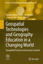
Geospatial Technologies and Geography Education in a Changing World

Geospatial Practices and Lessons Learned

herausgegeben von: Osvaldo Muñiz Solari, Ali Demirci, Joop Schee

Verlag: Springer Japan

Buchreihe : Advances in Geographical and Environmental Sciences

insite
SUCHEN

Über dieses Buch

This book is an initiative presented by the Commission on Geographical Education of the International Geographical Union. It focuses particularly on what has been learned from geospatial projects and research from the past decades of implementing geospatial technologies (GST) in formal and informal education. The objective of this publication is to inform an international audience of teachers, professionals, scholars, and policymakers about the state of the art and prospects of geospatial practices (GPs) as organized activities that use GST and lessons learned in relation to geographical education. GST make up an advanced body of knowledge developed by practitioners of geographic information systems (GIS), remote sensing (RS), global positioning systems, (GPS), and digital cartography (DC). GST have long been applied in many different sectors; however, their first use in higher education began in the early 1980s and then diffused to secondary schools during the 1990s. Starting with GIS and RS, it evolved into a much broader context, as GST expanded to include GPS and DC with new communication technologies and Internet applications. GST have been used around the world as a combination of tools and special techniques to make research, teaching, and learning more effective.
Inhaltsverzeichnis

Frontmatter
Chapter 1. Geospatial Technology in Geography Education
Abstract
The book is presented as an important starting point for new research in Geography Education (GE) related to the use and application of geospatial technologies (GSTs). For this purpose, the selection of topics was based on central ideas to GE in its relationship with GSTs. The process of geospatial practices (GPs) as the way to learn about GST and with GST marks the central ideas. The sequential presentation of chapters starts with a theoretical approach, followed by the use of GST at different levels in formal education. Teacher education represents an important third topic that analyzes professional development when learning about GST and using GST. The fourth topic focuses on the effectiveness of GST as a tool for teaching and learning in order to assess geospatial thinking in different educational settings. The exploration of trends and recommendations for future development are the final topic of this book. In one sentence, the book touches upon the most important issues on the use of GST in education and includes the most up to date information and discussions related to GST. Although GE is not in the front line of the Information and Communication Technology (ICT) revolution it cannot stay behind as modern education uses technology to prepare better citizens. The importance of this book relies on this basic and fundamental fact.
Osvaldo Muñiz Solari, Ali Demirci, Joop van der Schee

Geospatial Practices. Theoretical Background

Frontmatter
Chapter 2. Digital Geography Education in the Twenty-First Century: Needs and Opportunities
Abstract
The introduction of geospatial technologies is changing geography education very fast. Google Earth, web atlases and many location based services are available from the Internet and offer the opportunity to study almost every place in the world anytime anywhere. This opens up a great perspective for geography education in a way not known before. Nevertheless also in geography life is not just a bed of roses. The introduction of geospatial technologies is not always simple, due to technical problems and fast changing devices, a lack of experience in teaching with geospatial technologies and a huge amount of information that may prevent learners to see the wood for the trees. However, the advantages of using geospatial technologies in geography education far outweigh the problems if geographical thinking is involved. This contribution discusses briefly the needs and opportunities of digital geography education in the twenty-first century.
Joop van der Schee, Henk Trimp, Tine Béneker, Tim Favier
Chapter 3. Spatial Thinking in Education: Concepts, Development, and Assessment
Abstract
Spatial thinking has always been a fundamental cognitive skill for competency in geography. However, interest in it has increased in recent years as technological advances have driven political and societal changes producing a renewed awareness of its importance. This is especially true in the context of geospatial technologies (GST). The growth, expansion, and power of GST demands a citizenry with well-developed spatial thinking skills. But research exploring spatial thinking in an educational context is scant.
This chapter explores the current position of spatial thinking in education. First, we describe existing research in spatial thinking. We focus on advances in technology which have led, in part, to the increased interest in the topic. The roles of spatial thinking and GST in curricula are explored. Promising methods for assessing students’ spatial thinking are reviewed in order to provide guidance for curriculum decision-making. The chapter concludes with a summary of the current state of spatial thinking in education and with recommendations for further research.
Sandra K. Metoyer, Sarah Witham Bednarz, Robert S. Bednarz
Chapter 4. Education for Spatial Citizenship
Abstract
This chapter deals with approaches to use geoinformation (GI) as used in everyday settings. It first explores the concept of Spatial Citizenship, along an example taken from the holiday crowd that is easily translated to a host of other interest groups using space as symbolic means to exert their interests. It then looks into the role that digital GI may play in that process, and fields of competences needed to use GI competitively for active / activist citizenship. Theoretical foundations of a coherent concept of Spatial Citizenship are discussed, as is the reception of the approach by the scientific community not involved in the original conception of the Spatial Citizenship approach. The second part of the paper is devoted to the development of a more formalized set of competences as well as a curriculum that should enable in-service teachers to teach their classes in secondary schools along the line of the Spatial Citizenship approach. The contribution finally gives an outline of the materials developed within a European Union Comenius project.
Thomas Jekel, Inga Gryl, Uwe Schulze

Implementation of Geospatial Technologies in Formal Education and Informal Learning

Frontmatter
Chapter 5. Integrating GIS and Other Geospatial Technologies in Middle Schools
Abstract
This chapter describes theory, research and practice specific to middle school geospatial technology integration. From projects implemented in the late 1990s to the present, a variety of settings, project foci, and applications are reviewed. The unique pedagogical and curricular advantages and constraints on middle school geospatial technology integration situate geospatial thinking and learning in the young adolescent developmental context. The chapter presents evidence that middle school is an extremely age-appropriate opportunity for students to apply geospatial thinking and skills, generate new data, and develop a cognitive foundation for incorporating ever-expanding geospatial technologies and opportunities. From both reviewed and meta-analyses and specific applied research findings, we discuss successful projects from a variety of national settings and curricula. The adolescent developmental perspective is consistent with the theoretical statement that geographic practice is ontogenetic. This is congruent with the unique developmental advantages to introducing geospatial technologies across the middle school curriculum, beyond geography to integrated thematic settings. Integrating that practice with the developmentally appropriate activities of middle school students has yielded, in our findings and others’ far-reaching results.
Marsha Alibrandi, Donna Goldstein
Chapter 6. Geospatial Education in High Schools: Curriculums, Methodologies, and Practices
Abstract
Nowadays high school education throughout the world is expected to prepare the young people for understanding the twenty-first century globalization and adapting themselves in this fast-changing world. The ability of applying spatial thinking to real-world issues at a range of scales is essential for a responsible modern citizen and for an effective knowledge worker as well. Educators and students who can use geospatial technologies are more efficient spatial thinkers. That’s why the geospatial education in high schools receives increasing attention worldwide.
The adoption of geospatial technologies in high school education varies among and within countries in term of the status of geography course, information infrastructure, and teacher preparation. There is no general model toward the success in geospatial education. This paper focuses on finding the exemplars of curriculums, methodologies, and practices particularly suited to geospatial education in high school. Besides, GIS, GPS, and RS are the instructional tools traditionally used in geospatial education. The emergences of new technologies such as social media, interactive web-mapping platforms, and smartphones allow individuals or social groups to collect, georeference, and share geographic information. The applications of these technologies and their spatial data in high school geospatial education are also addressed.
Che-Ming Chen, Yao-Hui Wang
Chapter 7. Applied Geospatial Technologies in Higher Education
Abstract
This chapter discusses the international trends, roles, and instruction of GST in higher education. While all countries continue to emphasize teaching about GST, many are developing strategies to teach with GST. Technological advances (cloud-based GST applications, increasingly sophisticated software, etc.) are driving changes in higher education GST objectives, communication, and pedagogy. Countries are developing institutional and faculty peer networks to strengthen the depth and consistency of their GST curricula, as well as keep pace with rapid changes in GST itself. Best pedagogical practices for GST instruction are being developed, including high-impact techniques such as collaborative projects, undergraduate research and inquiry, global learning, and community-based learning. Challenges facing GST in higher education include limited availability of GST courses of study and student enrollment in GST programs. The rapid rate of change in GST technology is a significant barrier to faculty preparation, especially regarding disciplines outside of geography. A case study is described in which GST instruction is delivered through a study abroad program to the islands of Micronesia.
Reed Perkins
Chapter 8. Practice of Geospatial Technologies in Informal Learning
Abstract
This chapter focuses on the most recurrent methods used by practitioners to practice geospatial technologies (GSTs) in informal learning.
GSTs are used by a wide range of practitioners. Being either new young generations acting as digital natives or adults with professional experience, all of them are engaged with new technologies in one way or another. If geospatial practice (GP) is defined as organized activities to analyze and interpret geospatial phenomena by these practitioners, a great deal of these exercises can be attributed to non-formal practices engaged through informal education.
The fast and transformative expression of crowdsourcing as well as volunteered GST has given new positions to informal education. Traditional roads to acquire knowledge are challenged by new ways to practice geospatial visualization to resolve Earth’s problems in terms of physical and human transformation.
Voluntary participation, intense engagement with global tasks, individual and group improvisation, and flexible innovation are among the methods that are analyzed and discussed in the construction of GP. Ultimately, the free-choice learning is put in perspective to verify how effective informal education is to tackle complex geospatial problems that are global in nature.
Osvaldo Muñiz Solari, Melody Crenshaw

Teacher Education for Geospatial Technologies

Frontmatter
Chapter 9. WebGIS in Education
Abstract
Web-based GIS or WebGIS is powerful mapping and analytical functionality expressed within a web browser. Today, webGIS comes in many forms from consumer navigational maps to versatile location analytics tools that allow for user-directed analysis and content discovery. With nearly two decades of development history, webGIS tools are rapidly amassing strength, precision, and speed – in some cases, surpassing the capacities of basic desktop GIS applications. The inclusion of real-time data from sensor networks, social media, and the larger GIS community can extend WebGIS-based instruction to every learner. Because of the increased power and customization, webGIS can now better support learning standards-oriented content in the natural and social sciences. No longer is it necessary to teach learners how to use GIS before teaching the disciplinary content of interest.
In this article, the growing educative role for webGIS, both conceptually, technically, and practically will be explored, including the new affordances (e.g. collaboration, real-time data, distributed data, BYOD support, and interface customization) and constraints (e.g. bandwidth, privacy, and user management) provided by GIS in a cloud-based platform. Finally, considerations for preparing for new and pre-service teachers of webGIS, including pedagogical and technical considerations, will be discussed – providing a broad vision of the future of webGIS and how learners and educators can best utilize and prepare for that future.
Thomas R. Baker
Chapter 10. Teaching GIS and Other Geospatial Technologies to In-Service Teachers
Abstract
Since the early 1990s, geospatial technologies (GSTs) have been reported as effective and useful instructional tools in K–12 education to improve students’ learning and enhance their critical thinking, spatial thinking, and problem solving skills. However, the number of teachers who are implementing those technologies in their classrooms is still pretty low. Among various identified barriers, the major ones are teachers’ lack of background and lack of time to learn, practice, and develop lesson plans using GSTs. In order to solve these barriers, many researchers and professionals in different countries have been providing various kinds of training for in-service teachers. In this chapter, six models of in-service teacher training of GSTs—project-based learning, community partnership, iterative training, minimal Geographic Information System, snowball dispersion, and online training—are introduced and reviewed with exemplary case studies conducted in several countries. The future direction of the effective and useful in-service teacher training is also discussed.
Jung Eun Hong
Chapter 11. Professional Development Focusing on Inquiry-Based Learning Using GIS
Abstract
Geographic inquiry projects with GIS make geography education more relevant and challenging, and provide opportunities to stimulate in-depth knowledge about geography, increase higher-order thinking and develop a wide range of technology skills. Providing professional development that ensures teachers know how to use GIS to support geographic inquiry is necessary. The professional development experiences should take into account the various competencies teachers need to design and conduct geographic inquiry projects using geospatial technologies. The TPACK framework focuses on teacher competencies and is valuable when designing professional development. Considering the TPACK framework, a successful strategy for teacher training is a collaborative inquiry model. When applied to GIS, the collaborative inquiry model is designed to overcome the common barriers to using GIS such as the lack of curriculum, support, and data. The model highlights the successful implementation of geographic inquiry using GIS within a school or district based collaborative team. This chapter explores didactic models for integrating GIS in inquiry projects; frameworks for the competencies that teachers need to design and conduct such projects; and successful strategies for training these competencies.
Lara M. P. Bryant, Tim Favier

Evaluation and Assessment on Geospatial Practices

Frontmatter
Chapter 12. The Effectiveness of Geospatial Practices in Education
Abstract
Geospatial technologies (GST) has long been used in education in many countries. Teachers and students from around the world are using desktop and Web GIS, Global Positioning Systems (GPS), Google Earth, and many other location based services available from the Internet in teaching and learning various school subjects such as geography, environmental sciences, social sciences, history, biology, and mathematics. Potentials of GST for teaching and learning have been identified in many studies. GST provides teachers with a dynamic platform where they can incorporate inquiry-based, student-centered and many other constructivist teaching methods in their lessons. Geospatial practices has a great potential for students to equip them with versatile knowledge and skills as well as to improve their achievements in lessons. Although a great majority of the literature expresses many different benefits of GST for education, some studies raise concern about its effectiveness by addressing the need to find the proper methods for its implementation. This chapter first evaluates the potentials of GST for teaching and learning and then discusses whether geospatial practices are actually effective mainly for secondary education by looking at different concerns and questions raised in the related literature.
Ali Demirci
Chapter 13. An Assessment of the Use of GIS in Teaching
Abstract
The present research study is to provide an assessment of the use of GIS in teaching. A general evaluation of current literature was done to draw a global landscape of GIS in education. For the second part of this study, 15 research articles stemming from ten countries including USA, Germany, Northern Ireland, Ghana, Singapore, Hong Kong, Taiwan, South Korea, Australia and New Zealand written in the decade spanning across 2003–2013 were evaluated to assess the conditions encouraging and discouraging the integration of GIS usage in each country. While interest and belief in the benefits of GIS in teaching and learning among teachers have been affirmed by the research papers evaluated here, nonetheless, the adoption of GIS in schools remains low in both developed and developing countries due to a variety of factors. While common threads and challenges were identified, contextual differences among the countries present a diverse account of GIS integration into the curricula of the world today.
Geok Chin Ivy Tan, Qiu Fen Jade Chen
Chapter 14. A Review of Geospatial Thinking Assessment in High Schools
Abstract
The types of assessments found in geography teaching materials generally focus on declarative knowledge, include few geographic practices, are primarily multiple-choice format, and use a map/globe as the type of representation or none at all. With this context in mind, results are presented from an online survey of geospatial thinking assessment practices of educators involved in high school geography education from around the globe. The findings lead to a discussion of the assessment practices teachers use to measure high school students’ performance in geospatial thinking, the concepts they most often assess and the challenges they encounter in undertaking such assessments. The chapter concludes by recommending the development of new online tools for geospatial thinking assessment, and urging teachers to put into practice the ideas and instruments being proposed in the emerging literature on the assessment of geospatial thinking.
Bob Sharpe, Niem Tu Huynh

Trends and Recommendations

Frontmatter
Chapter 15. Opportunities and Challenges in Using Geospatial Technologies for Education
Abstract
Opportunities in using geospatial technologies as a meaningful and sustained part of education exist as never before. Most obvious are technological opportunities, centered on the evolution of GST to a web-based platform, including editable online maps that can be customized, analyzed, and shared on any device. Geospatial skills and approaches can be effectively taught in an ever-growing variety of face-to-face and online platforms such as Massively Open Online Courses (MOOCs). But equally important are opportunities in education that focus attention on inquiry, critical thinking, outdoor education, authentic assessment, STEM, technical, green, and other careers, and meaningful teaching with technology. Societal trends offer unprecedented opportunity to use GST in education. These include location analytics that are embedding a positional component in everyday electronic devices, a growing awareness of the geographic significance of key twenty-first century issues, such as biodiversity, urbanization, food, hazards, water, human health, and others, and the increasing role seen for citizen science in solving problems.
Despite these opportunities, technological, pedagogical, and administrative issues still pose challenges. Technological challenges include Internet bandwidth, spatial data availability and permissions, and cost for software as a service. Pedagogical challenges include teaching with rapidly evolving web GST tools and a lack of a “home” for and awareness of geospatial technologies and spatial thinking in the curriculum. Administrative issues such as competition for educational class time and funding pose additional challenges. Nevertheless, geospatial technologies as a “transformational technology” could very well be poised to make a significant positive impact on education and society.
Joseph J. Kerski
Chapter 16. Digital Earth – Digital World: Strategies for Geospatial Technologies in Twenty-First Century Education
Abstract
The chapter introduces the Digital Earth concept and summarizes recent developments in geospatial technology that provide near-ubiquitous access to our Digital World. It identifies the roles played by key stakeholders in the recent, rapid rise and development of the geospatial sector worldwide and considers education from the perspective needs of industry. The chapter then focuses on likely impacts to education and training of the rapid development of open access to geoinformation, geo-Web tools, mobile platforms and Cloud-based technologies. It then considers some issues education and training has been dealing with and maps out some example responses and initiatives. It continues by exploring the importance of sustainable innovation and change in education to meet the needs of industry and society and concludes by suggesting and discussing likely strategies that key stakeholders should implement to enable twenty-first century education to be achieved.
Karl Donert
Chapter 17. An Agenda of GST in Geography Education for the Future
Abstract
Recent advances in geospatial technologies (GST), wide availability of geospatial data, and a growing interest in the use of GST in education call for a comprehensive model for teaching and learning with GST. We propose a curricular model that can serve as a guide for integral geography education with GST, where spatial abilities and geospatial integrative skills constitute the two key pillars. Learning opportunities for students to acquire spatial concepts knowledge and to practice higher-level cognitive processes with GST must be critical components of this new approach. Instructional and assessment practices using GST should be designed in a way that can facilitate spatial thinking and geographic inquiry. Focusing on students’ understanding of concepts, ability to utilize a variety of tools of representations, and practice of problem solving through spatial analysis and reasoning in an authentic context can be an effective strategy. A challenge is preparing teachers who are capable of designing and implementing GST-supported inquiry-based instruction and authentic assessment. More research that focus on knowledge, skills, and dispositions related to teaching with GST should shed light on this matter.
Injeong Jo, Osvaldo Muñiz Solari
Metadaten
Titel
Geospatial Technologies and Geography Education in a Changing World
herausgegeben von
Osvaldo Muñiz Solari
Ali Demirci
Joop Schee
Copyright-Jahr
2015
Verlag
Springer Japan
Electronic ISBN
978-4-431-55519-3
Print ISBN
978-4-431-55518-6
DOI
https://doi.org/10.1007/978-4-431-55519-3