2020 | Buch

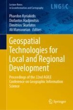
Geospatial Technologies for Local and Regional Development

Proceedings of the 22nd AGILE Conference on Geographic Information Science

herausgegeben von: Prof. Phaedon Kyriakidis, Prof. Diofantos Hadjimitsis, Dr. Dimitrios Skarlatos, Dr. Ali Mansourian

Verlag: Springer International Publishing

Buchreihe : Lecture Notes in Geoinformation and Cartography
insite
SUCHEN

Über dieses Buch

This book includes the full research papers accepted by the scientific programme committee for the 22nd AGILE Conference on Geographic Information Science, held in June 2019 at Cyprus University of Technology, Limassol, Cyprus. It is intended primarily for professionals and researchers in geographic information science, as well as those in related fields in which geoinformation application plays a significant role.

Inhaltsverzeichnis

Frontmatter

Geographic Information Representation, Retrieval and Visualization

Frontmatter
Place Questions and Human-Generated Answers: A Data Analysis Approach
Abstract
This paper investigates place-related questions submitted to search systems and their human-generated answers. Place-based search is motivated by the need to identify places matching some criteria, to identify them in space or relative to other places, or to characterize the qualities of such places. Human place-related questions have thus far been insufficiently studied and differ strongly from typical keyword queries. They thus challenge today’s search engines providing only rudimentary geographic information retrieval support. We undertake an analysis of the patterns in place-based questions using a large-scale dataset of questions/answers, MS MARCO V2.1. The results of this study reveal patterns that can inform the design of conversational search systems and in-situ assistance systems, such as autonomous vehicles.
Ehsan Hamzei, Haonan Li, Maria Vasardani, Timothy Baldwin, Stephan Winter, Martin Tomko
Relaxing Unanswerable Geographic Questions Using A Spatially Explicit Knowledge Graph Embedding Model
Abstract
Recent years have witnessed a rapid increase in Question Answering (QA) research and products in both academic and industry. However, geographic question answering remained nearly untouched although geographic questions account for a substantial part of daily communication. Compared to general QA systems, geographic QA has its own uniqueness, one of which can be seen during the process of handling unanswerable questions. Since users typically focus on the geographic constraints when they ask questions, if the question is unanswerable based on the knowledge base used by a QA system, users should be provided with a relaxed query which takes distance decay into account during the query relaxation and rewriting process. In this work, we present a spatially explicit translational knowledge graph embedding model called TransGeo  which utilizes an edge-weighted PageRank and sampling strategy to encode the distance decay into the embedding model training process. This embedding model is further applied to relax and rewrite unanswerable geographic questions. We carry out two evaluation tasks: link prediction as well as query relaxation/rewriting for an approximate answer prediction task. A geographic knowledge graph training/testing dataset, DB18, as well as an unanswerable geographic query dataset, GeoUQ, are constructed. Compared to four other baseline models, our TransGeo  model shows substantial advantages in both tasks.
Gengchen Mai, Bo Yan, Krzysztof Janowicz, Rui Zhu
Evaluating the Effectiveness of Embeddings in Representing the Structure of Geospatial Ontologies
Abstract
Nowadays word embeddings are used for many natural language processing (NLP) tasks thanks to their ability of capturing the semantic relations between words. Word embeddings have been mostly used to solve traditional NLP problems, such as question answering, textual entailment and sentiment analysis. This work proposes a new way of thinking about word embeddings that exploits them in order to represent geographical knowledge (e.g., geographical ontologies). We also propose metrics for evaluating the effectiveness of an embedding with respect to the ontological structure on which it is created both in an absolute way and with reference to its application within geolocation algorithms.
Federico Dassereto, Laura Di Rocco, Giovanna Guerrini, Michela Bertolotto
Web-Based Visualization of Big Geospatial Vector Data
Abstract
Today, big data is one of the most challenging topics in computer science. To give customers, developers or domain experts an overview of their data, it needs to be visualized. In case data contains geospatial information, it becomes more difficult, because most users have a well-trained experience how to explore geographic information. A common map interface allows users zooming and panning to explore the whole dataset. This paper focuses on an approach to visualize huge sets of geospatial data in modern web browsers along with maintaining a dynamic tile tree. The contribution of this work is, to make it possible to render over one million polygons integrated in a modern web application by using 2D Vector Tiles. A major challenge is the map interface providing interaction features such as data-driven filtering and styling of vector data for intuitive data exploration. A web application requests, handles and renders the vector tiles. Such an application has to keep its responsiveness for a better user experience. Our approach to build and maintain the tile tree database provides an interface to import new data and more valuable a flexible way to request Vector Tiles. This is important to face the issues regarding memory allocation in modern web applications.
Florian Zouhar, Ivo Senner

Geoinformation Science and Geospatial Technologies in Transportation

Frontmatter
A Clustering-Based Framework for Understanding Individuals’ Travel Mode Choice Behavior
Abstract
Travel mode choice analysis is a central aspect of understanding human mobility and plays an important role in urban transportation and planning. The emergence of passively recorded movement data with spatio-temporal and semantic information offers opportunities for uncovering individuals’ travel mode choice behavior. Considering that many of these choices are highly regular and are performed in similar manners by different groups of people, it is desirable to identify these groups and their characteristic behavior (e.g. for educational or political incentives or to find environmentally-friendly people). Previous research mainly grouped people according to “mobility snapshots”, i.e. mobility patterns exhibited at a single point in time. We argue that especially when considering the change of behavior over time, we need to investigate the behavioral dynamic processes resp. the change of travel mode choices over time. We present a framework that can be used to cluster people according to the dynamics of their travel mode choice behavior, based on automatically tracked GPS data. We test the framework on a large user sample of 107 persons in Switzerland and interpret their travel mode choice behavior patterns based on the clustering results. This facilitates understanding people’s travel mode choice behavior in multimodal transportation and how to design reasonable alternatives to private cars for more sustainable cities.
Pengxiang Zhao, Dominik Bucher, Henry Martin, Martin Raubal
Classification of Urban and Rural Routes Based on Motorcycle Riding Behaviour
Abstract
A basic problem in navigation is the selection of a suitable route. This requires a determination of costs or suitability. There are approaches for many standard situations, e.g., the shortest route for pedestrians, the fastest route for cars, a physically possible and legal route for trucks, or the safest route for bicycle riders. However, not much research has been done yet for motorcycle riders. Published approaches rely on interpretation of geometry, interviews, or user feedback. None of these approaches is precise and scalable. Since modern motorcycles have an increasing number of internal sensors (e.g., lean angle sensors for curve ABS), they could provide the data required for a classification of route segments. The combination with a navigational device allows to georeferenced the data and thus attach riding characteristics to a specific road segment. This work sketches the classification concept and presents data from a real-driving experiment using an external IMU.
Gerhard Navratil, Ioannis Giannopoulos, Gilbert Kotzbek
Route Choice Decisions of E-bike Users: Analysis of GPS Tracking Data in the Netherlands
Abstract
Over the past years, the usage of electric bikes has emerged. E-bikes are suitable for short and medium distance trips. Therefore, the Dutch government promotes using e-bikes for daily commuting trips. However, the impact of increasing demand on the cycling infrastructure is unclear. Additionally, route choice models for e-bikes are limited. This paper estimates a route choice model for e-bike users in the Noord-Brabant region of The Netherlands. The data used are based on 17626 trips from 742 users including user profiles extracted from GPS data. In order to analyze the data, a mixed logit model is applied on the route choice of respondents with addition of the path-size attribute. Mixed logit model allows a panel data setup and enables the examination of preference heterogeneity around the mean of distance attribute. Moreover, the path-size attribute is included on the model to account for the overlap between alternatives. Socio-demographic characteristics and trip-related factors are found to be influencing on the route choice decisions of e-bike and bike users. There are differences on the significance of variables between e-bike and bike users.
Gamze Dane, Tao Feng, Floor Luub, Theo Arentze
Route Optimisation for Winter Maintenance
Abstract
In many countries, winter maintenance is a requirement to keep public life going throughout the cold season. This paper investigates the optimization of salt spreading routes in Denmark in terms of service time and cost. It looks at salting as a capacitated arc routing problem and proposes a greedy randomized adaptive search procedure to this end. At the core of the proposed approach is a heuristic algorithm based on simulated annealing that improves the initial route by searching for alternatives within a predefined search space, taking into account a number of constraints and criteria at each iteration of the procedure. The performance of the optimization approach is tested on three different existing service routes, where it is shown to reduce route length by an average of 8.7% and service time by an average of 9.5%.
Nikmal Raghestani, Carsten Keßler

Geoinformation Science and Geospatial Technologies in Urban/Regional Planning

Frontmatter
Tracing Tourism Geographies with Google Trends: A Dutch Case Study
Abstract
Search engines make information about places available to billions of users, who explore geographic information for a variety of purposes. The aggregated, large-scale search behavioural statistics provided by Google Trends can provide new knowledge about the spatial and temporal variation in interest in places. Such search data can provide useful knowledge for tourism management, especially in relation to the current crisis of tourist (over)crowding, capturing intense spatial concentrations of interest. Taking the Amsterdam metropolitan area as a case study and Google Trends as a data source, this article studies the spatial and temporal variation in interest in places at multiple scales, from 2007 to 2017. First, we analyze the global interest in the Netherlands and Amsterdam, comparing it with hotel visit data. Second, we compare interest in municipalities, and observe changes within the same municipalities. This interdisciplinary study shows how search data can trace new geographies between the interest origin (what place users search from) and the interest destination (what place users search for), with potential applications to tourism management and cognate disciplines.
Andrea Ballatore, Simon Scheider, Bas Spierings
Estimating the Spatial Distribution of Vacant Houses Using Public Municipal Data
Abstract
This study aimed to develop a new method for estimating the spatial distribution of vacant houses using municipal public big data and sample field surveys instead of a field survey of the whole municipal area. This can help reduce the cost, time, and labor involved in conducting vacant house surveys. For this purpose, we developed a vacant house database to integrate various public big data with field survey results for different parts of Japanese municipalities (Kagoshima and Asakura). With our newly developed method, we could estimate the spatial distribution of vacant houses with high reliability utilizing crosstab tables developed from the database. The results help to realize a method for conducting surveys of vacant house distribution in broad areas in a quick, inexpensive, and continuous manner, which has not yet been achieved by previous studies.
Yuki Akiyama, Akihiro Ueda, Kenta Ouchi, Natsuki Ito, Yoshiya Ono, Hideo Takaoka, Kohta Hisadomi
Enhancing the Use of Population Statistics Derived from Mobile Phone Users by Considering Building-Use Dependent Purpose of Stay
Abstract
Recently, it is possible to grasp the spatiotemporal distribution of people in cities using population statistics based on the location information of mobile phone users. However, it is difficult to know their purpose of stay which varies according to the use of building they stay and their detailed attributes such as age and gender. In this paper, we firstly propose a model that describes the number of people staying inside/outside of buildings by considering the population density that varies according to the use of building, time, and local characteristics, by using GIS database and Mobile Spatial Statistics (MSS) which is one of the population statistics of mobile phone users. Next, we integrate the MSS data and the Person Trip survey data (PT data) which include detailed personal attributes as well as the purpose of stay. Using the integrated database, we demonstrate the advanced use of population statistics based on mobile phone users by addition of purpose of stay which varies according to building use.
Toshihiro Osaragi, Ryo Kudo
Potential of Crowdsourced Traces for Detecting Updates in Authoritative Geographic Data
Abstract
Crowdsourced traces collected by GPS devices during sports activities are now widely available on different websites. The goal of this paper is to study the potential of crowdsourced traces coming from GPS devices to highlight updates in authoritative geographic data. To reach this goal, an approach based on two steps is proposed. First, a data matching method is applied to match authoritative data and crowdsourced traces. Second, for the non-matched crowdsourced segments composing a trace, different criteria are defined to decide if whether or not, non-matched segments should be considered as an alert for update in authoritative data. The proposed approach is tested on crowdsourced traces and on BDTOPO® authoritative road and path network in mountain area. The results are promising: 727, 1 km of missing paths were found in the test area, which corresponds to 7.7% of the total length of used traces. The discovered missing paths also represent a contribution of 2.4% of the total length of BDTopo® road and path network in the test area.
Stefan S. Ivanovic, Ana-Maria Olteanu-Raimond, Sébastien Mustière, Thomas Devogele
A Scalable Analytical Framework for Spatio-Temporal Analysis of Neighborhood Change: A Sequence Analysis Approach
Abstract
Spatio-temporal changes reflect the complexity and evolution of demographic and socio-economic processes. Changes in the spatial distribution of population and consumer demand at urban and rural areas are expected to trigger changes in future housing and infrastructure needs. This paper presents a scalable analytical framework for understanding spatio-temporal population change, using a sequence analysis approach. This paper uses gridded cell Census data for Great Britain from 1971 to 2011 with 10-year intervals, creating neighborhood typologies for each Census year. These typologies are then used to analyze transitions of grid cells between different types of neighborhoods and define representative trajectories of neighborhood change. The results reveal seven prevalent trajectories of neighborhood change across Great Britain, identifying neighborhoods which have experienced stable, upward and downward pathways through the national socioeconomic hierarchy over the last four decades.
Nikos Patias, Francisco Rowe, Stefano Cavazzi
Improving Business-as-Usual Scenarios in Land Change Modelling by Extending the Calibration Period and Integrating Demographic Data
Abstract
Land use and land cover change (LUCC) models are increasingly being used to anticipate the future of territories, particularly through the prospective scenario method. In the case of so-called trend or Business-as-Usual (BAU) scenarios, the aim is to observe the current dynamics and to extend them into the future. However, as they are implemented as baseline simulation in most current software packages, BAU scenarios are calibrated from a training period built from only two dates. We argue that this limits the quantitative estimation of future change intensity, and we illustrate it from a simple model of deforestation in Northern Ecuadorian Amazon using the Land Change Modeler (LCM) software package. This paper proposes a contribution to improve BAU scenarios calibration by mainly two enhancements: taking into account a longer calibration period for estimating change quantities and the integration of thematic data in change probabilities matrices. We thus demonstrate the need to exceed the linear construction of BAU scenarios as well as the need to integrate thematic and particularly socio-demographic data into the estimation of future quantities of change. The spatial aspects of our quantitative adjustments are discussed and tend to show that improvements in the quantitative aspects should not be dissociated from an improvement in the spatial allocation of changes, which may lead to a decrease in the predictive accuracy of the simulations.
Romain Mejean, Martin Paegelow, Mehdi Saqalli, Doryan Kaced

Spatial Scale as a Common Thread in Geoinformation Analysis and Modeling

Frontmatter
Market Area Delineation for Airports to Predict the Spread of Infectious Disease
Abstract
Air travel facilitates the international spread of infectious disease. While global air travel data represent the volume of travel between airports, identifying which airport an infected individual might use, or where a disease might spread after an infected passenger deplanes, remains a largely unexplored area of research and public health practice. This gap can be addressed by estimating airport catchment areas. This research aims to determine how existing market area delineation techniques estimate airport catchments differently, and which techniques are best suited to anticipate where infectious diseases may spread. Multiple techniques were tested for airports in the Province of Ontario, Canada: circular buffers, drive-time buffers, Thiessen polygons, and the Huff model, with multiple variations tested for some techniques. The results were compared qualitatively and quantitatively based on spatial patterns as well as area and population of each catchment area. There were notable differences, specifically between deterministic and probabilistic approaches. Deterministic techniques may only be suitable if all airports in a study area are similar in terms of attractiveness. The probabilistic Huff model appeared to produce more realistic results because it accounted for variation in airport attractiveness. Additionally, the Huff model requires few inputs and therefore would be efficient to execute in situations where time, resources, and data are limited.
Carmen Huber, Claus Rinner
Reflective Practice: Lessons Learnt by Using Board Games as a Design Tool for Location-Based Games
Abstract
Location-based gaming (LBG) apps present many challenges to the design process. They have very different requirements compared to games that are aspatial in nature. They take place in the wild and this brings unique challenges to the practicalities of their design. There is a need to balance the core game play with the spatial requirements of location-aware technologies as well as considering the overall theme and objectives of the game together with the motivations and behaviours of players. We reflect upon this balancing act and explore an approach to creative paper prototyping through the medium of board games to co-design LBG requirements. We examine two case studies of location-based games with different goals. The first case study discusses the CrossCult Pilot 4 app built to trigger reflection on historical stories through thoughtful play. Whilst the second case study uses the City Conquerer app designed and played in Suzhou, China with a view to exploring notions of territoriality. The paper considers how spatial, social and interaction metaphors are used to simulate location-based games in a board game and discusses the lessons learned when transforming the paper game into a digital prototype. It forms part of a thinking by doing approach. By comparing the board games to the technical counterparts, we consider how effective are the features and activities implemented in the technology prototypes. We propose a set of 11 design constraints that developers must be mindful of when transitioning from paper to digital prototypes.
Catherine Jones, Konstantinos Papangelis
Agent-Based Simulation for Indoor Manufacturing Environments—Evaluating the Effects of Spatialization
Abstract
The paper elaborates on an Agent-based Modeling approach for an indoor manufacturing environment—in particular, a semiconductor production plant. In order to maintain a flexible production “line”, there is no conveyor belt, and a mix of different products is present in the indoor environment. With the integration of Industry 4.0 or Smart Manufacturing principles, production assets may be transported by autonomous robots in the near future. The optimization of manufacturing processes is challenging and computationally hard. Thus, simulation methods are used to optimize manufacturing plants and the processes. In contemporary literature, the effects of the spatial dimension with respect to the simulation of manufacturing processes is neglected. In this paper, we evaluate on the effects the spatial dimension in an Agent-based Model for indoor manufacturing environments. The Agent-based Model developed in this paper is utilized to simulate a manufacturing environment with the help of an artificial indoor space and a set of test data. Four simulation scenarios—with varying levels of spatial data usable—have been tested using Repast Simphony framework. The results reveal that different levels of available spatial information have an influence on the simulation results of indoor manufacturing environments and processes. First, the distances moved by the worker agents can be significantly reduced and the unproductive movements of worker agents (without production assets) can be decreased.
Stefan Kern, Johannes Scholz

User and Workforce Dimensions of Geospatial Technologies

Frontmatter
Towards a Usability Scale for Participatory GIS
Abstract
Since its emergence in the 1990s, the area of Participatory GIS (PGIS) has generated numerous interactive mapping tools to support complex planning processes. The need to involve non-expert users makes the usability of these tools a crucial aspect that contributes to their success or failure. While many approaches and procedures have been proposed to assess usability in general, to date there is no standardized way to measure the overall usability of a PGIS. For this purpose, we introduce the Participatory GIS Usability Scale (PGUS), a questionnaire to evaluate the usability of a PGIS along five dimensions (user interface, spatial interface, learnability, effectiveness, and communication). The questionnaire was developed in collaboration with the user community of SeaSketch, a web-based platform for marine spatial planning. PGUS quantifies the subjective perception of usability on a scale between 0 and 100, facilitating the rapid evaluation and comparison between PGIS. As a case study, the PGUS was used to collect feedback from 175 SeaSketch users, highlighting the usability strengths and weaknesses of the platform.
Andrea Ballatore, Will McClintock, Grace Goldberg, Werner Kuhn
Future Occupational Profiles in Earth Observation and Geoinformation—Scenarios Resulting from Changing Workflows
Abstract
Technological advances require continuous efforts to keep existing curricula up-to-date and graduates employable in the Earth observation (EO) and geoinformation (GI) sectors. The increasing availability of space/geospatial data and the maturity of technology induce disruptive changes to workflows in the EO/GI sector that suggest the development of training programmes and academic courses for re-skilling of workforce and training new user groups. The target in the EO domain in this respect is to facilitate the ‘user uptake’ of the space infrastructure. User uptake requires knowledge of the workforce demand on the market as well as a skills strategy that takes potential emerging and disruptive changes in the sector into account. In the present contribution we build upon a study of demand for current workforce on the EO/GI market and occupational profiles that require priority when developing training programmes and curricula. Reflections on the findings of that study highlight the need to illustrate expected changes of workflows, i.e. the sequence of tasks executed by employees with a certain occupational profile, for an improved basis of discussion. Therefore, we present a methodology to first, acquire current occupational profiles and second, to illustrate sector developments by mapping the developments on tasks of the workflow. This methodology is demonstrated for the profile of remote sensing specialists. The illustration of changing tasks suggests scenarios for future workforce and questions and directions for the development of a sector skills strategy.
Barbara Hofer, Stefan Lang, Nicole Ferber
Metadaten
Titel
Geospatial Technologies for Local and Regional Development
herausgegeben von
Prof. Phaedon Kyriakidis
Prof. Diofantos Hadjimitsis
Dr. Dimitrios Skarlatos
Dr. Ali Mansourian
Copyright-Jahr
2020
Electronic ISBN
978-3-030-14745-7
Print ISBN
978-3-030-14744-0
DOI
https://doi.org/10.1007/978-3-030-14745-7