2018 | Buch

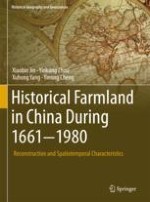
Historical Farmland in China During 1661-1980

Reconstruction and Spatiotemporal Characteristics

verfasst von: Prof. Dr. Xiaobin Jin, Prof. Dr. Yinkang Zhou, Dr. Xuhong Yang, Dr. Yinong Cheng

Verlag: Springer International Publishing

Buchreihe : Historical Geography and Geosciences

insite
SUCHEN

Über dieses Buch

This book explores various approaches to reconstruct the spatial and temporal distribution of historical farmland in China. The book contains background information about political regimes, economic and social development, population changes and land resource utilization in the past 300 years in China. A literature review focuses on the assumptions, methodologies and models of reconstructing historical land-use datasets while addresses accuracy evaluation issues. Historical population size, its growth rate, and the evolution of spatial-temporal patterns of farmland in China have also been discussed. Almost all available historical data about farmland such as historical documents, archives, taxation records, statistics and research outcomes have been collected to reconstruct the amount of historical farmland. With a few principles and assumptions, a delicate Cellular Automaton (CA) and Multi-Agents (MAS) model based on bottom-up management scheme has been applied to derive the spatial-temporal distribution of farmland with the 1km*1km grid resolution for the period between 1661 and 1980 in China. Suggestions for future studies related to reconstructing historical land-use changes are then provided.
Inhaltsverzeichnis

Frontmatter
Chapter 1. Overview of the Chinese History During the Past 300 Years
Abstract
This chapter briefs the China history from Qing Dynasty (1644–1911) to Republic of China (1912–1949) to People’s Republic of China (1949–Now) after reviewing the development and relationship between China and the world. The development of economy and society during the past 300 years in China is further analyzed from the aspects of agriculture, handicraft industry and modern industry. It ends with summaries over the evolution of historical land, population and economic policies.
Xiaobin Jin, Yinkang Zhou, Xuhong Yang, Yinong Cheng
Chapter 2. Review on China’s Spatially-Explicit Historical Land Cover Datasets and Reconstruction Methods
Abstract
This chapter dedicates to the evolution of research hotspots and datasets on historical farmland reconstruction in China and abroad. Based on the statistical analysis and literature review, related studies are analyzed by research paradigms, assumptions, working methods and model validation. From the perspective of methodology, there are two main types, i.e. a top-down method based on historical records and a bottom-up reconstruction method based on geographic spatial model. For model validation, direct verification of reconstruction pattern is obviously a more precise method, but it is often restricted to the spatial-temporal scales of research and data source; indirect validation method provides a new idea for accuracy evaluation of the reconstruction results.
Xiaobin Jin, Yinkang Zhou, Xuhong Yang, Yinong Cheng
Chapter 3. Study Area and Data Source
Abstract
This chapter details the geographical features of China such as topography, climate, soil, river, vegetation and land use/land cover. Specifically, it describes in detail the proceedings of land reclamation, the changes of administrative boundaries in China from Qing Dynasty (1644–1911) to Republic of China (1912–1949) and finally to People’s Republic of China (1949-Now), the climate changes and natural disasters. Based on these solid rich historical data, the spatial-temporal dimension of this research has been determined.
Xiaobin Jin, Yinkang Zhou, Xuhong Yang, Yinong Cheng
Chapter 4. The Spatial-Temporal Pattern of Population Changes in China in the Past 300 Years
Abstract
Setting 300 years as the time scale and the province as the spatial unit, respectively, using adjusted population data of 286 time phases, this chapter establishes the national population distribution for eight years, i.e., 1724, 1767, 1812, 1855, 1898, 1936 and 1982 as time sections. Generally, population of China in the past 300 years presented an uprising tendency and can be classified into five stages according to the feature of its growth. The distribution of population gradually tended toward equilibrium: the population gravity center changed within a narrow range and generally presented a moving tendency toward south-west, south-east, north-east and north-west.
Xiaobin Jin, Yinkang Zhou, Xuhong Yang, Yinong Cheng
Chapter 5. Farmland Dataset Reconstruction in the Past 300 Years in China
Abstract
Since the quantity forms the backbone of farmland reconstruction, this chapter focuses on China’s historical records from 1661 to 1985 and related archives to facilitate reconstructing China’s provincial farmland data with the modern provincial administrative settings. China’s farmland growth process and regional changes are also analyzed. The research shows that ever since the population boom in the Qing Dynasty, China’s farmland expanded more than three times i.e. from 42.4 × 106 ha in the early Qing Dynasty to 136.9 × 106 ha in 1985. In terms of the growth rate, the process of China’s farmland expansion can be identified into five phrases. Significant differences in farmland change existed across provinces.
Xiaobin Jin, Yinkang Zhou, Xuhong Yang, Yinong Cheng
Chapter 6. Reconstruction Spatial-Temporal Pattern of Historical Farmland Based on Bottom-up Methodology
Abstract
Considering the historical farmland change process and the interactions between behavioral subjects in the decision process of cultivation site selection, this chapter tries to put forward a new method system to reconstruct the spatial pattern of historical farmland. It is proposed with the “bottom-up” ideology, i.e., the Constrained CA (Cellular Automata) and MAS (Multi-Agent Systems) model. The empirical study has shown that in contrast to the “top-down” method, the “bottom-up” method is capable to obtain the greater simulation accuracy and reflect the change process of farmland better in reconstructing the historical farmland distribution. Nevertheless, the “bottom-up” method does consume more time and computing power to iterate thousands loops to simulate the potential spatial pattern of historical farmland.
Xiaobin Jin, Yinkang Zhou, Xuhong Yang, Yinong Cheng
Chapter 7. Farmland Spatial Pattern Reconstruction in the Past 300 Years in China
Abstract
Based on a constrained CA model, this chapter proposes a multi-region model to reconstruct historical farmland spatial distribution. Setting the contemporary farmland as a maximum potential scope, the model employs variables such as the suitability for land reclamation, the farmland density, and reconstructed amount of historical farmland at the provincial level with the resolution of 1 km × 1 km to simulate the spatial change of farmland from 1661 to 1952 in China. Afterwards, an accuracy evaluation and comparative analysis have been conducted as well. Referring to a historical survey map in the 1930s, this reconstruction result is of the simulation accuracy of 69.84% with randomly selected 610 samples in 14 regions.
Xiaobin Jin, Yinkang Zhou, Xuhong Yang, Yinong Cheng
Chapter 8. Conclusions and Research Prospects
Abstract
This chapter concludes that the amount of national farmland had increased about 320% in past the 300 years in China along with rapid population growth. It also discusses the research prospects in the field of reconstructing historical land cover such as strengthening data synthesis, improving the comprehensiveness with multiple land use types, coordinating reconstruction methodologies and synthesizing multiple verification methods.
Xiaobin Jin, Yinkang Zhou, Xuhong Yang, Yinong Cheng
Backmatter
Metadaten
Titel
Historical Farmland in China During 1661-1980
verfasst von
Prof. Dr. Xiaobin Jin
Prof. Dr. Yinkang Zhou
Dr. Xuhong Yang
Dr. Yinong Cheng
Copyright-Jahr
2018
Electronic ISBN
978-3-319-71879-8
Print ISBN
978-3-319-71878-1
DOI
https://doi.org/10.1007/978-3-319-71879-8