2019 | Buch | 1. Auflage

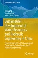
Sustainable Development of Water Resources and Hydraulic Engineering in China

Proceedings for the 2016 International Conference on Water Resource and Hydraulic Engineering

herausgegeben von: Wei Dong, Yanqing Lian, Yong Zhang

Verlag: Springer International Publishing

Buchreihe : Environmental Earth Sciences

insite
SUCHEN

Über dieses Buch

This book presents the gatherings of the “2016 International Conference on Water Resource and Hydraulic Engineering,” which primarily focused on the sustainable development of water resources and the environment in both China and the United States. The respective papers cover a wide variety of research areas, including watershed hydrology; river hydraulics; groundwater hydrology; water resources management and sustainability development; water supply planning under climate change; water quality analysis and water pollution; sponge city development and urban watershed management; environment and sustainability; global connections between air and water; and irrigation and drainage issues for agricultural engineering.

The contributions will be of interest to a global readership and highlight the emerging problems facing developing countries, as well as research and measures to successfully deal with them and promote a greener and more eco-friendly living environment.
Inhaltsverzeichnis

Frontmatter
Establishment of Groundwater Level Warning for Covered Karst Areas in Northern China

In view of the resources shortage and geological environment problems caused by over-exploitation of groundwater in northern China, the delineation of the groundwater level warning (GLW) is urgently needed. Based on the comprehensive consideration of the management objectives of water resources supply guarantee and karst collapse hazards warning, this paper proposed a method for the delineation of karst GLW in covered karst areas. Specific steps include: (1) establish the criterion of GLW based on statistical analysis of groundwater level using the groundwater depth criterion model of Pennsylvania as a reference; (2) establish the criterion of GLW for karst collapse in line with the experience and mechanism research; (3) establish the comprehensive judgment criterion model to determine the GLW of a single observation well; and (4) determine the GLW divisions based on observation wells cluster and issue and renew the warning afterward. The method was verified in the Chengqu-Jiuxian Karst System (CJKS) of Taian City in Shandong Province. It is demonstrated that the GLW conducted by the method in the study area was reasonable and reliable, and was appropriate for decision making for water authorities and governments.

Xiaowei Wang, Lizhi Wang, Jingli Shao, Zhiwei Zhao
Flow Chocking Characteristics of Leak-Floor Flip Buckets

Leak-floor flip bucket is a new type of flip bucket recently proposed. It has the advantages of decreasing flow choking on the bucket in small flow regimes and improving energy dissipation by a typical long-narrow nappe. However, if the structure parameters are designed unreasonably, flow choking may also occur on the bucket if the impact location of the lower jet trajectory is too near to the base of the structure, and will threaten the safety of the dam. The purpose of this paper is to study the critical conditions when flow choking begins to disappear or appear on the leak-floor flip bucket, during the increasing and decreasing discharge regimes, respectively. Five leak-floor flip bucket models were conducted, and one circular-shaped flip bucket was prepared for comparison. The critical conditions were investigated under a systematic variation of the approach flow depth, gap width and gap length. It concludes that the critical Froude numbers are primarily influenced by the relative bucket height and the area ratio of the gap; empirical equations for the prediction of critical conditions are obtained and conformed to the test data reasonably.

Shu-fang Li, Ji-wei Yang
Effects of Brackish Water Salinity on the Soil Salt and Water Movements and the Cotton Seedling Growth Under Film Hole Irrigation

Use of brackish water is becoming more and more important in agricultural irrigation, and it has not been effectively utilized. The effects of brackish water on the soil salt and water movements and the emergence rate of cotton with different salinities of brackish water (0 g/L (control group—CK), 2, 3, 5 and 7 g/L) through film hole irrigation were examined. The results showed that: (1) the cotton emergence rate significantly decreased under the salinity of brackish water more than 5 g/L, whereas the brackish water salinity of 0–5 g/L barely affected the cotton seedling growth; (2) the leaf net photosynthetic rate (Pn) and transpiration rate (E) gradually decreased with the increasing salinity brackish water; (3) the soil salinity increases with the increase of salinity brackish water; and, as time increased, soil salinity gradually moved downward. The results suggested that high salinity of brackish water may have impacts cotton seedling growth. The results may have important significance on cotton plantations with brackish water film hole irrigation.

Chao Ma, Haoyun Hu, Lihua Jia, Ce Zhang, Fei Li
Risk Assessment of Rainstorm Waterlogging in New District Based on MIKE Urban

Due to the urban rainstorm waterlogging problem which has frequently occurred in recent years, this paper establishes a rainwater pipe network system model for the newly built future science park area in Beijing based on the MIKE Urban model under the support of fundamental data in aspects of catch basin, storm sewer, land utilization, etc. Because of the lack of measured runoff data, this paper uses the runoff coefficient as the check objective to implement the experience calibration of the model parameters, verifies the model through the “6.23” storm runoff process in Beijing and establishes the regional model. On this basis, this paper simulates three designed rainfall runoff processes under different recurrence periods and obtains the simulation result of cumulated water quantity, pipe load, etc. in the corresponding catchment area of the research area. This paper concludes through analysis that the easy flooding and waterlogging points under different simulation scenarios in the research area provide the decision basis for the storm waterlogging risk management and rainfall resource utilization in this area.

Ying Wang, Qinghua Luan, Haichao Wang, Jiahong Liu, Jun Ma
International Comparison of Water Resources Utilization Efficiency in China

To obtain knowledge of the standard of water utilization of China from an international point of view, this paper analyzes the annual variation of water resources utilization in China, and compares with other typical countries. The study shows that water resources utilization efficiency has been greatly improved in China in the last 20 years and the water use amount per ten thousand-dollar GDP has declined by 88.6%. However, there is still room for improvement of water resources utilization efficiency compared to developed countries. The comparison of water utilization and human development shows that the higher Human Development Index (HDI) the country is, the more efficient water utilization the country has. The water utilization in China corresponds to its economic and social development with a little step forward. Development is the fundamental way to improve the standard of water utilization.

Long Yan, Jing Ma, Lanchao He, Fei Wang, Tao Chen
Dynamic Water Environmental Capacity Calculations of Rivers Based on Hydrological Processes

The process and mechanism of the water environmental capacity, and the coupling mechanism between it and the hydrological processes were studied. Then, a dynamic approach based on the hydrologic processes was developed in which distributed hydrological and water environmental capacity models were coupled to solve the problem in a traditional way. The Tieling Section of the Liao River Basin was taken as the study area for the purpose of demonstrating the proposed method. The results indicated that the water environmental capacity was uneven during different times and spaces. The results also explained that, contrary to the dynamic methods which separately calculated the years with different frequencies, seasons, or months, the traditional method was too conservative to make full use of the water environmental capacity.

Wei Deng, Jing Ma, Long Yan, Ying Zhang
Hourly Campus Water Demand Forecasting Using a Hybrid EEMD-Elman Neural Network Model

Accurate and reliable water demand forecasting is important for effective and sustainable planning and use of water supply infrastructures. In this paper, a hybrid EEMD-Elman neural network model for hourly campus water demand forecast is proposed, aiming at improving the accuracy and reliability of water demand forecast. The proposed method combines the Elman neural network, EEMD method, and phase space reconstruction method providing favorable dynamic forecast characteristics and improving the forecasting accuracy and reliability. Simulation results show that the proposed model provides a better performance of hourly campus water demand forecast by using the real data of water usage of our campus.

Xiao Deng, Shuai Hou, Wen-zhu Li, Xin Liu
The Study on Groundwater Recharge and Evolution in Northwestern China

The recharge and evolution of groundwater in the Wuwei Basin were investigated using chemical indicators, stable isotopes, and radiocarbon data. The results showed that the concentrations of Na+ and K+ in the groundwater were controlled by the dissolution of halite and sylvite from fine-grained sediments, whereas the increase of Na+ and Cl− was not in accordance with a ratio of 1:1, indicating that the dissolution of halite and sylvite barely affected the concentrations of Na+ and K+ in groundwater. Meanwhile, HCO3− was the dominant ion with a decreased ratio in the groundwater. The SO42−/Cl− ratio decreased with the sample profile from Southwest to Northeast due mainly to the increases of Cl− concentration. The Cl− was enriched in the hydrodynamic sluggish belt, and thus the Ca2+/Cl− ratio decreased with the enhancement of Cl−. In addition, the δ18O and δ2H values of groundwater gradually increased from Southwest to Northeast along the flow path. Compared with the isotopic values of precipitation, the heavy isotopic values were strongly depleted in the groundwater samples, suggesting that the recharge of groundwater in the plain region was very limited from precipitation. Moreover, the groundwater in the phreatic aquifer was younger water with 3H values from 47 to 71 a.BP, while the groundwater age in the confined aquifer was 1000–5800 BP evidenced by the 14C values between 48 and 88 pmc. These results suggested that the recharge duration of the groundwater was from the late Pleistocene or early Holocene. These results might have important significance for inter-basin water allocation and groundwater management of the Wuwei Basin.

Yunpu Zheng, Lili Guo, Liang Liu, Lihua Hao, Qiang Ma, Jingui Wang, Fei Li, Lishu Wang, Ming Xu
Evaluation System Building for Groundwater Overexploitation Zone Management

China’s demand for groundwater is growing along with its economic development. Such problems as continued declining of water table due to groundwater overexploitation, ground subsidence and water quality deterioration as well as other environmental issues have become increasingly prominent. Therefore, China has carried out a series of groundwater management measures in the overexploitation zones. However, management measures and experience cannot be evaluated and summarized systematically as a management evaluation system has not been put in place in a timely manner. Against this background, this paper aims to establish a relatively scientific and rational groundwater overexploitation management and evaluation system by combining with the generally applicable management experience in groundwater overexploitation zones oriented in management results, control measures, monitoring system and regional characteristics. The system is also applied to evaluate two typical overexploitation zones of Hebei Province and Jiangsu Province from 2012 to 2014 with their final scores of 70 and 86, respectively. The evaluation results are analyzed to prove the rationality of the system as a basis for reference to fully promote the management of groundwater overexploitation zones.

Siyu Liu, Genfa Chen, Hongzhen Ni
Runoff Simulation Using SWAT Model in the Middle Reaches of the Dagu River Basin

This article uses Dagu River basin that is located in Qingdao of Shandong Province as the research object, and sets up the hydrological model using SWAT hydrological model and the software of ARCGIS 9.3 which was combined with the basin DEM figure, soil, land use, the observed meteorological data and runoff data. It then established a simulation for regional hydrology on the basis of the runoff data in 1986–2000 and adjusts sensitive parameters by SWAT CUP-2012. The results showed that the determination coefficient (R2) was higher than 0.8 and Nash efficiency coefficient (NS) was higher than 0.7. Therefore, the simulation results can meet the requirements. In addition, it sets up five different land use scenarios and 25 kinds of assumptions of the weather situations to analyze the surface runoff variation of Dagu River basin with two different scenarios, and then sums up the impact of surface runoff influenced by land use change and climate change in Dagu River. The simulation results have an important reference value and practical significance for the sustainable development of this basin in the future and a reasonable allocation of water resources.

Fu-hui Du, Li Tao, Xin-mei Chen, Huai-xian Yao
Study on Water Threshold Value of Protection of Lake Wetland Ecosystem Health—Using Xinghai Lake as an Example

A lake wetland is the production of humans and nature. It has the functions of a natural lake wetland and an artificial reservoir. Lake wetland ecosystem health is an important symbol of humans and nature harmoniously using water. The study of water quantity threshold is important to the management of a lake wetland. Therefore, this paper explores the calculation method of water quality threshold value of protection of lake wetland ecosystem health from two aspects of non-biological and biological water which are formed by a lake, using Xinghai Lake as an example and using methods of water balance and minimum water level. Finally, the threshold value of water supply is 2462.35 million m3 and the minimum water requirement is 2778 million m3. Water quality requirements must be better than Class III.

Jian-Wei Wang, Hong-Zhen Ni, Lin Wang, Yu-Fei Zhang, Gen-Fa Chen, Si-Yu Liu
Construction and Application Analysis of SWMM Model in Beijing Future Science Park

Aiming at more frequent urban waterlogging problems in China, a system of rainwater drainage pipe network by SWMM (Storm Water Management Model) was constructed, using Beijing Future Science Park as the study area. The empirical runoff coefficient method is used for model parameter calibration and validation of “6.23” and “7.21” rainfall runoff processes to build the regional SWMM model and simulate regional rainfall runoff processes in different return periods. Comprehensive runoff coefficient and flood peak flow are used as indicators to analyze the above simulation results. In terms of the whole area, both elements increase with longer design return period, the same as regional flood risk. In terms of the local area, comprehensive runoff coefficient of sub-catchment area increases with a longer design return period, but different with various underlying surface conditions. Among them, the comprehensive runoff coefficient of green land with better permeability is only 0, while the corresponding value of road area with permeability of 90% is 0.89, to indicate the differences in spatial distribution of regional flood risk along with the underlying surface conditions. The above research results provide the technical support for the construction of regional low impact development measures (Low Impact Development, LID) and urban flood warning.

Lanshu Jing, Qinghua Luan, Haichao Wang, Xuerui Gao
Source Apportionment of PM2.5 in Handan City, China Using a Combined Method of Receptor Model and Chemical Transport Model

Handan is one of the top polluted cities in China, characterized by high concentration of fine particulate matter (PM2.5). In this paper, a receptor model, i.e., the Positive Matrix Factorization (PMF) model, and a chemical transport model, i.e., the Mesoscale Modeling System Generation 5 (MM5) and Models-3/Community Multiscale Air Quality (CMAQ) model, are both applied to apportion the sources of PM2.5 in Handan. It is concluded that regional sources contribute 36.0% of PM2.5, and within local sources, the contributions of major emission sectors are: 22.3% from coal combustion, 10.7% from metal smelting, 7.3% from Zn-OC-Ba, 18.5% from industry, 11.3% from transportation, 10.6% from biomass burning, and 19.2% from dust emissions. It indicates that regional joint air pollution controls should be emphasized in the future control strategy, and local source controls on coal combustion and industries are the key points to mitigate the severe PM2.5 pollution in Handan.

Zhe Wei, Litao Wang, Liquan Hou, Hongmei Zhang, Liang Yue, Wei Wei, Simeng Ma, Chengyu Zhang, Xiao Ma
The Review of River Health Assessment in China

This paper makes a systematic overview of the development process of evaluation on China river health growing out of nothing and summarizes the explanations of the river health concept made by famous experts and scholars in China to obtain the essence of river health evaluation. This paper compares the domestic typical evaluation methods and summarizes the common advantages and disadvantages of these methods. Based on the above-mentioned summary, this paper concludes that the research direction of health evaluation is the urban river health evaluation, biological habitat evaluation, research on the river ecological base flow and evaluation on the influence of inter-basin water transfer. Finally, this paper gives a brief prospect of China’s river health evaluation work in the future.

Cun Liu, Shi-Lu Zhang, Wen-Yan Cui, Chao Lin, Jun Zhang
Dissolution Experiment of the Halite of Palaeogene Shahejie Formation, Shulu Sag, Eastern China

Dissolution mining is the main production mode for well salt. Understanding the dissolution property of halite is very important controlling mining efficiency and to predict shapes of the salt cavern. The dissolution experiment of the halite of Paleogene Shahejie Formation, Shulu Sag, and Jizhong Depression is conducted in this study. The results show that, along with the rise of baume degrees, the lateral dissolution rates decline gradually from 7–8 to 1–2 mm/h; and the lateral dissolution angles increase gradually from 9° to 34°. The contents of NaCl of the brine increases linearly, from 50 to 320 g/L, while the contents of the CaSO4 stay around baseline. More than 77% of the dissolution residues are smaller than 2 mm and the sinking rates of these fine residues are very little, from 2.8 to 2.0 cm/s. These results indicate in the early stage of the mining that fresh water should be injected to accelerate the forming of the caverns; and in the late stage of the mining, brine of low concentration should be injected, which will help to maintain the high dissolution rates and discharge the residues in a timely manner. This will guarantee the long-term continuous production of the salt mine.

Langtao Liu, Chao Jin, Shuantong Shangguan, Yang Li, Chenyang Xu, Lei Li
Water Resource Development and Ecological Reclaim in Chinese Fen River Basin

In this paper, the author put forward some views and suggestions on water resources utilization and management and the ecological environment protection process in the future, through a new historical perspective of Fen River basin water resources development and the governmental efforts to solve the ecological troubles it caused. Fen River is the largest river in Shanxi Province and number two of Yellow River’s first-grade tributaries. Along with the development of the social economy and changes in the natural climate environment, Fen River basin appeared to have serious ecological environment problems, an increasingly serious shortage of water resources and pollution trouble which brought about the bottleneck of ecological and economic development in Shanxi Province, and affected the water quality and flow of Yellow River. Since the founding of new China, there have been four massive, systemic governances of Fen River focusing on surface water development, utilization of groundwater, flood control for security, and recovery of clean water flow, respectively. All have made some significant achievements; however, the governances have not been able to fundamentally solve the problems of the ecological environment under the limitation of temporal governing ideas and capital. During the twelfth five-year projects Shanxi Province launched, the “two longitudinal and cross ten” large water program, which aims at facing and solving the trouble of uneven spatial and temporal distribution and guaranteeing the entire province’s economic development demand of water resources by connecting the six major rivers and their large and medium-sized reservoirs in the province, taking the north trunk stream of Yellow River and Fen River as the two longitudinal trunks. The ecological restoration planning outline (2015–2030) that Shanxi Province issued in July 2015 sounded the horn of large-scale administering in Fen River basin for the fifth time. This new round of river basin ecological management must include: ecology—resources—environment—society—economy, the five elements which should be balanced considerations, none of which are dispensable; from divided ruling to shared governance within basin, from passive decontamination to active anti-fouling, from focusing on engineering construction at master stream to balance controlling of whole basin, all relevant departments and personnel need to create new ideas and actions.

Xiao-Hong Zhang, He-Li Wang
Current Situation and Analysis of Water Saving Irrigation Project in Hebei

Hebei is a water resource shortage area, which relies on groundwater alone. Massive and unreasonable exploitation of groundwater caused a series of ecological and geological environmental problems, which pose a threat to the economic and social development. In recent decades, Hebei has pioneered some water-saving irrigation projects, aimed at increasing water and land productivity. Analyzing the present water-saving irrigation situation in this province, benefits and areas for improvement are proposed in this paper and can have a certain value in this fields.

Wenbin Chen
Numerical Simulation for Impacts of Mountainous Tunnel Drainage on Groundwater Environment

Mountainous tunnel drainage can cause various negative impacts on the groundwater environment and human life; as a result, it is necessary that the drainage is quantitatively estimated and minimized during the construction period. In this study, a numerical model was conducted to predict the influences of mountainous tunnel drainage on the groundwater environment in northern China. The results show that the drainage would change the groundwater flow field and form drawdown funnels; however, it would not cause regional groundwater drawdown. Besides, the discharge amount of springs was also affected by the tunnel drainage, and the maximum reducing amount was up to 25%. The storage resources of the aquifers were decreased under the effect of tunnel drainage. All negative influences could be gradually eliminated after the strong drainage. This research can provide effective methods to measure and decrease the impacts of tunnel drainage.

Yong Xiao, Qichen Hao, Jingli Shao, Yali Cui, Qiulan Zhang
The Influence of Straw Mulch on the Transport and Distribution of Water and Salt in Indirect Drip Irrigation with Saline Water

Straw mulch could effectively inhibit the ineffective evaporation of soil water, which could significantly improve the water use efficiency of crops and inhibit the return of soil salt. The research and popularization of straw mulch technology is beneficial to the sustainable development of agriculture. An indoor, indirect drip irrigation experiment with saline water was done under different straw thicknesses and straw comminution degrees, analyzing the soil water content and soil electrical conductivity. The results showed that: the hindering effect of straw mulch on water and salinity increased with the increase of straw mulch thickness; soil water content decreased with the distance from the water-conducting device increasing; soil electrical conductivity reached the minimum in the water outlet of a water-conducting device; and it reached a maximum in the straw mulching edge and wetting front boundary. The hindering effect of straw mulch on water and salinity decreased with the increase of the straw comminution degree.

Ce Zhang, Lihua Jia, Yingying Shen, Chao Ma
The Design of a Check Gate in Wu Village’s Branch Canal

In engineering construction, the design of sluice often appears; the check gate (also known as regulating sluice) is one of a common kinds of sluice. This article will concentrate on the check gate in Wu Village and give an example to introduce its layout, downstream energy dissipation and anti-scour and stability of locker chamber, which provides the basis and reasons for the design of small- and medium-sized check gates.

Si Li, Defeng Yang, Zhouxiang Yuan
Application Research of SWMM in the Simulation of Large-Scale Urban Rain Flood Process—A Case Study of Yizhuang District, China

Storm Water Management Model (SWMM) is established based on the data of the Yizhuang Beijing Economic Development Zone in the core region of China, including the information of the terrain variation, the underlying surface conditions and the storm sewer system. The data of two typical rainstorm events in Beijing were selected; the model parameters were calibrated; and the simulation accuracy results were validated. The simulation regional average depth in different return periods designed precipitation scenarios were calculated. From a comparison of these results, potent measures to deal with the calibration and validation in a condition of the development zone lack of measured rainfall flow data have been suggested. The green space and square land is much better than the others in rain flood digestion. It is important and instructive for the application and popularization of SWMM in large scale-urban areas in China.

Xiaoran Fu, Qinghua Luan, Haichao Wang, Jiahong Liu, Xuerui Gao
The Response Relationship Between Flushing Time and Water Quality in Xiangxi Bay of the Three Gorges Reservoir

For the problem of the spring blooms in the tributary embayment of the Three Gorges Reservoir, 3D hydrodynamic and water quality mode based on the background of Xiangxi River analyzed the response relationship between flushing time and water quality of Xiangxi Bay during the discharge period. The results show that in the upper reaches and near the estuary of the bay, chlorophyll and dissolved silicon concentration are smaller. The chlorophyll concentration in the waters of 12.5 km (in spring, 2005) and 7.5 km (in spring, 2007) away from the estuary remained at a relatively high value, while the dissolved silicon concentration is the opposite. In general, there was a positive correlation between flushing time and chlorophyll concentration, but a negative correlation between flushing time and nutrient salt for the growth of algae. The results can provide a reference for preventing the water environment problems of the tributary embayment.

HongQing Zhang, ZhongJin Bao
Removal of Phthalate Esters by Combination of Activated Carbon with Nanofiltration

Nanofiltration (NF), combined with activated carbon (AC) for phthalate esters (PAEs) treatment, were studied. Three kinds of typical PAEs dimethyl phthalate (DMP), di-(2-ethylhexyl) phthalate (DEHP) and dioctyl phthalate (DOP) were selected as target contaminant. Fifty µg/L of each PAEs liquid match was prepared with natural river water and treated by NF combined with 10 mg/L or 50 mg/L powdered AC. The test was processed at normal temperature, 0.4 MPa pressure, and pH value as 7. The results indicated that AC can be used as the pretreatment of NF to remove the majority of dissolved organic matter and inorganic particles and can be a safeguard for NF membrane. The removal rates of three PAEs by AC-NF were all above 99%, which suggests that the AC-NF process is feasible for PAEs treatment.

Long Wang, Qiaoling Wan, Junjie Wu, Ming Guo, Shuang Mao, Jiaqi Lin
Startup of Formatting Biological Membrane in Denitrifying Filter at Low Temperature

Pollution and treatment of the wastewater have been the focus of environmental protection. In the microbial nitrogen removal processes, a denitrification filter has the advantages of low investment, less land occupied, high biomass and high treatment efficiency. Therefore, it is one of the most widely used processing technologies in advanced treatment. This study uses secondary effluent of the East Sewage Treatment Plant as the research object. The effluent of the waste water treatment plant (WWTP) has a low temperature about 10–20 °C. The inner diameter of the filter column is 150 mm, and the height of the column is 2.3 m. The denitrification filter used boring exposure and continuous water to select the advantage bacterium group to form biological membrane attached on the surface of the filter material. This experiment studies the different treatment effect when forming biological membrane using two different packing processes (ceramsite packing and polyethylene polyhedral hollow ring filter packing) in the denitrification filter. During the experiment, TN, NO3−–N, NO2−–N, NH4+–N, CODCr were constantly measured as well as other regular indicators. The above regular indicators show the biological membrane attachment condition during the formation of the biological membrane. To confirm this procedure successfully, the mark was that the CODcr removal rate reached 50% and the NO3−–N removal rate reached 60%. It was shown that the ceramsite packing needed 25 d, and the polyethylene polyhedral hollow ring packing needed 30 d. This experiment indicates that the startup time, membrane growth and removal efficiency of the ceramsite filter are better than the polyethylene polyhedral hollow ring filter.

Long Wang, Yanyan Dou, Qiaoling Wan, Shuang Mao, Wen Zhang, Jiaqi Lin
Study on Geochemical Evolution and Isotopic Characteristics of Groundwater in Arid and Semi-arid Areas

The utilization ratio of water resources is remarkably high in the Shiyang River Basin, which is a typical zone susceptible to water resources crisis in the arid area in China. Owing to the continuous deterioration of the ecological environment in the Shiyang River Basin, it is of great significance to investigate the groundwater circulation and geochemical evolution law in this area. Samples were collected from the top of the Qilian Mountains to Hongyashan Reservoir along the flow cross section. Isotopic survey and geochemical technology were employed to analyze hydrochemistry and environmental isotopes of precipitation, surface water and groundwater. Results indicated that precipitation was the provenance of water resources in the Shiyang River Basin. The groundwater runoff system accepted river leakage and irrigation water infiltration recharge constantly in the process of the runoff to the downstream, meanwhile drained through the river overflow and pumping with a primary vertical movement. The downstream of the Basin was the main groundwater discharge area. The groundwater in the northern Basin overflowed into the surface water due to the basement uplift. The TDS (Total Dissolved Solids) values were between 131 and 1750 mg/L, gradually increasing along the flow direction. The hydrochemical types showed an obvious zonation from the upper reaches to the lower, which gradually changed from bicarbonate to sulphates.

Lishu Wang, Qingjiao Cao, Yunxin Zhang, Fei Liu, Yingying Shen, Qiang Ma, Yunpu Zheng
A Bibliometric Analysis of Publications on Solar Pumping Irrigation

Solar energy is considered as one of the cleanest forms of energy sources. Meanwhile, many studies have used solar power for water pumping, which is an economically attractive solar energy application since the year of 1615. To better understand the history of the development of solar energy irrigation, a bibliometric analysis of publications on solar energy pumping research from 1956 to 2015 in the sci-direct database is presented here. The analysis informs of the growing trends and indicates that “water”, “solar”, and “soil” are hot topics of research on solar energy irrigation during this period. The language of the publications, publication output, journal distribution, countries and territories of these publications, hot topics and highly cited papers have been assessed. The top 10 countries/territories were ranked according to their total number of articles (TA), single country articles (SCA), internationally collaborative articles (ICA) and first author articles (FAA). Meanwhile, the processes of solar energy installations for pumping irrigation water can be divided into three stages, including photo-thermal conversion stage, solar energy-thermal-electric power conversion stage and photovoltaic conversion stage.

Yunxin Zhang, Zhanyi Gao, Yan lei Jia
Applicability of Runoff Simulation in the Zhanghe Upstream Based on SWAT Model

Sequential Uncertainty Fitting-2 (SUFI-2) with ArcSWAT2009 was used to test the performance of SWAT model for predicting runoff in the Zhanghe upstream. Parameter calibration and distributed hydrologic model building for the Zhanghe upstream were performed by coupling manual and auto-calibration methods. Monthly simulation values of R2 and NSE were 0.83 and 0.79 during the calibration period, and 0.83 and 0.76 during the validation period, respectively. The results showed that SWAT model could be successfully used to model long-term continuous runoff in the study area. The calibrated model can be used for further analysis of the effects of the climate and land use change, water quality analysis and sediment yield analysis.

Wu Haixia, Li Qingxue, Sun Yuzhuang
Research on Reservoir Water Temperature Simulation and Fish Response

Temperature is an important parameter for a body of water, affecting chemical and biological reactions as well as the material exchange. It is also important with respect to the water environment and the growth and propagation of microbes. Water temperature research addresses two important aspects: the impact on the environment due to water temperature change caused by human activities, and better analysis of reactions related to water temperature. Deep reservoirs have both vertical and horizontal temperature stratification. This paper establishes a 2D water temperature model for the Panjiakou Reservoir and simulates the stratification phenomena. Temperature was simulated from May to October 2010, and the diffusion parameters were confirmed. Results showed distinct stratification from May to August with vertical equality from September to October. From May to June, water temperature downstream declined because of discharging. Discharged water temperature significantly affects the spawning time of fishes downstream and can delay spawning by up to a month.

Wei Li, Jia-Hong Liu, Yu-fei Zhang, Wei-Hua Xiao
Calculation of Early Warning Index of Mountain Torrent Disaster in Yushe County

According to the investigation of the disaster of mountain torrents in Yushe County, the disaster water level of the flood disaster prevention objective is determined with regard to the disaster situation of the village and the historical flood investigation of the small watershed. According to the “Shanxi Hydrological Calculation Manual” analysis of a design storm, combined with the actual situation in Shanxi, analysis determined the warning period and soil moisture content. Based on the hypothesis of rainstorm and flood of the same frequency, the same frequency anti-push method is used to reverse the disaster flow from the designed storm flood. The designed rainfall is the early warning rainfall in the early warning period, that is, the small rainfall warning index (immediate transfer of indicators). Through the analysis and calculation, the rainfall warning index of 0.5, 1 and 1.5 h of Yuhong County flood disaster prevention objective is determined, and the rationality of an early warning index is analyzed. The results show that the early warning index of the mountain flood disaster in Yuqi County is reasonable and reliable.

Xuyang Yang, Dandan Yan, Lingling Sun
Impacts of Climate Variability and Human Activities on Runoff: A Case Study in the Jinghe River Basin

Assessing the impacts of climate variability and human activities on streamflow is crucial to regional water resource management. In recent years, significant decreases in streamflow have emerged in the Yellow River basin. The Jinghe River Basin (JRB), a tributary in the middle reaches of the Yellow River, has experienced dramatic land use changes over the past decades. At the same time, the climate has also shown a significant change. The annual streamflow exhibits an apparent decreasing trend in the JRB. In this study, the non-parametric Mann-Kendall test is employed to detect the trend and breakpoint. The effects of climate variability and human activities are assessed quantitatively using the climate elasticity method and the hydrological model. The results showed that annual streamflow in the JRB decreased significantly (P<0.05) from 1956 to 2012 and that an abrupt change occurred in 1997. The annual precipitation presents a slightly decreasing trend, whereas the annual mean temperature and potential evapotranspiration show an upward trend. The results of quantitative assessment indicated that climate variability was responsible for 44.0% of the decrease in streamflow, whereas the hydrological modeling method indicated a value of 48.8%. The annual amount of water diversion from the Jinghe River increased, accounting for 20.5% of the decrease in streamflow from 1997 to 2010. Moreover, the land use and land cover change contributed to 30.7–35.5% of the decrease in streamflow. All human activities contributed to 51.2–56.0% of the decrease in streamflow. Therefore, the effect of human activities played a dominant role in the decrease in streamflow in the JRB.

Qiu-Bo Long
Research on Water Resources Carrying Capacity Based on ET

With the progress of society, the human demand for water resources is increasing. However, due to the shortage of water resources and the serious water pollution, the contradiction between people and water is becoming more prominent. Therefore, it is necessary to study the water resources carrying capacity. Based on the previous studies, the water resources carrying capacity is defined as a region whose water resources is not beyond the allowable transpiration evaporation and can bear the largest population and the corresponding arable land area in the condition of sustainable development and ensuring the normal material level in this paper, using Weixian as an example. The method of ET was used and the relationship between subject and object was considered; meanwhile, the regional evapotranspiration was defined as the subject and the largest population and the corresponding cultivated land area was the object; and the water resources carrying capacity of different levels in Weixian was calculated.

Su Li, Bin Liu
Estimation of Environmental Water Requirements via an Ecological Approach: A Case Study of Yongnian Wetland, Haihe Basin, China

Due to natural change and special human destruction, the area of wetland is greatly decreasing. To recover the wetland ecological system has become an urgent task that must be faced. Water plays an important role in the course of wetland recovery. With Yongnian wetland as a case study, the ecological function method was used, based on structures and functions of the wetland ecological system, the ecological water requirement was divided into four parts: water requirement of wetland vegetation, water requirement of wetland soil, water requirement of wildlife habitats and water requirement of recharging ground water. According to the indexes that were presented in the paper, each part was classified to three grades, respectively. According to the formulas that were given in the paper, all kinds of ecological water requirement of Yongnian wetland were calculated; the results showed that the least ecological water requirement is 1.256 × 10⁸ m3. The proper ecological water requirement is between 3.041 × 10⁸ m3 and 4.301 × 10⁸ m3, and the most ecological water requirement is 6.350 × 10⁸ m3.

Lingyue Wang, Xiaoliu Yang
Establishment and Application of Evaluation Index System of Soil Salinization in Plain Reservoir: An Example for Shifosi Reservoir

Plain reservoir surrounding soil salinization assessment method for the small scope of application, low evaluation precision of the common problems proposed for underground water level elevation, soil water salinity, evaporation and precipitation ratio were used as evaluation factors of the soil salinization assessment index system. Shifosi Reservoir, as an example, in the field water test obtained evaluation parameters based on using AHP fuzzy comprehensive evaluation method of the reservoir after impoundment and the degree of soil salinization was evaluated. The results show that the most serious salinization area is in the left bank of Shifosi Reservoir, after the impoundment of Shifosi reservoir; and closer to the main salinization is more serious, and away from the main dam area the salinization degree is gradually reduced. The right bank of the terrain is relatively low in soil salinization degree due to a serious problem in most parts; less parts presented mild salinization. According to the result of the evaluation, the measures of prevention and control of the salinization of precipitation and water supply were determined, and the rational development and utilization of water resources were realized. This study provides a new idea for the evaluation of soil salinization and provides a scientific basis for the control and prevention of environmental geological hazards in the reservoir area.

Lijun Xu
Effects of Discharge of Dripper on Soil Water and Heat Energy Movements Under Water Storage Pit Irrigation

Water storage pit irrigation was combined with drip irrigation, and the influence of discharge of the dripper on soil water and heat movements was examined to explore a better water-saving irrigation. The results showed that the maximum soil moisture content appeared below the drop point after irrigation. In addition, the soil moisture content near the drop point has a greater change than soil moisture content near the wetting front. There was only a little trend after 24 h of irrigation because of water evaporation. It was also found that increased discharge of the dripper not only increased the volume of the wetted soil, but also increased the soil moisture content of each layer. In addition, a different dripper discharge pit has an effect on soil temperature about water storage pit; the temperature is higher with greater flow than with a small flow.

Fei Li, Chao Ma, Lihua Hao, Shubin Li, Qiang Ma, Ming Xu, Yunxin Zhang, Lishu Wang, Yunpu Zheng
The Relationship and Influencing Factors Water-Gas Interface Mercury Emission Flux and Water Suspended Mercury of a Gold Mining Area River

In order to study the coupling relationship and its influencing factors river water-air interface emission flux of mercury with the rivers of mercury, based on the small Qin Lingjin mining area shuangqiao river as the research object, with field investigation, monitoring and indoor suspended adsorption desorption experiments means. Obtaining the datas about winter and summer season water, suspended solids, gaseous mercury and hydrological and meteorological conditions of river. The result show that water velocity and Quantity of flow, relative pressure were positively correlated with the river-gas interface mercury exchange flux; humidity and rivers of mercury volatilize were positively correlated in summer, the winter not no monitoring data shows that correlation; river volatile mercury is restricted in air and water temperatures, Water temperature affect the suspended solids of mercury adsorption desorption, the higher the temperature, the lower adsorption. Mercury not easily soluble in river water, suspended matter mercury concentration as positively related with river-gas interface mercury emission flux. Research results will enrich the river mercury migration transformation rule and pollution prevention and control work.

Rui-Ping Liu, You-Ning Xu, Jiang-Hua Zhang
Erratum to: Sustainable Development of Water Resources and Hydraulic Engineering in China

■■■

Wei Dong, Yanqing Lian, Yong Zhang
Metadaten
Titel
Sustainable Development of Water Resources and Hydraulic Engineering in China
herausgegeben von
Wei Dong
Yanqing Lian
Yong Zhang
Copyright-Jahr
2019
Verlag
Springer International Publishing
Electronic ISBN
978-3-319-61630-8
Print ISBN
978-3-319-61629-2
DOI
https://doi.org/10.1007/978-3-319-61630-8