1981 | Buch

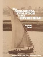
The GEOLOGICAL EVOLUTION of the RIVER NILE

verfasst von: Rushdi Said

Verlag: Springer New York

insite
SUCHEN

Über dieses Buch

This book gives the geological history of the river Nile since it started to excavate its course in the Egyptian plateaus in late Miocene time in response to the lowering sea level of the desic­ cating Mediterranean. It formed a canyon longer, deeper, and just as awe inspiring as the Grand Canyon, Arizona. The canyon was transgressed by the advancing Mediterranean as it started filling during the early Pliocene, and since then by a number of rivers which ebbed and flowed as they succeeded one another. The modern Nile is a recent and humble successor to mighty rivers which once occupied the Nile Valley. Dallas, Texas Rushdi Said August 1981 Acknowledgments This book is based on field work carried out in Egypt during the seasons 1961-1978 while the author was a member of the Com­ bined Prehistoric Expedition sponsored by Southern Methodist University, the Polish Academy of Science, and the Geological Survey of Egypt. Grateful acknowledgment is made to Professor Fred Wendorf, leader of the Expedition, and to several members for their fruitful discussions. Notable among these arepr. Claude Albritton, Southern Methodist University, and Dr. J. De Heinze­ lin, University of Ghent, Belgium. The field work was aided by geologists M. S. Abdel Ghany and A. Zaghloul of the Geological Survey of Egypt. The drafting was by Reed Ellis and Hoda S. Ar­ manious. I am also grateful to Dr. M. K.

Inhaltsverzeichnis

Frontmatter
Chapter I. Introduction
Abstract
This book presents the geological evolution of the River Nile within the boundaries of Egypt through a critical synthesis of a large amount of information worked out and assembled over many years. It aims at finding some order in the extremely complex stratigraphy of the fluvial and other sediments which fill the Nile Valley and which escaped erosion and/or diligent human interference. The younger sediments of the Nile are almost barren of datable materials except for the youngest of these which yielded, in addition to archeological materials, a reasonable number of radiocarbon dates and a few fossil remains. The older sediments of the Nile, now known through a large number of bore-holes, though not including materials amenable to radiometric measurements, are fossiliferous. Much of the stratigraphic order adopted in this book for the younger sediments is based on field relations as well as on correlations with sections outside Egypt, especially those described in detail from the Mediterranean and Red Sea areas where extensive oceanographic and submarine geological work has been recently carried out.
Rushdi Said
Chapter II. The Nile in Egypt
Abstract
The following chapters deal with the geological history of the river which followed a course closely associated with the present-day Nile Valley. The valley seems to have been cut during late Miocene time. The earlier pre-late Miocene rivers which drained the elevated lands of Egypt do not seem to have been associated with the valley in its present form and, therefore, do not constitute the subject of this work. Relics of these earlier rivers are preserved in fluviatile sand and gravel spreads and in deltaic sediments recorded in several places in northern Egypt. The earliest of the fluviatile Tertiary deposits date back to late Eocene and early Oligocene time. They are in the form of a 310 to 470 m thick section of deltaic and associated offshore and barrier beach deposits (Qasr el-Sagha and Qatrani formations) in the Faiyum region to the north of Birket Qarun at an elevation of 350 m above sea level. The Faiyum deltaic deposits have been extensively studied (Beadnell, 1905; Vondra, 1974).
Rushdi Said
Chapter III. Geological History and Concluding Remarks
Abstract
The history of the Egyptian Nile Valley and delta is intimately connected with the geological evolution of northeastern Africa, the Eastern Mediterranean basin, and the Red Sea. Flowing today midway through the rainless wastes of the Sahara, the modern Nile gets its waters from sources outside Egypt, draining an area of more than 3,000,000 km2. This enormous basin extending for 35° of latitude underwent great changes in recent geological history. These changes and the great climatic fluctuations of the past with their impact on world sea levels had their effect on the shape, regimen, and evolution of the river. In addition, the Eastern Mediterranean basin was subject to tremendous changes that converted it into an internal sea. It is fed by the overflow of waters from the Atlantic over the Gibraltar and Messina Straits. Eustatic lowering of the sea level would certainly sever its connection with the ocean and convert it into a basin with a stagnant anaerobic bottom such as occurred several times during the Pleistocene, (Thunnel et al., 1977), or even into a dry basin, as occurred during the late Miocene (Ryan et al., 1973a).
Rushdi Said
Backmatter
Metadaten
Titel
The GEOLOGICAL EVOLUTION of the RIVER NILE
verfasst von
Rushdi Said
Copyright-Jahr
1981
Verlag
Springer New York
Electronic ISBN
978-1-4612-5841-4
Print ISBN
978-1-4612-5843-8
DOI
https://doi.org/10.1007/978-1-4612-5841-4