2015 | Buch

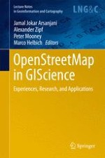
OpenStreetMap in GIScience

Experiences, Research, and Applications

insite
SUCHEN

Über dieses Buch

This edited volume presents a collection of lessons learned with, and research conducted on, OpenStreetMap, the goal being to promote the project’s integration. The respective chapters address a) state-of-the-art and cutting-edge approaches to data quality analysis in OpenStreetMap, b) investigations on understanding OpenStreetMap contributors and the nature of their contributions, c) identifying patterns of contributions and contributors, d) applications of OpenStreetMap in different domains, e) mining value-added knowledge and information from OpenStreetMap, f) limitations in the analysis OpenStreetMap data, and g) integrating OpenStreetMap with commercial and non-commercial datasets. The book offers an ideal opportunity to present and disseminate a number of cutting-edge developments and applications in the field of geography, spatial statistics, GIS, social science, and cartography.
Inhaltsverzeichnis

Frontmatter
An Introduction to OpenStreetMap in Geographic Information Science: Experiences, Research, and Applications
Abstract
Recent years have seen new ways of collecting geographic information via the crowd rather than organizations. OpenStreetMap (OSM) is a prime example of this approach and has brought free access to a wealth of geographic information—for many parts of the world, for the first time. The strong growth in the last few years made more and more people consider it as a potential alternative to commercial or authoritative data. The increasing availability of ever-richer data sets of freely available geographic information led to strong interest of researchers and practitioners in the usability of this data—both its limitations and potential. Both the unconventional way the data is being produced as well as its richness and heterogeneity have led to a range of different research questions on how we can assess, mine, enrich, or just use this data in different domains and for a wide range of applications. While this book cannot present all types of research around OpenStreetMap or even the broader category of User Generated Content (UGC) or Volunteered Geographic Information (VGI), it attempts to provide an overview of the current state of the art by presenting some typical and recent examples of work in GIScience on OSM. This chapter provides an introduction to the scholarly work on OpenStreetMap and its current state and summarizes the contributions to this book.
Jamal Jokar Arsanjani, Alexander Zipf, Peter Mooney, Marco Helbich

Data Management and Quality

Frontmatter
Assessment of Logical Consistency in OpenStreetMap Based on the Spatial Similarity Concept
Abstract
The growth in the number of users and the volume of information in OpenStreetMap (OSM) indicate the success of this VGI-based project in attracting diverse sets of people from all over the world. A huge amount of information is generated daily by non-professional users and OSM faces the challenge of ensuring data quality. Spatial data quality comprises several basic elements; among them, logical consistency concerns the existence of logical contradictions within a dataset. It is one of the most important elements, but has not been studied much in VGI despite the key role in quality assurance. Because of the participatory nature of data collection and entry in OSM, the common consistency checking routines for spatial data should be revised. Since contributors have different views about objects, data integration in OSM may be considered as a form of multi-representation data combination. In this article, the concept of spatial similarity in multi-representation considering three elements, i.e. directional relationships, topological relationships, and metric distance relationships, is used to build a framework to determine the probable inconsistencies in OSM.
Peyman Hashemi, Rahim Ali Abbaspour
Quality Assessment of the Contributed Land Use Information from OpenStreetMap Versus Authoritative Datasets
Abstract
Land use (LU) maps are an important source of information in academia and for policy-makers describing the usage of land parcels. A large amount of effort and monetary resources are spent on mapping LU features over time and at local, regional, and global scales. Remote sensing images and signal processing techniques, as well as land surveying are the prime sources to map LU features. However, both data gathering approaches are financially expensive and time consuming. But recently, Web 2.0 technologies and the wide dissemination of GPS-enabled devices boosted public participation in collaborative mapping projects (CMPs). In this regard, the OpenStreetMap (OSM) project has been one of the most successful representatives, providing LU features. The main objective of this paper is to comparatively assess the accuracy of the contributed OSM-LU features in four German metropolitan areas versus the pan-European GMESUA dataset as a reference. Kappa index analysis along with per-class user’s and producers’ accuracies are used for accuracy assessment. The empirical findings suggest OSM as an alternative complementary source for extracting LU information whereas exceeding 50 % of the selected cities are mapped by mappers. Moreover, the results identify which land types preserve high/moderate/low accuracy across cities for urban LU mapping. The findings strength the potential of collaboratively collected LU features for providing temporal LU maps as well as updating/enriching existing inventories. Furthermore, such a collaborative approach can be used for collecting a global coverage of LU information specifically in countries in which temporal and monetary efforts could be minimized.
Jamal Jokar Arsanjani, Peter Mooney, Alexander Zipf, Anne Schauss
Improving Volunteered Geographic Information Quality Using a Tag Recommender System: The Case of OpenStreetMap
Abstract
Studies have analyzed the quality of volunteered geographic information (VGI) datasets, assessing the positional accuracy of features and the semantic accuracy of the attributes. While it has been shown that VGI can, in some contexts, reach a high positional accuracy, these studies have also highlighted a large spatial heterogeneity in positional accuracy and completeness, but also concerning the semantics of the objects. Such high semantic heterogeneity of VGI datasets becomes a significant obstacle to a number of possible uses that could be made of the data. This paper proposes an approach for both improving the semantic quality and reducing the semantic heterogeneity of VGI datasets. The improvement of the semantic quality is achieved by using a tag recommender system, called OSMantic, which automatically suggests relevant tags to contributors during the editing process. Such an approach helps contributors find the most appropriate tags for a given object, hence reducing the overall dataset semantic heterogeneity. The approach was implemented into a plugin for the Java OpenStreetMap editor (JOSM) and different examples illustrate how this plugin can be used to improve the quality of VGI data. This plugin has been tested by OSM contributors and evaluated using an online questionnaire. Results of the evaluation suggest a high level of satisfaction from users and are discussed.
Arnaud Vandecasteele, Rodolphe Devillers
Inferring the Scale of OpenStreetMap Features
Abstract
Traditionally, national mapping agencies produced datasets and map products for a low number of specified and internally consistent scales, i.e. at a common level of detail (LoD). With the advent of projects like OpenStreetMap, data users are increasingly confronted with the task of dealing with heterogeneously detailed and scaled geodata. Knowing the scale of geodata is very important for mapping processes such as for generalization of label placement or land-cover studies for instance. In the following chapter, we review and compare two concurrent approaches at automatically assigning scale to OSM objects. The first approach is based on a multi-criteria decision making model, with a rationalist approach for defining and parameterizing the respective criteria, yielding five broad LoD classes. The second approach attempts to identify a single metric from an analysis process, which is then used to interpolate a scale equivalence. Both approaches are combined and tested against well-known Corine data, resulting in an improvement of the scale inference process. The chapter closes with a presentation of the most pressing open problems.
Guillaume Touya, Andreas Reimer
Data Retrieval for Small Spatial Regions in OpenStreetMap
Abstract
Using OpenStreetMap data usually means, firstly, filtering for thematic extracts. This can be done with the OpenStreetMap mirror database Overpass API (application programming interface). To do this efficiently, the database takes advantage of the assumption that data is often selected from a relatively small spatial region instead of randomly across the planet. The paper aims to investigate what design choices are required to be able to answer almost any geographic query whilst serving common use cases fast enough such that the services based on this database are fast on affordable and standard sized hardware. The usage patterns from the main instance of Overpass API on overpass-api.de are evaluated. These comprise more than 40 million requests from the years 2012 to 2013 coming from about 60 % of the global IPv4 (IP protocol version 4) space. Therefore it can be said for sure that the assumption that queries are spatially dense holds on a large share of all queries.
Roland M. Olbricht

Social Context

Frontmatter
The Impact of Society on Volunteered Geographic Information: The Case of OpenStreetMap
Abstract
Volunteered Geographical Information (VGI) has been extensively studied in terms of its quality and completeness in the past. However, little attention is given to understanding what factors, beyond individuals’ expertise, contribute to the success of VGI. In this chapter we ask whether society and its characteristics such as socio-economic factors have an impact on what part of the physical world is being digitally mapped. This question is necessary, so to understand where crowd-sourced map information can be relied upon (and crucially where not), with direct implications on the design of applications that rely on having complete and unbiased map knowledge. To answer the above questions, we study over 6 years of crowd-sourced contributions to OpenStreetMap (OSM) a successful example of the VGI paradigm. We measure the positional and thematic accuracy as well as completeness of this information and quantify the role of society on the state of this digital production. Finally we quantify the effect of social engagement as a method of intervention for improving users’ participation.
Afra Mashhadi, Giovanni Quattrone, Licia Capra
Social and Political Dimensions of the OpenStreetMap Project: Towards a Critical Geographical Research Agenda
Abstract
Critical cartographic scholarship has demonstrated that maps (and geoinformation in general) can never be neutral or objective: maps are always embedded in specific social contexts of production and use and thus unavoidably reproduce social conventions and hierarchies. Furthermore, it has been argued that maps also (re)produce certain geographies and thus social realities. This argument shifts attention to the constitutive effects of maps and the ways in which they make the world. Within the discussion on neogeography and volunteered geographic information, it has been argued that crowd sourcing offers a radical alternative to conventional ways of map making, challenging the hegemony of official and commercial cartographies. In this view, crowd-sourced Web 2.0-mapping projects such as OpenStreetMap (OSM) might begin to offer a forum for different voices, mapping new things, enabling new ways of living. In our contribution, we frame a research agenda that draws upon critical cartography but widens the scope of analysis to the assemblages of practices, actors, technologies, and norms at work: an agenda which is inspired by the “critical GIS”-literature, to take the specific social contexts and effects of technologies into account, but which deploys a processual view of mapping. We recognize that a fundamental transition in mapping is taking place, and that OSM may well be of central importance in this process. However, we stress that social conventions, political hegemonies, unequal economic and technical resources etc. do not fade away with crowdsourced Web 2.0 projects, but rather transform themselves and impact upon mapping practices. Together these examples suggest that research into OSM might usefully reflect more critically on the contexts in which new geographic knowledge is being assembled.
Georg Glasze, Chris Perkins
Spatial Collaboration Networks of OpenStreetMap
Abstract
The interaction of the editing operations from different OpenStreetMap (OSM) contributors provides valuable information on collaboration patterns. This chapter describes a new type of spatial collaboration network which can be extracted from OSM edit history data. Drawing from current literature in the field of Social Network Analysis different concepts of collaboration are discussed. It is shown how to apply the measurement of interlocking responses known from research on non-spatial collaboration in wikis to collaboration in OSM. The advantages of the approach are demonstrated by an analysis of collaboration on OSM sample data.
Klaus Stein, Dominik Kremer, Christoph Schlieder

Network Modeling and Routing

Frontmatter
Route Choice Analysis of Urban Cycling Behaviors Using OpenStreetMap: Evidence from a British Urban Environment
Abstract
The neglect of non-motorized transportation options in transport planning and demand modelling is gradually being addressed in the United Kingdom. In route choice research there has been, in recent years, a trend away from modelling hypothetical situations towards field testing. This is partly due to the effective use of emerging GPS technologies for gathering travel behavior data in “wild” urban spaces, making it possible to observe realistic situations. Such data on detailed travel behaviors offer possibilities for further research, especially in the non-motorized transportation arena. Globally, there has been progress in the development of cyclists’ route choice models using revealed preference GPS data from various geographical and local contexts. However, we have little evidence on detailed cyclists’ route choices in the UK in a national and local context. This is particularly the case with low cycling participation cities in North England, where there have been various attempts to increase cycling uptake in recent years. This chapter fills this knowledge gap by undertaking a route choice analysis using the cycling-friendly version of OpenStreetMap (OSM) as the transportation network for analysis, alongside GPS tracks (7 days) and travel diary data for 79 Utility Cyclists around Newcastle upon Tyne in North East England. We examined specific variables as proposed in the relevant cycling literature and used these to develop a model testing the null hypothesis that network restrictions (i.e. one way, turn restrictions and access) do not have any significant influence on the movement of commuter cyclists. The findings suggest that OSM can provide a robust transportation network for cycling research, in particular when combined with GPS track data. The observed routes were significantly longer than their shortest path alternatives, the only exception being the straight-line distance between the observed bike routes and the unrestricted network routes, where the difference was not statistically significant. We conclude that network restrictions for both observed and shortest paths are significant, suggesting that route directness is an important factor to be considered for restricted and unrestricted networks.
Godwin Yeboah, Seraphim Alvanides
The Next Generation of Navigational Services Using OpenStreetMap Data: The Integration of Augmented Reality and Graph Databases
Abstract
The OpenStreetMap (OSM) project is the most successful collaborative geospatial content generation project. The distinguishing attribute of OSM is free access to huge amounts of geospatial data, which has resulted in hundreds of commercial and non-commercial web and mobile applications and services. The OSM data is freely available and that is why the data can be used within many data infrastructure applications and value-added services. In addition, the free access to data has led to the growth of OSM as a replacement of propriety systems in academic and business environments. This chapter describes the implementation of a navigational application using OSM data as part of the eCampus project in Maynooth University (formerly known as National University of Ireland Maynooth or NUIM). The application provides users several navigation services with navigational instructions through standard textual and cartographic interfaces and also through augmented images showing way-finding objects. There are many navigation services available over the internet; however, the navigation services in this chapter are implemented using a graph database which can be used in connected as well as disconnected modes (online and offline). In addition to the graph database, there is a spatial database for storage and management of images in the system. In other words, the implemented eCampus uses polyglot geospatial data persistence in order to get the best features of several storage systems in a single system in contrast to many traditional storage systems in which all data is stored in a single storage system. The evaluation of the eCampus application by the target users of university students and staff indicated that the visual navigation service using augmented reality provides an intuitive interface that could be integrated into augmented reality systems.
Pouria Amirian, Anahid Basiri, Guillaume Gales, Adam Winstanley, John McDonald
Building a Multimodal Urban Network Model Using OpenStreetMap Data for the Analysis of Sustainable Accessibility
Abstract
This chapter presents the process of building a multimodal urban network model using Volunteered Geographic Information (VGI) and in particular OpenStreetMap (OSM). The spatial data model design adopts a level of simplification that is adequate to OSM data availability and quality, and suitable to the measurement of the sustainable accessibility of urban neighborhoods and city-regions. The urban network model connects a private transport system (i.e. pedestrian, bicycle, car), a public transport system (i.e. rail, metro, tram and bus) and a land use system (i.e. building land use units). Various algorithmic procedures have been developed to produce the network model, supporting the reproducibility of the process and addressing the challenges of using OSM data for this purpose. While OSM demonstrates great potential for urban analysis, thanks to the detail of its attributes and its open and universal coverage, there is still some way to go to provide the data quality and consistency required for detailed operational urban models.
Jorge Gil

Land Management and Urban Form

Frontmatter
Assessing OpenStreetMap as an Open Property Map
Abstract
Approximately 5/6th of the world’s land and property rights, restrictions and responsibilities (RRRs) are unrecorded. This applies to both the developing and developed world and suggests that a considerable gap exists in worldwide land tenure information. Crowdsourcing can be used as a methodology for addressing this information gap. This chapter investigates the potential of OpenStreetMap (OSM) as a crowdsourcing system in collecting and recording land tenure information including RRRs. The chapter uses a case study in Victoria, Australia, to investigate the quality of the current OSM data and its potential as a crowdsourced record of public properties. The chapter studies the completeness of the public property records in the OSM, and the location, shape, area and description of the existing records. The analysis concludes with a mixed result. While the results show a considerable gap in the OSM records, at same time they indicate an acceptable quality for the existing records. The paper finally discusses the potential of OSM as an Open Property Map (OPM).
Mohsen Kalantari, Veha La
Investigating the Potential of OpenStreetMap for Land Use/Land Cover Production: A Case Study for Continental Portugal
Abstract
In the last decade, volunteers have been contributing massively to what we know nowadays as Volunteered Geographic Information (VGI). Through the research that has been conducted recently, it has become clear that this huge amount of information might hide interesting and rich geographical information. The OpenStreetMap (OSM) project is one of the most well-known and studied VGI initiatives. It has been studied to identify its potential for different applications. In the field of Land Use/Cover, an earlier study by the authors explored the use of OSM for Land Use/Cover (LULC) validation. Using the COoRdination of INformation on the Environment (CORINE) Land Cover (CLC) database as the Land Use reference data, they analyzed the OSM coverage and classification accuracy, finding an interesting global accuracy value of 76.7 % for level 1 land classes, for the study area of continental Portugal, despite a very small coverage value of approximately 3.27 %. In this chapter we review the existing literature on using OSM data for LULC database production and move this research forwards by exploring the suitability of the OSM Points of Interest dataset. We conclude that OSM can give very interesting contributions and that the OSM Points of Interest dataset is suitable for those classified as CLC class 1 which represents artificial surfaces.
Jacinto Estima, Marco Painho
Using Crowd-Sourced Data to Quantify the Complex Urban Fabric—OpenStreetMap and the Urban–Rural Index
Abstract
To date, hardly any classification of the urban–rural continuum exists that is based on objective and reproducible criteria. This particularly applies to regions of the world where accurate and up-to-date geodata is scarce Therefore, an Urban–Rural Index (URI) was developed as a contribution to the theoretical debate about the spatiality of urban–rural gradients as well as to make use of the increasing amount of crowd-sourced data especially in traditionally data-scarce regions of the developing world. The URI was calculated based on two subindexes representing: (1) the kernel density of existing buildings derived from high-resolution satellite imagery and (2) the travel times from the city center calculated based on OpenStreetMap data. The advantage of this index over common categorizations of urban, periurban, and rural areas lies in its ability to quantify the spatial implications of urban morphology. This paper draws on the analysis of three study sites: Bamenda in Cameroon, Moshi in Tanzania, and Bangalore in India. The URI as a reproducible representation of the spatial complexity of the urban landscape and its surrounding areas has the potential to contribute to the understanding of urban development patterns. Furthermore, it is a time- and cost-effective way for municipal town planning institutions to increase their knowledge of past, current, and future urbanization trends in their respective areas of responsibility.
Johannes Schlesinger

Outlook

Frontmatter
An Outlook for OpenStreetMap
Abstract
This volume has presented “OpenStreetMap in GIScience: experiences, research and applications” with a collection of experiences and research carried out with OpenStreetMap as the central and core theme. The volume has sought to build a firm foundation to highlight research work focused on OpenStreetMap. This was one of our original goals when we set out at the beginning of the editorial process. This is, to the best of our current knowledge, the first academically produced volume of its kind which focuses exclusively on OpenStreetMap. Approximately one decade on from the birth of OpenStreetMap in 2004 this volume appears at the most opportune of times. OpenStreetMap has emerged from one of the most tumultuous decades in Information and Communication Technologies (ICT) and possibly in the history of human communication. In the decade where ICT, social media, ubiquitous computing and the Internet of Things emerged OpenStreetMap arguably now proudly stands as one of the best examples of crowd and volunteered-based innovation of this time. Its past has been remarkable and the future for OpenStreetMap is bright.
Peter Mooney
Metadaten
Titel
OpenStreetMap in GIScience
herausgegeben von
Jamal Jokar Arsanjani
Alexander Zipf
Peter Mooney
Marco Helbich
Copyright-Jahr
2015
Electronic ISBN
978-3-319-14280-7
Print ISBN
978-3-319-14279-1
DOI
https://doi.org/10.1007/978-3-319-14280-7