2014 | Buch

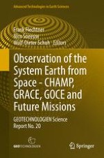
Observation of the System Earth from Space - CHAMP, GRACE, GOCE and future missions

GEOTECHNOLOGIEN Science Report No. 20

herausgegeben von: Frank Flechtner, Nico Sneeuw, Wolf-Dieter Schuh

Verlag: Springer Berlin Heidelberg

Buchreihe : Advanced Technologies in Earth Sciences

insite
SUCHEN

Über dieses Buch

Significant advances in the scientific use of space based data were achieved in three joint interdisciplinary projects based on data of the satellite missions CHAMP, GRACE and GOCE within the R&D program GEOTECHNOLOGIEN. It was possible to explore and monitor changes related to the Earth’s surface, the boundary layer between atmosphere and solid earth, and the oceans and ice shields. This boundary layer is our habitat and therefore is in the focus of our interests. The Earth’s surface is subject to anthropogenetic changes, to changes driven by the Sun, Moon and planets, and by changes caused by processes in the Earth system. The state parameters and their changes are best monitored from space. The theme “Observation of the System Earth from Space” offers comprehensive insights into a broad range of research topics relevant to society including geodesy, oceanography, atmospheric science (from meteorology to climatology), hydrology and glaciology.
Inhaltsverzeichnis

Frontmatter

LOTSE-CHAMP/GRACE

Frontmatter
Chapter 1. LOTSE-CHAMP/GRACE: An Interdisciplinary Research Project for Earth Observation from Space
Abstract
The research project LOTSE-CHAMP/GRACE (Long time series of consistently reprocessed high-accuracy CHAMP/GRACE data products) has the overall goal to reprocess all CHAMP and GRACE gravity, magnetic and atmospheric mission data. The reprocessing will provide a 10 years long, consistent and high-quality time series of (a) static and time variable gravity field models describing the mass distribution and mass variation in the system Earth, (b) atmospheric parameters such as mean global temperatures or tropopause altitudes and (c) the state and change in the Earth’s outer core and lithospheric magnetic field during the CHAMP (2000–2010) and/or GRACE (since 2002) mission life time. These consistent data sets are used by the national and international user community as a valuable and complementary source of information for global change analysis such as monitoring of the continental hydrological cycle, polar ice mass loss, sea level change or monitoring of global temperature variations, as well as for geological and tectonic studies.
Frank Flechtner
Chapter 2. Improvement in GPS Orbit Determination at GFZ
Abstract
Precise orbits of the GPS satellites are required at GFZ for generation of Earth’s gravity field models, precise determination of baselines between Low Earth Orbiters (LEOs) such as TerraSAR-X and TanDEM-X, for processing of various LEO radio occultation data as well as in research following the integrated approach where ground and space-borne GPS data are used together to estimate parameters needed for determination of a geodetic terrestrial reference frame. For this GFZ has implemented many GPS modelling improvements including GPS phase wind-up and attitude model, improved ambiguity fixing, absolute antenna phase centre offsets and variations, global constrains for the terrestrial reference system, frame transformation according to IERS Conventions 2010, higher order ionospheric corrections and improvements in the parameterization of the solar radiation pressure model. In this paper the influence of all these modelling improvements on the accuracy of the GPS orbits is presented. It is shown, that the application of the new models reduced the mean 3D difference of our orbits from 7.76 to 3.01 cm when compared to IGS final orbits.
Grzegorz Michalak, Daniel König, Karl-Hans Neumayer, Christoph Dahle
Chapter 3. Using Accelerometer Data as Observations
Abstract
By established convention, non-gravitational accelerations measured on-board satellites are not treated as genuine observations in the “observed minus computed” sense, like other data types. Instead, they appear as an additional perturbation on the right hand side of satellite dynamics and accelerometer calibration factors (scaling, biases) play the role of dynamical parameters. The more logical method would be to treat them conceptually in the same manner as other kinds of measurements, like SLR (satellite laser ranging), GPS or inter-satellite ranging. This alternative method has been investigated and compared to the conventional method. Benefits and disadvantages are discussed and the performance of the conventional and the new method is assessed in the context of gravity field recovery, for a simulated scenario and using real-world CHAMP and GRACE mission data.
Karl-Hans Neumayer
Chapter 4. GFZ RL05: An Improved Time-Series of Monthly GRACE Gravity Field Solutions
Abstract
After publishing its release 04 (RL04) time-series of monthly GRACE gravity field solutions starting end of 2006, GFZ has reprocessed this time-series based on numerous changes covering reprocessed instrument data, observation and background models as well as updated processing environment and standards. The resulting GFZ RL05 time-series features significant improvements of about a factor of two compared to its precursor. By analyzing 72 monthly solutions for the time span 2005 till 2010, a remarkable noise reduction and a noticeably higher spatial resolution become obvious. The error level has significantly decreased and is now only about a factor of six above the pre-launch simulated baseline accuracy. GFZ RL05 solutions are publically available at ISDC and PO.DAAC archives.
Christoph Dahle, Frank Flechtner, Christian Gruber, Daniel König, Rolf König, Grzegorz Michalak, Karl-Hans Neumayer
Chapter 5. GRACE Gravity Modeling Using the Integrated Approach
Abstract
Monthly gravity field solutions up to d/o 60 are derived by applying the Integrated (one-step) Approach of space geodesy, i.e. by simultaneously processing of the GPS constellation and the twin GRACE satellites. The results are based on latest GRACE RL05 standards (without constraining L3-ambiguities), and consists of 24-h arcs covering the test month April 2008 where the monthly solution was obtained by accumulation of the daily normal equations. The alternative gravity model is compared with the corresponding two-step solution derived by standard two-step GFZ RL05 GRACE processing (including constrained L3-ambiguities). It is shown, that difference degree amplitudes with respect to the static satellite-only model ITG-GRACE2010s for both the Integrated Approach and the two-step solution only differ significantly beyond d/o 17 where the two-step approach still performs slightly better. A great advantage of the Integrated Approach is the largely reduced formal errors indicating higher stochastic significance.
Daniel König , Christoph Dahle
Chapter 6. Comparison of Daily GRACE Solutions to GPS Station Height Movements
Abstract
In Kurtenbach (2011) and Kurtenbach et al. (2012) an approach has been introduced that allows to calculate daily gravity field solutions from GRACE data within the framework of a Kalman filter and smoother estimation. The method utilizes spatial and temporal correlations of the expected gravity field signal derived from geophysical models in addition to the daily observations, thus effectively constraining the spatial and temporal evolution of the GRACE solution. Here, we offer an extended validation of these daily solutions by comparing the derived mass variations to vertical displacements at various permanent GPS stations. The comparison confirms the conclusion that the daily solutions contain significant high-frequent temporal gravity field information, especially in higher latitudes.
Annette Eicker, Enrico Kurtenbach, Jürgen Kusche, Akbar Shabanloui
Chapter 7. Identification and Reduction of Satellite-Induced Signals in GRACE Accelerometer Data
Abstract
Although the GRACE satellite mission has achieved outstanding results in the ten years since it has been launched, signals within accelerometer data remain non-understood. We analyzed 10 Hz Level 1a Accelerometer data (ACC1A) and could link signals to switch events due to magnetic torquers and heaters, and also were able to find a systematic for so called “twangs”. Those signals could be either empirically or physically modelled. With those signals time-series consisting of spikes only could be computed, with which a possible impact onto the gravity field could be determined. It showed that especially the radial component could have an impact. In order to investigate the impact onto the gravity field sufficiently we subtracted the modelled signals from ACC1A, downsampled that data to 1 Hz in order to obtain ACC1B data format and derived a gravity field with the use of our ACC1B dataset. The results appear to have a little, but visible effect of up to 2 cm equivalent water height onto the gravity field determined by GRACE.
Nadja Peterseim, Anja Schlicht, Jakob Flury, Christoph Dahle
Chapter 8. Reprocessing and Application of GPS Radio Occultation Data from CHAMP and GRACE
Abstract
In recent years, the GPS radio occultation (RO) technique has become an established approach for global atmospheric remote sensing. For instance, GPS RO data are operationally used in numerical weather prediction since 2006. At the beginning of the GEOTECHNOLOGIEN research project ATMO-CHAMP/GRACE, the German CHAMP (CHAllenging Minisatellite Payload) satellite provided the first and only long-term GPS RO data set, comprising nearly eight years. Around 440,000 occultation measurements were performed between Feb. 2001 and Oct. 2008. This data set is complemented and continued by GPS RO measurements aboard the GRACE-A (Gravity Recovery And Climate Experiment) satellite. To generate a homogeneous and high quality long-term set of CHAMP/GRACE GPS-RO data for climatological applications and trend analyses, a consistent reprocessing was needed. Major results of the ATMO-CHAMP/GRACE project are: (a) significant improvement of the GPS RO analysis software at GFZ, including capability of open-loop processing (TerraSAR-X, TanDEM-X); (b) consistently reprocessed GPS RO data set from CHAMP and GRACE applying the improved analysis software; (c) based on the reprocessed long-term data set: temperature trends in the Upper Troposphere Lower Stratosphere region (UTLS), results on variability and trend behavior of tropopause parameters, results on gravity wave activity and occurrence of sporadic E-layers.
Stefan Heise, Jens Wickert, Christina Arras, Georg Beyerle, Antonia Faber, Grzegorz Michalak, Torsten Schmidt, Florian Zus

REAL–GOCE

Frontmatter
Chapter 9. Real Data Analysis GOCE (REAL GOCE): A Retrospective Overview
Abstract
Many years of intensive research led to the realization of the Gravity Field and Steady-State Ocean Circulation Explorer (GOCE) satellite mission (cf. ESA 1999), which was launched on 17 March 2009. The primary goal of this mission is the determination of the static component of the Earths gravity field with the unprecedented global accuracy and resolution of at least 1 mGal for gravity anomalies and 1–2 cm for the geoid at a global scale of at least 100 km. With the availability of this model other geoscientific core goals can be realized: the Earth system with all its interacting geophysical and oceanographic processes may be modeled with much higher reliability by means of a high-precision GOCE gravity field, while a high-precision geoid will finally enable geodesists to unify and connect the heterogeneous national height reference systems.
Wolf-Dieter Schuh, Boris Kargoll
Chapter 10. GOCE Gravity Gradients: Reprocessed Gradients and Spherical Harmonic Analyses
Abstract
Detailed analyses of the original GOCE data have shown that specific improvements can be achieved by a Level 1b (L1b) processor update Stummer et al. (2011, 2012). In the first part of this work the four processor update steps are discussed, and the impact on GOCE gravity fields is shown. The largest improvements occur in the lower spherical harmonic (SH) degrees. But furthermore significant improvements of the sectorial SH coefficients up to high SH degrees can be achieved. Therefore also combined models based on GOCE and GRACE data benefit from the reprocessed L1b data Pail et al. (2012). The second part of this study gives an overview of the operational GOCE Quick-Look (QL) models, which have been computed as part of ESA’s calibration/valida-tion activities. These QL gravity field solutions give consistent and realistic estimates of GOCE gravity fields, with short latency. It is shown that already the first GOCE QL models revealed important new gravity field information contained in GOCE data. One of the results of QL processing is a realistic estimate of the observation noise of all GOCE gradiometer components. Based on this stochastic information, the goal of the last part of this work is a formal error validation of three recent GOCE-only models. The time-wise approach pail (2011) leads to the most realistic formal errors.
Michael Murböck, Claudia Stummer, Roland Pail, Weiyong Yi, Thomas Gruber, Reiner Rummel
Chapter 11. GOCE Gravity Gradients: Combination with GRACE and Satellite Altimetry
Abstract
GOCE gravity gradients are a new satellite observable, which are given in the instrument frame that is only indirectly connected to the Earth. A rotation to other frames requires to take the different accuracies of the gradients into account. We show that replacing the less accurate gradients with model information allows to rotate the tensor, but for the diagonal gradients \(V_{XX}\) and \(V_{YY}\) the model information can reach up to 50 % in the Local-North Oriented Frame, whereas it is only a few percent for \(V_{ZZ}\). We also show that in the direct comparison of GOCE gravity gradients and satellite altimetry derived gradients one has to account for the difference between the along-track altimeter derivatives and the GOCE gradients in a Cartesian frame, as well as the dynamic ocean topography signal. A validation of GOCE using ERS-1 data shows that both data sets are consistent at levels where GOCE is sensitive. For high spatial resolutions below 40 km wavelength GOCE does not contribute, as expected.
Johannes Bouman, Martin Fuchs, Verena Lieb, Wolfgang Bosch, Denise Dettmering, Michael Schmidt
Chapter 12. Incorporating Topographic-Isostatic Information into GOCE Gravity Gradient Processing
Abstract
Global high-resolution digital terrain models provide precise information on the Earth’s topography, which can be used to determine the high- and mid-frequency constituents of the gravity field (topographic-isostatic signals). By using a Remove-Compute-Restore concept these signals can be incorporated into many methods of gravity field modelling. Due to the smoothing of observation signals such a procedure benefits from an improved numerical stability in the calculation process. In this paper the Rock-Water-Ice topographic-isostatic gravity field model is presented that we developed in order to generate topographic-isostatic signals which are suitable to smooth gravity gradients observed by the satellite mission GOCE. In contrast to previous approaches, this model is more sophisticated due to a three-layer decomposition of the topography and a modified Airy-Heiskanen isostatic concept. By using measured GOCE gravity gradients, the degree of smoothing is analyzed, showing a significant reduction of the standard deviation (about 30 %) and the range (about 20–40 %). Furthermore, we validate the performance of the generated topographic-isostatic signals by means of a wavelet analysis.
Thomas Grombein, Kurt Seitz, Bernhard Heck
Chapter 13. Global Gravity Field Models from Different GOCE Orbit Products
Abstract
In this contribution, the in-house (processed) GOCE products including precise orbit and Earth’s gravity field are compared to the official ESA products. The comparison is drawn on orbit product as well as gravity field level. To ensure comparability, gravity field models from both orbits are estimated in an identical fashion, which is particularly true for the stochastical model. We find that the in-house processed orbit is piecewise rather smooth, but contains jumps like discontinuities in the calculated geometrical point-wise positions. This leads to a degradation of the gravity field solution about by a factor of two in terms of degree variances when compared to the solution from the official orbit product.
Akbar Shabanloui, Judith Schall, Annette Eicker, Jürgen Kusche
Chapter 14. Adjustment of Digital Filters for Decorrelation of GOCE SGG Data
Abstract
GOCE satellite gravity gradiometry (SGG) data are strongly autocorrelated within the various tensor components. Consideration of these correlations in the least-squares adjustment for gravity field determination can be carried out by digital decorrelation filters. Due to the complexity of the correlation pattern the used decorrelation filters consist of a cascade of individual filters. In this contribution some of the properties of these filters and their application to GOCE SGG data decorrelation will be presented.
Ina Krasbutter, Jan Martin Brockmann, Boris Kargoll, Wolf-Dieter Schuh
Chapter 15. Stochastic Modeling of GOCE Gravitational Tensor Invariants
Abstract
The aim of the Gravity Field and Steady-State Ocean Circulation Explorer (GOCE) Mission is to provide global and regional models of the Earth’s time-averaged gravity field and of the geoid with high spatial resolution and accuracy. The approach based on the rotational invariants of the gravitational tensor constitutes an independent alternative to conventional analysis methods. Due to the colored noise characteristic of individual gradiometer observations, the stochastic model assembly of the rotational invariants is a highly challenging task on its own. In principle, the invariants’ variance-covariance (VC) information can be deduced from the gravitational gradients (GG) by error propagation. But the huge number of gradiometer data and the corresponding size of the VC matrix prohibit this approach. The time series of these invariants, however, display similar stochastic characteristics as the gravitational gradients. They can thus be decorrelated by means of numerical filters. A moving-average (MA) filter of order 50 has been estimated and a filter cascade (high-pass and MA filters) has been developed. This filter cascade has been implemented in the decorrelation of the GOCE tensor invariant observation model.
Jianqing Cai, Nico Sneeuw
Chapter 16. Cross-Overs Assess Quality of GOCE Gradients
Abstract
We address the important issue of quality assessment of GOCE gravitational gradients. To assess the gradients quality before being used in geophysical research and geodetic applications, a validation method is investigated that compares gradients in satellite track cross-overs (XO). The comparison of two three-dimensional measurements like the GOCE gradient tensors has to be performed in a common coordinate system, which requires tensor rotation. The XO residuals are then analyzed. An anomaly in the \({{\varvec{V}}}_{yy}\) component is identified affecting gradients in vicinity of the geographical and magnetic poles that spread to other tensor components (mainly \({{\varvec{V}}}_{xx}\) and \({{\varvec{V}}}_{xz})\) in the context of tensor rotation. The analysis of all non-anomaly-affected XO residuals underlines the very good quality of the GOCE gravitational gradients: \(\Delta {{\varvec{V}}}_{xx}\) and \(\Delta {{\varvec{V}}}_{yy}\) have an RMS of only 3.2 mE, the RMS of \(\Delta {{\varvec{V}}}_{zz}\) is only slightly worse with 5.3 mE.
Phillip Brieden, Jürgen Müller
Chapter 17. Consistency of GOCE Geoid Information with in-situ Ocean and Atmospheric Data, Tested by Ocean State Estimation
Abstract
Ocean state estimation is a powerful method to test the consistency of data sets assimilated into an Ocean General Circulation Model (OGCM) among each other and with the initial and boundary conditions of the model. We apply the GOCE-GRACE combined GOCO01s geoid model to reference temporal Mean Sea Surface (MSS) height measured from satellite altimetry to derive the Mean Dynamic Topography (MDT). The consistency of this MDT with ocean and atmospheric data is tested through application of the GECCO (German part of Estimating the Circulation and Climate of the Ocean) model. Three optimizations are performed: One as a reference run applying usual data sets but without assimilation of MDT, and two integrations applying different MSS models in the computation of the MDT. We find improved performance of the state estimation, if MDT is assimilated. The choice of the MSS, however, has no significant impact on the optimization. The MDT is overall consistent with both, the other assimilated ocean data sets as well as the atmospheric forcing.
Frank Siegismund, Armin Köhl, Detlef Stammer
Chapter 18. Regional Validation and Combination of GOCE Gravity Field Models and Terrestrial Data
Abstract
High-precision terrestrial gravity field data sets in Germany and Europe are utilized to validate recent global gravity field models (GGMs), emphasizing the progress with respect to the latest GOCE GGM releases. The agreement between the release 3 GOCE GGMs and terrestrial data up to degree and order 200 is about 5.5 cm for height anomalies, 1.7 mGal for gravity anomalies, and 0.55" for vertical deflections, respectively, being fully compatible with the relevant error estimates. Furthermore, results from the combination of the GOCE GGMs with terrestrial gravity data in Europe sets are outlined, showing that especially the release 3 GGMs adequately represent the long wavelength gravity field structures, with further improvements expected from the next GGM releases.
Christian Voigt, Heiner Denker
Chapter 19. Height System Unification Based on GOCE Gravity Field Models: Benefits and Challenges
Abstract
In addition to the traditional way of realizing height systems based on spirit levelling and local gravity observations methods based on gravity field models and GNSS observations become more important. This contribution validates recent global gravity field models (GGM) with independent GNSS/levelling data in Germany. A European GNSS/levelling data set and a GOCO02S and EGM2008 combined GGM are used to unify the national European height systems. The comparison of the results to the traditional approach results based on the United European Levelling Network (UELN) confirms the high potential of this method although in most cases the satellite only GGMs need to be densified by additional terrestrial observations.
Axel Rülke, Gunter Liebsch, Uwe Schäfer, Uwe Schirmer, Johannes Ihde
Chapter 20. EIGEN-6C: A High-Resolution Global Gravity Combination Model Including GOCE Data
Abstract
GOCE satellite gradiometry data were combined with data from the satellite missions GRACE and LAGEOS and with surface gravity data. The resulting high-resolution model, EIGEN-6C, reproduces mean seasonal variations and drifts to spherical harmonic degree and order (d/o) 50 whereas the mean spherical harmonic coefficients are estimated to d/o 1420. The model is based on satellite data up to d/o 240, and determined with surface data only above degree 160. The new GOCE data allowed the combination with surface data at a much higher degree (160) than was formerly done (70 or less), thereby avoiding the propagation of errors in the surface data over South America and the Himalayas in particular into the model.
Richard Shako, Christoph Förste, Oleh Abrikosov, Sean Bruinsma, Jean-Charles Marty, Jean-Michel Lemoine, Frank Flechtner, Hans Neumayer, Christoph Dahle

Future Missions

Frontmatter
Chapter 21. Future Gravity Field Satellite Missions
Abstract
The project “Future Gravity Field Satellite Missions” (FGM) was a logical consequence of two previous phases in Theme 2 “Observation of the System Earth from Space” in the BMBF/DFG (Federal Ministry of Education and Research/German Research Foundation) Research and Development Programme GEOTECHNOLOGIEN.
Tilo Reubelt, Nico Sneeuw, Siavash Iran Pour, Marc Hirth, Walter Fichter, Jürgen Müller, Phillip Brieden, Frank Flechtner, Jean- Claude Raimondo, Jürgen Kusche, Basem Elsaka, Thomas Gruber, Roland Pail, Michael Murböck, Bernhard Doll, Rolf Sand, Xinxing Wang, Volker Klein, Matthias Lezius, Karsten Danzmann, Gerhard Heinzel, Benjamin Sheard, Ernst Rasel, Michael Gilowski, Christian Schubert, Wolfgang Schäfer, Andreas Rathke, Hansjörg Dittus, Ivanka Pelivan
Metadaten
Titel
Observation of the System Earth from Space - CHAMP, GRACE, GOCE and future missions
herausgegeben von
Frank Flechtner
Nico Sneeuw
Wolf-Dieter Schuh
Copyright-Jahr
2014
Verlag
Springer Berlin Heidelberg
Electronic ISBN
978-3-642-32135-1
Print ISBN
978-3-642-32134-4
DOI
https://doi.org/10.1007/978-3-642-32135-1

    Premium Partner