1991 | Buch

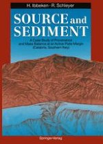
Source and Sediment

A Case Study of Provenance and Mass Balance at an Active Plate Margin (Calabria, Southern Italy)

verfasst von: Professor Dr. Hillert Ibbeken, Dr. Ruprecht Schleyer

Verlag: Springer Berlin Heidelberg

insite
SUCHEN

Über dieses Buch

Deciphering provenance - this is the study of how far geology, geomorphology and climate of a source, a mountainous area, may be reconstructable from its erosional products released to the sea; from gravel and sand, from silt, sand, clay which recombine to form a new cycle of rocks. The purpose of this book is to give a quantitative picture of both source and sediment and the masses involved in the flux of material; based on a modern case study in Calabria, southern Italy, a mountain range which is part of an active plate margin. High erosion rates in the past (200mm/ka), and dramatic ones at present (1500mm/ka), make the area a powerful source of sediment comparable to orogenic conditions of the geological past. The book presents the first systematic, quantitative and data-bank supported study - here a larger source with small rivers and their sedimentary products - of the complex topic of provenance of terrigenous sediments and related mass balances at an active plate margin. It may serve as an orientation for corresponding research in other plate tectonic realms.
Inhaltsverzeichnis

Frontmatter

Introduction

Introduction
Abstract
Why write a provenance study, when the main interest on terrigenous sediments is being shifted towards facies interpretation, basin fill, seismic stratigraphy and the like? We know that provenance work has yielded many results until now, but the main emphasis of modern studies has been on big rivers at passive margins, the results being mostly qualitative, with little regard to mass balances. Moreover, almost as a rule, only a limited number of rivers of a given area, if not only one, were usually investigated. As a consequence, no statistical tests to prove the reliability of the findings could be undertaken.
Hillert Ibbeken, Ruprecht Schleyer

The Source

Frontmatter
Chapter 1. Position and Geological Framework
Summary
Calabria forms part of the African deformed margin; the Ionian slope of the Calabrian arc is interpreted as an active plate margin, characterized by strong neotectonics, 1000m uplift during 1 Ma, and strong seismic activity. So we are dealing, for the purpose of this study, with a well-definable plate tectonic setting.
Hillert Ibbeken, Ruprecht Schleyer
Chapter 2. Basins and Channel Network
Summary
We digitized the topographic map 1: 25000 using a 250·m geomatrix and quantified nearly all geomorphological properties of the area which comprises 103 basins and interfluves. We subdivided three main physiographic provinces, Aspromonte, Zomaroand SerreProvinces; 19 larger rivers were investigated more closely.
An order and size classification of the drainagedivides and the 103 basins and interfluves did not yield meaningful results, remaining purely descriptive. Most basins are distinctly elongated; basin shapes (Horton’s formula) do not correlate with properties of the river-mouth sediments.The arrangement of the drainage basins and the basin shapes makes us assume that uplift startedwith a continuous Mid-Pleistocene emergence plain (Chap.6).
The size of the drainage basins obviously has an effect upon shelf width;the largerthe hinterland, the smallerthe shelf. The rivers are highly braided multi-channel systems. Despite maximum basin lengths of only 20 km, four rivers of the 19 main basins reach the seventh order, the other 15 rivers are all of the sixth order. Drainage density ranges between 5.1 1/km and 10.36 1/km; bifurcation ratios vary between3.8 and 5.8.
The architecture of the channelnetworkof some rivers allows us at least to speculate upon possible former river-mouth positions which may have been situated at the former shelf break
Differences of basin configuration and channel network do not correlate with distinguishable differences of the river-mouth sediments.
Hillert Ibbeken, Ruprecht Schleyer
Chapter 3. Altitude and Slopes
Summary
The altitude standard deviation, the measure of relief, varies considerably between the single basins (213 to 481 m), as does the altitude skewness, the measure of dissection (-0.144 to 1.156). However, both variables exert no influence on properties of the river-mouth sediments such as uni–or bimodality of grain-size distributions.
We found many interesting byproducts but no striking correlation between a specific geomorphological parameter of the source area and a specific sedimentological feature of the rivermouth sediment. without regard to the fact that we are dealing with steep-graded mountain rivers.
Plots of altitude versus distance from the river mouth yield insight into internal basin differentiation and the river’s longitudinal profiles. The main trunk slopes, the highest-order segments, vary between 1: 30 and 1: 110.
The regional distribution of the gradients makes it possible to delineate low-and high-gradient belts of strengthened slope erosion subparallel to the coast. The frequency distribution of the aspects, of the directions in which the slopes are facing, reveals a surprising symmetry and signalizes an almost perfect Independence of the slope directions from geology or even altitude.
Hillert Ibbeken, Ruprecht Schleyer
Chapter 4. Climate and Vegetation
Summary
Calabria has a marine mediterranean climate with a strong, altitude-dependent zonation of temperature, precipitation and consequently vegetation. From the coast to the mountains, mean annual temperatures vary between> 16and < 10°C and mean annual precipitation ranges between < 600 and > 2000 mm. Rainstorms with precipitations of more than 400 mm a day are the most striking climatic events of the area.
The flora is characterized by an overlap of west-, east and south-mediterranean plants.
Hillert Ibbeken, Ruprecht Schleyer
Chapter 5. Rock Units and Their Regional Distribution
Summary
We digitized the Carta Geologica Della Calabria (CGDC) 1: 25000 using the 250-m geomatrix. Granitic rocks cover 24% of the basins 01 — 19, metamorphic rocks yield 37%, and 39% are made up by sedimentary rocks. We condensed the 55 lithological rock units of the CGDC to eight source rock types to which the provenance discussion of this book refers: granite (24% area), gneiss (7%), schist (30%), limestone (1%), conglomerate (9%), sandstone (9%), siltstone (12%) and argillite (8%). It goes without saying that source area geology is by far the most important variable controlling the composition of river-mouth sediments.
Hillert Ibbeken, Ruprecht Schleyer
Chapter 6. Erosion and Predicted Sediment Composition
Summary
The mean erosion rate, calculated as long-term (1 Ma) erosional budget instead of sediment yield, is 178mm/ka for the total area and 206 mm/ka if only the 19 basins are calculated, maximum values being 850 mm/ka. During the reference time of 1 Ma the entire area would have been able to produce a sedimentary deposit of 100 x 100 km, 55 m thick, with a calculated pore volume of 50%.
Corresponding to the “high gradient belt”, a belt of high erosion can be established. Rock-specific erosion rates in the single basins reveal that one and the same rock type yields different erosion rates due to different positions in the mountains.
The effective composition of a basin is the area percentage of its rock types weighed by its erosion rates. This effective composition may also serve as predicted sediment composition, a reference level for the provenance discussion.
Shifting from the pure areal to the effective composition, granitic rocks drop from 24 to 15%, metamorphic rocks go from 37 to 41% and sedimentary rocks from 39 to 44%.
Hillert Ibbeken, Ruprecht Schleyer
Chapter 7. Water Budget and Dissolved Load
Summary
The mean effective precipitation in the 50-year period between 1921 and 1970 is 698 mm/a, the mean evaporation rate 48.6%. This results in an average annual runoff of 1278x 106 m3. The mean mineralization of the river waters is 322.6 ppm after the summer period and 221.4 ppm in late winter, 250 ppm being a reliable mean. About 47% of this dissolved load is regarded as being recycledor from atmospheric and anthropogenic input. The composition of the Calabrian river water corresponds fairly well to the worldwide mean of river water. Compared to the long-term (1 Ma) mean erosion rates of the 19 basins (206 mm/ka) the proportion of the present–day dissolved load is 16.3%; compared to mean actual effective erosion rates of 1527mm/ka consequently it is only 2.2%. Today the 19 basins release 319425 metric tons of dissolved load per year into the Ionian Sea, of which 169295 tons (53%) are geogenetic. This corresponds to a solid-rock cube of about 40 m side length.
Hillert Ibbeken, Ruprecht Schleyer
Chapter 8. Composition of Rocks and Soils
Summary
The igneous rocks of the Serre are mostly granodiorites. The majorityof the metamorphic rocks belong to the transition from greenschist to amphibolites facies, sometimes retrograde. Among the sediments the conglomerates are a distinct but controllable source of misleading results due to recycled gravels. The sandstones are mainly arkosic. The siltstone or olisthostrome complex contains only 20% sand (40% silt, 40% clay). The soils are dystric and eutric cambisols, orthic luvisols, calcaric regosols; we measureda mean of 71% sand, 19% silt and only 10% clay. Soils of granite and feldspathic sandstone show an arkosic composition (F/Rf and F/L> 1), while the samples from gneiss and schist show a lithic composition (F/Rf and F/L< 1). ZTR values of soil vary greatly; soils from metamorphic rocks contain 12% of ZTR and from granitic or sedimentary ones only 4%.
Hillert Ibbeken, Ruprecht Schleyer

From the Source to the River-Mouth Sediment

Frontmatter
Chapter 9. Development of the Chemical Composition of Sand
Summary
The chemical composition of the single types of source rocks and the sand fraction 63 — 500 μm of the soils, of the effective composition of the source rocks and soils, of the river-mouth sediments and of the longshore bar is compared. Gain and loss and constant-AI2O3 calculations reveal that the composition of the river-mouth sands comes closer to the source rocks than to the soils. Attrition during fluvial transport is the most important source of sand at this active plate margin, chemical weathering and soil formation being less effective.The chemical composition of the average Calabrian river-mouth sand fits almost perfectly that of active-margin sandstones; single rivers, however, deviate greatly from this mean and it may be hazardous to draw conclusions from only one or even a limited number of rivers.
Hillert Ibbeken, Ruprecht Schleyer
Chapter 10. Development of Grain-Size Distributions
Summary
Calabrian river-mouth sediments are both bimodal or unimodal. The gravel mode of the bimodal distributions, mostly Rosin-distributed, is interpreted as a first-order element, a primary feature inherited from the jointed and weathered source rocks, whereas the sand mode can be seen as a secondorder element acquired during fluvial attrition. The shape of the gravel mode varies significantly from the jointed and weathered source rocks over the river mouths to the shoreface, the latter exhibiting lognormal grain-size distributions.
If the percentage of the fraction 1–20 mm exceeds about 35%, the distributions became unimodal. Thus this fraction is crucial for modality and is called, consequently, a third-order element.
All single factors assumed to control modality alone, such as relief, basin shape, source rock petrography, the petrographical composition of the river sediment itself or postdepositional refill of interstices, fail to exert a significant or mono-causal influence on modality. In addition, no hydrodynamic conditions are known which specifically select, as a rule and within the grain-size range of gravel and sand, this fraction of 1–20 mm. Thus, other possibilities being excluded, only availability remains, but not in the sense of source area-related sediment production. It is assumed that different floods drive the “sedimentary mill” of these mountain rivers differently and that the formation of the fraction 1– 20 mm is sensitive to these differences.
Hillert Ibbeken, Ruprecht Schleyer
Chapter 11. Development of Gravel Sphericity
Summary
The axes of more than 40000 pebbles were measured. Sphericity is strongly dependent on lithology and increases with grain size. It increases from the jointed and weathered source rocks towards the river-mouth sediments and decreases along the beach, seen as a whole, that is, the sphericity distribution of the coast returns exactly to its starting pattern or joint block origin. So sphericity fails to be a useful provenance signal.
Hillert Ibbeken, Ruprecht Schleyer
Chapter 12. Special Topics of Sediment Development of Lower River Course and Beach
Summary
Grain size. We sampled the entire spectrum of grain sizes. Grain-size distributions vary only little longshore but strongly normal to the beach. This is proven by 13 large samples taken in the foreshore/shoreface strip with 800m distances and by 32 samples from a beach-normal profile (Strand Profil) from 2 m above sea level down to 4 m below, more or less continuously sampled.We were unable to find “the” grain-size distribution typical of beaches.The overall grain-size distribution of the entire beach in motion comes very close to the mean river-mouth sediment, being shifted, however, towards the fines by one phi step. The gravel modes of the foreshore/shoreface strip are predominantly Gauss-distributed, in contrast to the chiefly Rosin-distributed river-mouth gravels.This may be seen as the only grain-size characteristic predominantly developed on the beach — in Calabria.
Rock Type. Not to get lost in details, we concentrate on one rock type, “dark gneiss”, and the fraction 20–31.5 mm only, when we describe the petrographic differentiation and the development of sphericity and roundness. The amount of “dark gneiss”, a fine-grained, low resistant rock type, drops from about 55 to 45% during final fluvial transportation (7.5 km) and from about 45 to 20% during longshore transportation (9 km).
Sphericity. Mean fluvial sphericitydecreasesfrom psir = 0.61 to 0.57. Along the beach, mean sphericity drops in the direction of net transportation, strongly along the backshore strip, less evidently along the shoreface and offshore strip (distance as above). The Strand Profil displaysan amazing regular, unidirectional trend of increasing sphericity from land to sea. Sphericity is no provenancesignal.
Roundness. This property, measured as equivalent of modified Krumbein pebble-images via Fourier analysis increases from rFO = 0.48 to 0.57 during fluvial transportand from rFO = 0.6 to 0.8 during longshore transport(distances as above). Roundness is not a sensitive provenance signal, end members of very bad and very good rounding not being taken into account.
Hillert Ibbeken, Ruprecht Schleyer

River-Mouth Sediment and Provenance

Frontmatter
Chapter 13. River-Mouth Gravel
Summary
One sample of about 270 kg suffices to represent the petrographic composition of the river-mouth sediment of all fractions < 80 mm. The “petrographic mixing” of the rivers is so perfect that even after larger floods there is no change in composition.
Petrographic composition is closely connected with grain size, thus an uncritical comparison of different fractions must yield misleading results.
The amount of granitic and metamorphic debris in the rivermouth sediments (16 –80-mm fraction) correlates nicely with that of the effective rock composition of the 19 feeder basins or, in other words, the predicted sediment composition (granite: r = 0.76*, metamorphic rocks: r = 0.71*); but the sedimentary rocks do not (r = 0.45). Only the Jurassic limestones climb to r = 0.87*. The correlation source/sediment basing on the 2– 16-mm fraction is much worse.
Hillert Ibbeken, Ruprecht Schleyer
Chapter 14. River-Mouth Sand, Silt and Clay
Summary
Calabrian river-mouth sands are texturally and mineralogically immature. Quartz grains are angular and average 0.19 (Powers). The mineralogic stability index (Q/F+Rf) is commonly < 1.0. Chemical weathering is of minor importance with respect to mechanical disaggregation. Grain proportions for medium-fine sands average Q44 F20 Rf36 and Lcr73 Lvo0 Lse27. The lithic population is dominated by crystalline phanerites, both grain size and counting procedure exerting a relevant control on detrital modes. Calabrian river sands provide compositional reference data based on the previously defined metamorphic, granitic and sedimentary source areas (Chap. 8). Granitic and metamorphic provenances can be separated simply by determining large mineral groups, such as quartzose, feldspathic and lithic grains and/or transparent, opaque and altered heavy minerals; heavy minerals, however, discriminate source provinces better than light minerals (Chap. 18).
Hillert Ibbeken, Ruprecht Schleyer

Processes, Budget and Statistical Comparison

Frontmatter
Chapter 15. Mass Balances on Land
Summary
Different methods yield different values of modern erosion rates:
Object: landslides; time span: 50 years. Precipitation data from 1936 to 1986 and estimates of the volumes of landslides on air photos from 1941, 1955 and 1973 result in an estimated erosion rate of about 2700 mm/ka.
Object: sediment trap Lago Costantino; time span: 12 years. The volume of accumulated sediment corresponds to an estimated erosion rate of about 1900 mm/ka.
Object: geodetic survey of the long profile; time span: 26 years. Accumulation along the river course led to an estimated erosion rate of 900 mm/ka, the amount lost to the ocean during this time not taking into account.
Object: overall mass balance of the Buonamico [08]; time span: 50 years. The input into the Buonamico is estimated at 19 x 106 m3, the amount still stored along the river course may add up to 7.5 x 10⁶ m3 solid rock equivalents. The difference, 11.5 x 10⁶ m3, is obviously exported into the Ionian Sea. This corresponds to an erosion rate of 1527 mm/ka, seven times more than calculated from the 1 Ma mean.
Hillert Ibbeken, Ruprecht Schleyer
Chapter 16. Mass Balances in the Marine Realm
Summary
The central part of the research area is bordered by the 5-km-wide Bianco shelf and the 2-km-wide Bovalino shelf, separated by the head of the Buonamico-Careri Canyon. The shelf break is between 100 and 120 m water depth;we mapped the slope to a depth of about 900 m. The comparison of our 1974 map with soundings from 1877 reveals negative deviations or erosion in the dimension of 100 m and positive deviationsor accumulationup to 30 m. Loci of enhanced sedimentation are the canyon head and the outer shelf, where also the major slump scars occur.The conversion of only accumulation values on the shelf into erosion rates of the respective hinterland yields 7500 mm/ka. This huge value surmounts the 1-Ma average of the entire area (206 mm/ka) by factor 35 and the 50-year average of the Buonamico [08] basin (1527 mm/ka) by factor 5.
Hillert Ibbeken, Ruprecht Schleyer
Chapter 17. Comparison of Source and Sediment: a Multivariate Approach
Summary
The Euclidian distances between the basins in a kdimensional space defined by k variables were used as a measure of similarity. According to this procedure, based on both source and sediment properties, the subdivision of Calabria into Aspromonte, Zomaro and Serre Provinces has to be modified. The Aspromonte basins have to be regrouped into two subprovinces, one whose rivers reach the main divide, the large Aspromonte Province, and one whose short rivers do not, the small Aspromonte Province. Novito [13] and Torbido [14] prove to be special cases which fit neither the Zomaro Province nor the Serre Province. A t-test of the distances between different provinces and with in provinces yields the following rank of source area properties: geology and altitude separate the provinces with more than 99% significance;gradient and precipitation yield between 95 and 99% significance, and erosion rates finally separate the provinces with only less than 95% significance.The same procedure ranks the sediment properties: heavy minerals, the mineralogy of the clay fraction and gravel petrography with more than 99% significance, silt minerals and geochemistry between 95 and 99% significance and, the least, grain sizes and light minerals with less than 95% significance.It is the first time a quantitative rank and evaluation of the commonly used provenance signals has been established.
Hillert Ibbeken, Ruprecht Schleyer
Chapter 18. Summary and Conclusion
Abstract
After all this — what can be concluded? For clearness, we start with a synopsis, a condensed summary of the summaries of the 17 chapters.
Hillert Ibbeken, Ruprecht Schleyer
Backmatter
Metadaten
Titel
Source and Sediment
verfasst von
Professor Dr. Hillert Ibbeken
Dr. Ruprecht Schleyer
Copyright-Jahr
1991
Verlag
Springer Berlin Heidelberg
Electronic ISBN
978-3-642-76165-2
Print ISBN
978-3-642-76167-6
DOI
https://doi.org/10.1007/978-3-642-76165-2