Top

2019 | Book

Exploring the Nexus of Geoecology, Geography, Geoarcheology and Geotourism: Advances and Applications for Sustainable Development in Environmental Sciences and Agroforestry Research

Proceedings of the 1st Springer Conference of the Arabian Journal of Geosciences (CAJG-1), Tunisia 2018

Editors: Dr. Haroun Chenchouni, Prof. Ezzoura Errami, Prof. Dr. Fernando Rocha, Prof. Luisa Sabato

Publisher: Springer International Publishing

Book Series : Advances in Science, Technology & Innovation

insite
SEARCH

About this book

This edited volume is based on the best papers accepted for presentation during the 1st Springer Conference of the Arabian Journal of Geosciences (CAJG-1), Tunisia 2018. The book is of interest to all researchers in the fields of Environmental Sciences, Geoecology, Agroforestry, Geography, Geoarcheology and Geotourism. The Mediterranean Basin, Middle East and surrounding regions are ecologically unique due to large differences in climatic, geographical, and geological features, which grant countries of these regions with significant socio-economic potentials in terms of fertile agricultural lands, rich natural resources, and the existence of strategic resources such as crude oil and natural gas. However, the valuation of ecosystem functions, goods and services of natural and cultural heritages and bioressources of these regions is still little known. This volume offers an overview of the latest information and ideas on the physical environment of these regions, assessment and monitoring of natural bioressources including flora and fauna, and the use of cutting-edge methods for the development of sustainable agricultural systems. It gives also new socio-economic insights on geotourism and archaeology. Main topics include:1. Environmental Assessment and Monitoring of Agrisilvicultural Systems2. Environmental Impacts and Restoration Ecology of Natural and Agricultural Habitats3. Investigations and Applications in Environmental Biotechnology4. Spatiotemporal Patterns of Marine Biodiversity and Terrestrial Paleobiodiversity5. Socio-economics of Geotourism and Archaeology
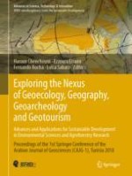
Table of Contents

Frontmatter

Keynote

Frontmatter
Using Water Chemistry to Understand Ancient Maya Land and Water Use Interactions
Abstract
A major goal of Geoarchaeology is to understand complex societies and their relationship with the environment. The Ancient Maya encountered numerous environmental challenges to live in the tropical landscape of Mesoamerica. This research was intended to provide insight into Ancient Maya Collapse and Resilience, and provide environmental models for society now and in the future. Here we focused on using geochemistry, with special attention to water, as a tool for geoarchaeological understanding of ancient Maya land and water use potentials.
Sheryl Luzzadder-Beach, Timothy Beach

Environmental Assessment and Monitoring of Agrisilvicultural Systems

Frontmatter
Digital Diffusion for Inclusive Agroecosystems
Abstract
The technological advancements in agriculture have resulted in higher yields but lower ecological efficiency and nutritional value. Little innovations in later sectors such as integrating ecological functions in the production systems have crippled our agro-ecosystems to meet the ever-growing demands. The digitization of the agro-ecosystems has become the most essential entry point for any large scale sustainable developmental entities whether it is, crop diversification, sustainable intensification, input use efficiency, agronomic practices, to restoring ecosystem services and risk management. Recent advances in geoinformatics technology and big-data analytics enabled the diffusion of ecological functions in farm production to achieve the desired return (production follows functions). The overarching goal of the ongoing effort was to build an integrated farming system by leveraging technological diffusion with sound ecological functions to design an ‘inclusive agro-ecosystem’ for sustainable development. Meta-analytics of farming systems dynamics in spatial domains help quantifying changes, trajectories and drivers under changing climate, demography and degradation process to target site specific developmental interventions and scaling the proven technologies, such as intensification of food legumes in rice fallows, adoption of conservation agriculture, quantification of yield gaps, land/water productivity and transboundary cooperation.
Chandrashekhar Biradar, Jacques Wery, Fabian Löw, Khaled El-Shama, Rajkumar Singh, Layal Atassi, Jalal Omari, Atef Swelam, Ashutosh Sarkar, Mounir Louhaichi, Boubaker Dhehibi, Enrico Bonaiuti, Bao Le, Theib Oweis, Yashpal Saharawat, Abdoul Aziz Niane, Ahmad Amri, Karan Nadagoudar, Jawoo Koo, Xiangming Xiao, Hrishikesh Ballal, M. H. Mehta
Climate and Territorial Suitability for the Vineyards Developed Using GIS Techniques
Abstract
This study assessed the wine vocation of two grapevine cultivars (Maceratino and Sangiovese) in Macerata Province (Central Italy) for different periods: 1931–1960, 1961–1990 and 1991–2014. The maps of viti-cultural potential were edited using GIS software, on the basis of late frosts, optimum temperatures, water requirement and slope. Raster math allowed the summation of the parameters considered, also assessing climate change between periods, in relation to the crops. The aim of this research was to provide a valuable tool for more rational spatial planning.
Matteo Gentilucci, Maurizio Barbieri, Peter Burt
Projected Small-Scale Range Reductions of Cedrus atlantica Forests Due to Climate Change at the Belezma National Park (Algeria)
Abstract
The aim of this study was to highlight the impact of climate change on the spatial distribution of Cedrus atlantica forests in the Belezma National Park (BNP) in Algeria. Maximum entropy (MaxEnt) species distribution modeling approach combined with 19 climatic, 15 soil-related and 15 topographical factors were implemented here for the spatial distribution of Cedrus atlantica. The future predictions of both horizons 2050 and 2070 (CCSM4 model) were carried out to understand the future suitable range of the species. Results showed that the model MaxEnt was efficient and revealed significantly higher measurement of the AUC value (Area Under Curve) compared to the random prediction. AUC was 0.986 for training and 0.980 for the test data. The response curves of species occurrence vs. environmental variables showed that climatic variables have the most significant contributions compared to edaphic and topographic factors. A very high decrease in suitable area of C. atlantica was forecast on the basis of our predictions for 2070. This indicates that the species has a little chance to survive under the conditions of the future climate change scenarios. Our findings incite us to call for urgent actions in order to reduce the vulnerability of this species’ habitats in front of climate change.
Abdelkrim Arar, Slimane Tabet, Yacine Nouidjem, Rabah Bounar, Haroun Chenchouni
Sinuosity of Meandering Channels in Upper Krishna River Basin, India
Abstract
Krishna River is one of the important drainage systems in South India. Krishna River and its tributaries, like Panchganaga and Dudhaganaga Rivers, show a meandering planform morphology. The Krishna River and its tributaries originate in the high rainfall region of Western Ghat. Flood discharge conditions of these channels cause change in channel morphology like the formation of chute channels or cut-off processes. To understand the cut-off channel formation, hydraulic and topographic sinuosity of channel segments were calculated. To this end, three segments of each channel were considered first, before meander, second at the meander and third after the meander of the channel were calculated. It is observed that when the hydraulic sinuosity is greater than the topographical sinuosity, chute channels are formed in the upper Krishna Basin.
Suchitra Pardeshi, Sudhakar Pardeshi, Pallavi Kulkarni

Environmental Impacts and Restoration Ecology of Natural and Agricultural Habitats

Frontmatter
An Assessment of Environmental Impact on Agriculture in the Indus Delta Pakistan
Abstract
The agriculture sector in Pakistan is still the country backbone. Indus Delta was historically recognized as fertile land but the present study revealed that the severe kind of water-flow and sediment discharge from River Indus to the Deltaic area has changed the situation and deteriorated the greatest part of the agricultural land in the delta. Earlier, during the 1980s, the water flow condition of the Indus River used to be good. The finding related to the land degradation and its impact on the agricultural sector has been compiled and analyzed. (i) The results show that a large area has been submerged by the sea invasion, causing about 26% of the land of six coastal administrative units (Talukas) unusable (ii) The data collected for the period of 1998–99 to 2007–08 show extreme losses in cultivable area and more than 80% of the land was abandoned. (iii) The data collected for the same period related to the yield of rice, sugarcane and sesame also show a declining trend. (iv) Based on a survey conducted in the region, the annual earning of a farmer’s family was estimated to be only $ 2 US per day. If enough water were supplied to the delta for agricultural and coastal areas or sea then the situation will be improved.
Gohar Ali Mahar, Nayyer Alam Zaigham
Conservation of Wetlands on Tunisian Islands: Kerkennah and Kuriat Islands as a Case Study
Abstract
Mediterranean islands’ wetlands have a crucial role in protecting not only the islands of the region from the effects of climate change and natural hazards, but also a wide range of endangered and endemic wildlife species, including a significant number of migratory birds. Islands’ wetlands have highly dynamic changing ecosystems due to the effects of isolation and the anthropogenic perturbations that put these natural systems in a major distress and threaten their well-functioning and existence. Thus, these areas are one of the world’s most threatened ones. Therefore, it is important to know, understand and monitor the changes within them to better understand the ecosystem and habitats dynamics. Through the Mediterranean Islands’ Wetlands project, a methodology has been developed by the WWF Greece and disseminated to 9 Mediterranean countries in order to inventory more than 14,000 Mediterranean islands’ wetlands located on 160 islands. In this project, Google earth’s satellite images, national land use geo-databases with previous inventories’ output were combined to identify, delineate and document possible wetlands. Together with in situ field inventory, these findings were used to better understand the evolution and changes in the systems and create a scientific database for all islands’ wetlands. The aim of this study was to apply this methodology to the Tunisian islands’ wetlands focusing on the significant number of wetlands that were identified in Kerkennah and Kuriat islands. This study showed the importance of building a scientific database to better understand the identified areas, and monitor their evolution in order to set up restoration and conservation strategies.
Khouloud Ben Charfi, Amjad Kallel, Thanos Giannakakis, Imen Rais
Vegetation Analysis of Chott Tinsilt and Sebkhet Ezzemoul (Two Ramsar Sites in Algeria) in Relation to Soil Proprieties
Abstract
The vegetation of two Ramsar wetlands (Chott Tinsilt and Sebkhet Ezzemoul) was characterized in this research study. Plant community included 34 species belonging to 16 families in Chott Tinsilt and 43 species belonging to 17 families in Sebkhet Ezzemoul. Most of the species are halophytes with low-medium vegetation cover. The generalized linear model indicated that the soil’s electrical conductivity and organic matter are the main drivers of spatiotemporal variations of plant species richness, abundance and distribution. This study proved the high plant diversity in these two wetlands, which makes a real biological heritage.
Adel Bezzalla, Moussa Houhamdi, Haroun Chenchouni
Nabkha Morphometry and Properties of Aeolian Sediments Around Native Plants in Kuwait
Abstract
The aeolian sediments (mobile sand and dust) trapped along native plants create a geomorphological landform, known as nabkhas. About 600 core samples from aeolian accumulations settled around 15 species of main native plants in Kuwait. Cyperus conglomeratus, Haloxylon salicornicum and Rhanterium epapposum nabkha sediment is characterized by more alkaline (pH) values, low moisture content and electrical conductivity (EC). The later plants contain short branches spacing and are at close distances from the nearby nabkhas. The Astragalus sp. nabkhas mean grain sizes are considered the finest and contain considerable carbonate percentages as it grows in playa and alluvial fan deposits. Citrulus sp. nabkhas are characterized by the lowest pH, EC, and moisture content but the highest content of carbonate in comparison to other native plants. Lycium sp. has the longest distance between branches and to the equivalent nearby species. The maximum aeolian accumulation volume was noted around Nitraria retusa, Lycium shawii, Haloxylon salicornicum and Calligonum polygonoides up to 21.9, 15.5, 14.5, and 13.3 m3, respectively, which spot them as the most effective solutions for future applications in controlling aeolian activities in the region. This study aimed to assess the sediment properties around native plants and detect the most efficient plants in controlling aeolian activities in Kuwait.
Ali Al-Dousari, Modi Ahmed, Noor Al-Dousari, Safaa Al-Awadhi
The Ecological Role of Cornulalca aucheri (Amaranthaceae) in the Stabilization of Degraded Sandy Soils in Kuwait: The Case Study of Liyah Area
Abstract
Cornulaca aucheri is an annual and biannual herb considered as a disturbance indicator currently visible and widely distributed in disturbed lands in Liyah area in Kuwait. Such area suffers from severe land degradation due to multiple interacting factors such as, overgrazing, camping and recreation, gravel and sand quarrying, military activities and natural processes. A restoration program was applied after the quarry surface irregularities were refilled and levelled. During the past 10 years of rehabilitation, noticeable healthy cover of Cornulaca sp. has been seen especially around an artificial lake and playas. The existence of such species in high density means that the restoration program was a success and was transitted from bare ground to Cornulaca and annual forb state. This is a lower state of Range State Transition Succession model, but it is better than bare soil. Cornulaca sp. is a native desert plant that grows in arid conditions. Despite its spiny leaves, it provides good food for camels and increases the supply of milk produced by lactating females. It is about 80 cm tall and has a stem that is branched from the base with new faster greenery growth in the summer. It shows good environmental potential to be managed as natural types used for restoration of degraded lands in desert areas.
Modi M. Ahmed, Noor Al-Dousari, Ali M. Al-Dousari
Orchard Understory Species Diversity in Relation to Orchard Age and Soil Factors (in Ibadan, Southwestern Nigeria)
Abstract
The relationship between species richness and environmental variables enhances valid conclusions on the effect of biodiversity on ecosystem processes. Extant literatures exist on the relationship between species richness, a measure of biodiversity and ecosystem functionality. Therefore, this study examined understory plant species diversity of Citrus orchards (Citrus sinensis) between the young (twenty years) and the old (forty years) in relation to soil parameters. Direct method of gradient analysis was used whereby sample plots were randomly located and marked at the study site and understory plant species per unit area recorded and categorized. A set of 30 quadrats and 39 quadrats were taken in the young and old orchards respectively. The collected data in the undergrowth were subjected to an ecological analysis. The data were analyzed using Simpson’s index, student T-test and canonical correspondence analysis (CCA). The result of the diversity index showed that the older orchards had greater species dominance than the younger ones. The t-test shows a significant difference between orchards (t = 0.03, P = 2.27). The placement of environmental variables in CCA showed that the first gradient (that is, the main explainable variation in floristic composition) was positively correlated with pH, total nitrogen and negatively with clay content.
Olutoyin Adeola Fashae, Adeyemi Oludapo Olusola, Arioluwa Aribisala, Aishah Oyeniyi

Investigations and Applications in Environmental Biotechnology

Frontmatter
Effect of Climatic Factors on Essential Oil Accumulation in Two Lamiaceae Species from Algerian Semiarid Lands
Abstract
Plant metabolism is vastly influenced by climatic factors in terms of quantity and quality. In this regard, the objective of this study was to assess the impact of some climatic factors on the amount of essential oils (EOs) in two plant species growing spontaneously in an Algerian semiarid zone: Thymus algeriensis Boiss & Reut. and Rosmarinus officinalis L. for five successive years (2010–2014). Essential oils were extracted from plant aerial parts by hydrodistillation using Clevenger type system and the oil yield rates were estimated in relation to the dry matter of the plants. The obtained results showed significant differences in EO yields during the five years, among the species and the interaction ‘Year × Species’ (P < 0.001). R. officinalis accumulated the best oil content during 2010, 2012 and 2013 with 1, 0.93 and 0.88% respectively. T. algeriensis yielded higher EOs in 2013 followed by 2012 and 2011 with 1.08, 0.67 and 0.59% respectively. Furthermore, R. officinalis produced higher EO amount than T. algeriensis. Oils accumulation increased significantly with the increase of precipitation, wind speed and hygrometry but was negatively influenced by air humidity and aridity in both species.
Souad Mehalaine, Haroun Chenchouni
A Biotechnological Method for Breeding Grapes Using in Vitro Growth Stimulants
Abstract
The aim of the research was to found grape breeding method that allows obtaining virus-free plants during breeding. It used the apical meristem for grapes breeding which is usually free from viruses. The conducted observations showed that a part of meristems was necrotic during the first stage of cultivation (2 weeks). The remaining meristems have evolved into micropiles of 2–2.5 mm which were re-transplanted. One month after planting, the surviving apical meristems were transplanted into a nutrient medium containing the same components. The transplantation was carried out in biological test tubes performed during 45–55 days for formation of regenerants with a size of 6–10 cm and obtaining microclones. The obtained material quality was measured according to growth regulators implemented such as 6-benzylaminopurine (6-BAP) and gibberellic acid (GA). It was found the microshoots grown on a medium with GA and 6-BAP concentration of 0.5 mg/l developed the most effective and virus free grape plants. 40% of the survival rate of the apical meristems was reached which allowed their further cultivation and propagation aiming at the production of virus-free planting material.
Abdulmalik Batukaev, Mukail Mukailov, Magomed Batukaev, Tatiana Minkina, Svetlana Sushkova
Effects of Inoculation with Rhizospheric Pseudomonas on Physiological Responses in the Broad Bean (Vicia Faba) Grown Under Copper Stress
Abstract
The accumulations of chemical pesticides residues in soils represent one of the greatest risks for the environment and especially for plants. The copper bioviability in rhizosphere is the clearest aspect of this pollution process, causing high levels of metal stress, reducing crops yield by altering physiological and biochemical processes in plants. To face such risks, researchers have frequently studied the effect of plant growth promoting rhizobacteria (PGPR) as enhancer of the plant growth under abiotic stress. The goal of this study was firstly to know the level of broad bean tolerance to metal stress of copper, and its physiological effects in the plant, on the one hand, and the role of plant-Pseudomonas interaction in enhancing the plant tolerance level to metal stress, on the other. In this study, three Pseudomonas strains were isolated and screened by salinity and copper tolerance, then they were individually used as an inoculum in rhizosphere of broad bean Vicia faba (OTONO variety) in the presence of 0; 2.5; 10 and 20 mM.L-1 of CuSO4. According to the obtained results, under copper stress conditions with and without bacterial inoculation, the production of biomass and total chlorophyll content were significantly decreased. Copper treatments increased proline content in inoculated plants with P7 and P15 strains and in those which were not inoculated. However, this content was decreased in inoculated plants with P1 strain. The inoculation with P1, P7 and P15 strains motivated the production of fresh biomass and accumulation of proline, and otherwise decreased total chlorophyll content in plants.
Boubaker Idder, Rachid Djibaoui, Abdelhakim Reguieg Yassaad El Hocine, Abdelhak Djoudi

Spatiotemporal Patterns of Marine Biodiversity and Terrestrial Paleobiodiversity

Frontmatter
Arcellinida (Testate Lobose Amoebae) as Sensitive Bioindicators of Arsenic Contamination in Lakes
Abstract
Arcellinida (testate lobose amoebae) are sensitive to arsenic (As) contamination from historic gold mining in Canadian subarctic lakes. Partial redundancy analysis revealed that As (9.4%) and S1 (labile organic matter, 8.9%) were the most important contributors to variance in faunal distribution. Arcellinida are important intermediary food web components in lacustrine environments. Microbes are their primary food source and elevated As-levels are known to suppress microbial growth (S1). The observed correlations are likely to be related to As-destabilization of Arcellinida microbial food supplies. To assess the utility of arcellinidans as tracers of temporal variation in As, we analyzed a freeze core from Frame Lake in the city of Yellowknife, which requires remediation following a steep decline in water quality through the 1960s that left it dead. Land-use activities in the area of the lake are well documented but little information is available regarding their impact on the lake itself. Geochemical, sedimentological and arcellinidan analysis showed that the system was non-depositional from the mid Holocene until ~1962 when the lake began to rapidly infill with highly As contaminated sediments. Since the early 1990s runoff from the catchment, and reduced lake circulation associated with installation of a causeway with rarely opened sluiceways at the only outlet, has caused eutrophication.
R. Timothy Patterson, Nawaf A. Nasser, Braden R. B. Gregory, Melody J. Gavel, Etienne Menard, Jennifer M. Galloway, Helen M. Roe
Massive Molluscan Shell Accumulation on the Sea Side of Land Strips of Amvrakikos Gulf Lagoon Complex (NW Greece)
Abstract
The analysis of the molluscan shells deposition on the sea side of land strips of the lagoon complex of the NW Amvrakikos Gulf shows that bivalve (61.10%) and gasteropod (12.48%) shells constitute the major share of the organogenic material of the sea side land strips. Major representative bivalve species are Cerastoderma glaucum (35.32%) and Polititapes aureus (17.89%), while a range of other species, such as Loripes orbiculatus (4.06%), Mytilus galloprovincialis (2.76%), Peronidia albicans (2.66%), Chamelea gallina (1.80%), Modiolus barbatus (1.03%), Parvicardium exiguum (1.00%) were also present.
Konstantinos Tsolakos, George Katselis, John A. Theodorou
Vertical Distribution of Recent Benthic Ostracoda at Pullivasal and Kurusadai Islands, Gulf of Mannar, Southeast Coast of India
Abstract
Two core samples were collected during April 2017 from the territorial zone of two islands in the Gulf of Mannar; Pullivasal and Kurusadai for a length of about 1.05 and 0.87 m respectively, at a low tide of the day. Calcium carbonates, organic matter, type of substrate were determined at a resolution of 2.5 cm for both cores. A total of thirty-six Recent Benthic Ostracoda species were identified. The species as well as their assemblage were found and compared with the parameters determined. The vertical distribution of species and their diversity, abundant species and the occurrence of cosmopolitan species within the region of study were discussed. The study is based on the environmental parameters that promotes Ostracoda diversities as well as for their abundance, in order to create an information system on the resources of Gulf of Mannar.
Kumari Deepali, Sithu G. D. Sridhar, Shaik M. Hussain, Subramanian Maniyarasan
Ecological Interactions of Miocene to Pleistocene Siwalik Bovids, Suids and Giraffids Traced Out by Enamel Hypoplasia Analysis
Abstract
Enamel hypoplasia is the thinning of enamel caused by depletion of ameloblasts (enamel forming cells) during tooth development. The depletion of ameloblasts is associated with the physiological or environmental stress that an animal faced during its life history, so this dental defect can provide us a permanent and reliable record of the ecological stress faced by an animal during its tooth development. The fossils discovered from the Siwalik deposits of Pakistan having chronological age from 18.3 to 0.6 Ma and belonging to thirteen bovid, eight suid and seven giraffid species of the Siwalik regions were analyzed for comparative occurrence of enamel hypoplasia. The moderate level of stress throughout the Siwaliks for all the three studied families was inferred by enamel hypoplasia results. This shows that even though the studied three Siwalik artiodactyle families have diversity in their ecological behavior, the changing climatic condition throughout the Siwaliks had strong impact on the species of all the three studied taxa.
Abdul Majid Khan, Rana Manzoor Ahmad, Ayesha Iqbal
Why Anthracotheroides had Faced Family Level Extinction: Enamel Hypoplasia an Answer to the Question
Abstract
The extinction of the Siwalik anthracotheroides is a family level extinction. In order to point out the possible causes of this extinction the occurrence of enamel hypoplasia is compared in 848 teeth of 487 extinct animals belonging to 39 species of 7 Siwalik artiodactyle families. The stratigraphic range of the analyzed material is from early Miocene-Pleistocene. The results show that the occurrence of enamel hypoplasia is in highest percentage in anthracotheroides among the Siwalik artiodactyle families and occurrence of enamel hypoplasia is also high in the anthracotheroides throughout their stratigraphic range in the Siwalik region. The high occurrence of enamel hypoplasia means high level of ecological stress faced by an animal so the current enamel hypoplasia analysis results indicate that the anthracotheroides had faced the highest ecological stress among all the Siwalik artiodactyls. The cumulative effect to these unfavorable ecological conditions might be the cause to this family level extinction.
Rana Manzoor Ahmad, Abdul Majid Khan, Amtur Rafeh, Ayesha Iqbal, Ghazala Roohi

Socio-economics of Geotourism and Archaeology

Frontmatter
Urban Accessibility and Its Economic Linkage Analysis: A Case Study in Beijing, Tianjin and Hebei Region, China
Abstract
Based on the analysis of urban function intensity index, this paper applied and improved potential model to implement measurement of the urban accessibility composite and spatial differences analysis in Beijing-Tianjin-Hebei Region of China. The results showed that, the grade of urban accessibility and economic linkage intensity in Beijing-Tianjin-Hebei Region were inhomogeneous; the spatial patterns of urban accessibility and economic linkage intensity in Beijing-Tianjin-Hebei Region revealed a spatial pattern distribution of spheres structure. According to the spatial pattern distribution rule of accessibility and economic linkage intensity, this paper revealed the problem of spatial pattern structure and traffic network structure in Beijing-Tianjin-Hebei Region, explained the role that economic level, development model and location playi in the difference of spatial accessibility, and proposed policy recommendations for improving the accessibility of transport networks.
Chenxi Li
An Assessment of Socio-economic Profile and Sustainable Development in Tourism Potential Areas: A Case Study of Galiyat (Pakistan)
Abstract
Pakistan is a country with a great potential of tourism but unfortunately this sector has remained badly neglected. The north and west of Pakistan attracts tourists from all over the world due to its eye-catching natural beauty, massive and unique glaciers, sky-scraping peaks, fast flowing rivers and historical sites related to different civilizations. In spite of these facts the socio-economic conditions of these tourist rich areas are unsatisfactory. The present study was an attempt to assess the socio-economic profile of the tourist potential region of Lesser Himalayas-The Galiyat, by a comprehensive questionnaire. Galiyat is the most attractive destination among the local tourists and hence badly affected by mass tourist and unplanned construction. This study suggested a sustainable economic development in the study area using indigenous resources and potential, and proposed suitable sites for eco-tourism development.
Razzaq Ahmed, Shaukat H. Khan, Khalida Mahmood
Archaeology and Archaeometry of Ceramics of the Roman City of Thaenae (Tunisia): Between Inland Roman Africa and the Mediterranean Basin
Abstract
This research project is about the archaeological and archaeometric characterization of African ceramics. The development of a combined archaeological, petrographic and geochemical approach is currently one of the most promising approaches for the determination of ancient ceramic productions and their tracing throughout the Mediterranean basin. Tested on the collection of African Red Slip wares of the Museum of Gap (France), this interdisciplinary method is currently tested on the ceramic material of the Ancient city of Thaenae/Thyna (Tunisia). This integrated study aimed to provide a characterization of the pottery production specific to the Thaenae site, measure its diffusion in the Mediterranean basin and determine the economic role of Thaenae during late antiquity. The development of rigorous protocols would allow the application of this approach to other ceramic productions in the Mediterranean basin.
Rémi Rêve, Jean-Paul Ambrosi, Claudio Capelli, Michel Bonifay, Abdelhamid Barkaoui
“Giallo Antico” in Roman Architecture of Lombardy: A Preliminary Survey
Abstract
“Giallo antico” is a historical term to identify a limestone coming from Chemtou (Jendouba, northern Tunisia) featuring a yellow ground crossed with red veins. This stone pertains to the ancient coloured marbles, a group of different stone materials used in architecture and for decoration in the whole Roman Empire. Giallo antico was extensively used in Lombardy (Northern Italy) as witnessed in many archaeological sites (Temples, houses, villas, baths and mausoleums) of Milano, Como, Cremona, Brescia. A preliminary survey allowed classifying hundreds of artefacts of Giallo antico (slab for flooring and for veneering, architectural elements as shafts or capitals) occurring also in the rural areas of the regional territory.
Roberto Bugini, Luisa Folli, Romina Marchisio
Metadata
Title
Exploring the Nexus of Geoecology, Geography, Geoarcheology and Geotourism: Advances and Applications for Sustainable Development in Environmental Sciences and Agroforestry Research
Editors
Dr. Haroun Chenchouni
Prof. Ezzoura Errami
Prof. Dr. Fernando Rocha
Prof. Luisa Sabato
Copyright Year
2019
Electronic ISBN
978-3-030-01683-8
Print ISBN
978-3-030-01682-1
DOI
https://doi.org/10.1007/978-3-030-01683-8