2023 | Buch

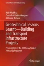
Geotechnical Lessons Learnt—Building and Transport Infrastructure Projects

Proceedings of the 2021 AGS Sydney Annual Symposium

herausgegeben von: Hadi Khabbaz, Cholachat Rujikiatkamjorn, Ali Parsa

Verlag: Springer Nature Singapore

Buchreihe : Lecture Notes in Civil Engineering

insite
SUCHEN

Über dieses Buch

This book contains accepted papers submitted and peer-reviewed for the 25th Annual Symposium organised by the Sydney Chapter of the Australian Geomechanics Society (AGS). The objective is to bring together the key stakeholders of the Australian geological and geotechnical community. It showcases state-of-the-art practices, new research findings, and case histories that demonstrate geotechnical advances and challenges in building and transport infrastructure. It focuses on geotechnical aspects of smart solutions and improvements in geotechnical approaches for transport infrastructure projects, advances in tunnel design and construction, and geotechnical challenges in design and construction – case histories and lessons learnt. This volume will be a useful guide to those in academia and industry working in the fields of geotechnical engineering.
Inhaltsverzeichnis

Frontmatter
Smart Solutions in a Circular Economy for Advancing Railroad Design and Construction Using Recycled Materials
Abstract
Ballasted rail tracks are the most common type of transportation infrastructure. However, ballast progressively degrades under dynamic and impact loads. The degree of degradation will be accelerated due to the increasing demand for elevated speeds of passenger trains and heavier axle loads for freight trains. It is, therefore, necessary to develop novel and cost-effective technologies to enhance the longevity and performance of tracks through amended design and construction. Over the past two decades, a number of studies have been conducted by the researchers of Transport Research Centre (TRC) at the University of Technology Sydney (UTS) to investigate the ability of recycled rubber mats/pads, as well as waste tyre cells and granulated rubber to improve the stability of track substructure materials including ballast and sub-ballast layers. This paper presents an overview of these novel methods and materials based on comprehensive laboratory tests using iconic testing facilities. Test results from comprehensive laboratory tests and field studies have indicated that the use of energy-absorbing rubber inclusions can substantially improve overall track stability. The findings reflect the following: (i) the inclusion of recycled-rubber based synthetic energy absorbing layers (SEAL: SFS-CW-RC mixture) significantly attenuates the magnitude of the dynamic load with depth and ballast breakage, (ii) an alternative solution by using CW-RC mixtures as capping layer is also introduced in this study, and the compressibility of the rubber is captured by cyclic compression triaxial tests, (iii) the installation of under ballast mats (UBM) significantly reduces permanent vertical and lateral deformation of ballast as well as ballast degradation, (iv) waste tyre cells infilled with granular aggregates effectively increase the stiffness and bearing capacity of the capping layer and help mitigate track displacement, and (v) field tests indicate geogrids and shockmats are efficient methods to reduce the track displacement and ballast degradation. These research outcomes provide promising approaches to transform traditional track design practices to cater for future high-axle rolling stock carrying heavier loads.
Buddhima Indraratna, Yujie Qi, Cholachat Rujikiatkamjorn, Miriam Tawk, Fatima Mehmood, Sinniah K. Navaratnarajah, Tim Neville, Jim Grant
Geotechnical Designs Gone Wrong—Lessons Learnt
Abstract
Since the occurrence of several apartment building problems in recent years, government agencies have taken steps to promote a greater level of building design and construction compliance. For example, the Design and Building Practitioners Regulation 2021 (NSW) [1, 2] that came into force on 1 July 2021 requires engineering reports associated with Class 2 buildings (i.e. residential or part-residential) to be signed by a registered Design Practitioner with relevant qualifications and skills, and a completion compliance certificates to be issued by the various design discipline practitioners of the project and submitted by a registered Professional Engineer. Perhaps time will tell, but the author is sceptical that the introduction of additional government regulations would necessarily reduce the number of failures in geotechnical practice. The author believes that it may be helpful for the industry to publish more case studies on geotechnical failures so that lessons can be learnt from common mistakes. This paper outlines some common geotechnical design problems encountered based on 50 or so expert witness cases that the author has been involved in during the last decade and provides a generalized discussion on some of the most prevalent geotechnical design issues and the lessons learnt.
Patrick K. Wong
The Challenges of Field Measurement of Suction Within Free-Standing Mainline Railway Embankments
Abstract
For over 100 years, adequate performance has been observed for free-standing mainline railway embankments despite the typically rudimentary earthworks techniques used. Notwithstanding this performance, use of effective stress limit equilibrium analyses often do not satisfy the design criteria adopted today. Embankments on the Main Southern Railway are frequently up to 20 m high and have been subjected to environmental events; including drought, intense rainfall, flooding on their upslope side and substantial earthquake loading over the last century. In addition, these same embankments can be subjected to the influence of subsidence from underground mining. One feasible explanation of their adequate performance is the presence of suction within the body of the embankments. The phenomenon of suction has attracted much study and is thought to be understood by the geotechnical profession. Nevertheless, recognition of suctions within engineering analysis are seldom attempted. What is known as suction can be measured under laboratory conditions and its presence is accepted in the field. However, its measurement in the field, especially at depth, is technically challenging. There is a dearth of research and reported installations of this nature, particularly for embankments and the authors are endeavouring to correct this. The hope is that this paper will stimulate discussion within the geotechnical profession by providing an update on the authors attempts to measure suction at depth in the field with commercially available instruments, and whilst illustrating the challenges faced.
Andrew Leventhal, Tim Hull, Nasser Khalili
Excessive Post-construction Settlement of Improved Ground—Case Histories
Abstract
This paper presents a few case histories where excessive settlements were reported following ground improvement of a number of soft soil sites. The case histories involved different ground improvement techniques such as preloading and surcharging with and without prefabricated vertical drains (PVD), deep soil mixing, concrete injected columns and vacuum consolidation. The ground conditions and the adopted ground improvement designs are discussed. The observed post-construction settlements for the various cases are also presented. Further, the back-analysis works are detailed in order to provide some insight into the possible contributing factors to the measured excessive settlements. It is clear from these case histories that observational approach by monitoring the ground behaviour during and after ground treatment and construction should be adopted to ensure that the post-construction performance is consistent with design expectation. In addition, the paper demonstrates that selection and design of the ground improvement techniques should be conducted with clear understanding of the theoretical background and limitation of the improvement techniques, regardless of the system adopted. Consideration of construction activities and staging is also important in order to capture the impact of various construction loading on soft soil consolidation and settlement.
Kim Chan
A Smart Geotechnical and Geological Approach for Future Building and Transport Infrastructure Projects
Abstract
There is a rapid and unprecedented scale of infrastructure planning and development across the Sydney region. A SMART approach that captures historical ground investigation and regional geological data is required to support early transport planning by Government. This will allow the refinement of geological and geotechnical knowledge gaps that will be augmented with additional investigation once these corridors are further assessed as the design develops. To allow a SMART approach in infrastructure planning and development, Government Departments and potentially the private sector could integrate their internal geological and geotechnical data as part of a centralised state-wide data collection centre. This will require Government to legislate a registry system for factual geotechnical data for all Departments and Authorities. Consideration would also need to be given to how to release this information from the private sector many of whom would claim this was their intellectual property despite typically being derived (and paid services for) from Government projects. Consideration should be given to a two-stage process so as not to derail the implementation due to potential delays with the private sector:
(i)
Combine and integrate geological and geotechnical data from historical Government projects including those delivered under corporatised government entities.
 
(ii)
Integration of factual data obtained from the private sector.
 
Any data compiled under both (i) and (ii) will need to be relied upon without any impact or recourse to the originators. This has been key to the success of similar data sharing mechanisms in the United Kingdom (British Geological Survey) and the Netherlands (Dutch Geological Survey). A way of making this work successfully in New South Wales, following successful international models such the UK and Netherlands, is to have government allow contracts or documentation to have historic data relied upon. The State will achieve better value for money by way of having significantly more geological and geotechnical data as part of Environmental Impacts Statements to inform approvals and stakeholders as well as for its Request for Proposals (RFP). In all cases with more reliable information a better outcome will be achieved by way of increased certainty and avoiding approval delays, possible injunctions, as well as more informed Request for Tenders (RFTs).
David J. Och
Deep Wet Soil Mixing Columns Ground Treatment Technique-Lesson Learnt from Project
Abstract
Deep Wet Soil Mixing (WSM) ground treatment columns have been designed and constructed first time on TfNSW Lisarow to Ourimbah Stage 3B project to meet performance requirements for embankment and retaining wall foundation. However, during construction, the project faces a number of challenges such as reuse of several thousand cubic meter of soil–cement mixed waste material produced from WSM construction, various quality control testing issues and construction difficulties arising from interlayered stiff/dense soil. Hence, the project team developed extensive field trials and innovative solutions to mitigate all these challenges. Instrumentation monitoring results obtained from settlement plate, inclinometer, piezometer, survey plugs and wall tags suggested that primary consolidation settlement of the WSM treated ground is virtually completed within one month after the construction. Field monitoring results also reveal that settlements and lateral movements of the bridge approach embankments and hybrid retaining wall (Reinforced Soil Wall combined with L-shaped wall) foundations are much less than the predicted design values. In addition, the trend of the 12 months monitoring results provides confidence on the long-term performance of these structures, which is expected be smaller than the predicted values. Furthermore, it is revealed that about 5000 m3 of soil–cement mixed waste material/spoil have been recycled, and used successfully as fill materials for various civil engineering applications at the project site. Following the several field testing regime, it is concluded that only Unconfined Compressive Strength (UCS) testing from the cored samples is the most reliable quality control measure for high strength WSM materials. In addition, strength and deformation parameters of the field core samples are proven to be increased with the increase of curing time. Hence, it is recommended to include curing effects on the design of deep soil mixed columns ground improvement technique for future projects.
A H M Kamruzzaman, Andy Aldridge, Kim Chan
Improvements to the Observational Method in New South Wales Road Tunnel Construction
Abstract
The past 5 years has seen an unprecedented boom in tunnel construction in Sydney. Road tunnels in particular, continue to push both design and construction to their limits, no less than when Sydney Harbour Tunnel was constructed 30 years ago. Integral to the safe and efficient construction of road tunnels has been the application of the Observational Method in design and construction. This paper describes some important “lessons learned” in implementing the Observational Method in New South Wales road tunnels since the construction of the Sydney Harbour Tunnel. Underground infrastructure construction in New South Wales in the early 1990’s had very few precedents. Construction of the major underground excavations relied on application of the principles of the Observational Method as described by Peck in 1969. This concentrated on validating design assumptions against detailed monitoring data. As confidence in the ability to predict the behaviour of rock masses in the Sydney Region increased, it could be argued that appreciation of the fundamentals of the Observational Method diminished to a process of collecting data for the sake of collecting data, rather than being a live tool to identify and manage geotechnical hazards. The tunnel collapses in the Cross City Tunnel (2004) and Lane Cove Tunnel (2005) led to the industry reassessing tunnel construction risk management. The Permit to Tunnel (PTT) process was born, and at its heart, it provides a means to manage geotechnical risk via a formalised process that includes reviewing of observations by both designers and constructors and agreement to continue construction, within the main principles of the Observational Method. However, over the past 5 years, the author has observed waning deference to the Observational Method. Construction processes used on major projects, including the Observational Method, the PTT and associated processes have become opportunities for contractors and designers to modify certified designs in an ad hoc manner, often without design changes being adequately reviewed against key criteria such as safety, stability and durability. This paper aims to identify key concerns with the current implementation of the Observational Method through the PTT process. Recommendations are proposed to reset practice to ensure designs are constructed safely and owners are provided with assurances that construction delivers the intended design.
Phil Clark
Precision Tunnelling Under Heritage Building in Sydney CBD
Abstract
The design of a pedestrian tunnel has been completed as a part of the integrated station design of Metro Martin Place (MMP). This tunnel connects two deep station entrance shafts (up to 28 m deep) and is located immediately below a hundred-year-old heritage building in Sydney CBD area. The heritage building is ornately finished and therefore extremely sensitive to ground movement. During detailed design, it was identified that Mass Concrete Backfill (MCB) supporting the building foundations was found to extend within the tunnel profile. Numerical modelling was carried out to assess the design of tunnel support for ground and building loads. It has also been used to estimate the surrounding ground deformation and foundation settlement of the building. The tunnel is mainly formed within Hawkesbury Sandstone impacted by the Martin Place Joint Swarm. The ground model including overall stratigraphy, in-situ stress condition, and rock/joint parameters was developed according to available borehole information, surrounding tunnel and excavation mapping, and past project experience. 3DEC software package was utilised to develop a local model and a global model simulating the interaction between rock and joints due to the tunnelling using determinate Discrete Fracture Network (DFN). The local model assessed sensitivity of MCB in terms of settlement due to different rock-MCB interface parameters. The global model captured the overall ground deformation and considered the effects of staged construction for the entire project site. The numerical results formed the basis of final tunnel support design, the impact assessment of the heritage building and monitoring strategies to minimise the impact on the building above and provide safe design.
Adrian Callus, Ruoshi Xu, Hannes Lagger, Josef Rabanser
Design of Complex Permanent Tunnel Linings at Sydney Metro’s Victoria Cross Station
Abstract
The permanent tunnel linings of Victoria Cross Station include complex intersections associated with their asymmetric geometry, significant groundwater and rock loads, and the large span of the station cavern. Victoria Cross is one of six underground railway stations recently completed by the John Holland CPB Ghella JV (JHCPBG JV) as part of the Sydney Metro City and Southwest project. Sydney Metro is Australia’s biggest public transport project, which will deliver 31 metro stations and more than 66 km of new metro rail line. It runs from Sydney’s northwest region, beneath Sydney Harbour, through new CBD stations and then southwest to Bankstown. Victoria Cross Station comprises a 265 m long cavern with several pedestrian and service adits connecting the cavern to two adjacent shafts. Located beneath Miller Street in North Sydney, it includes the largest cavern on the project with a clear span of 24 m and internal height of almost 16 m. The design of the permanent lining at the intersection between the lift access adit, lift shaft and the cavern was particularly challenging due to the complex geometry. The lift shaft intersects the crown of the cavern and connects to the access adit located above the cavern, with these two structures separated by only a 2 m thick sandstone slab. A range of numerical modelling techniques were developed to address the various design considerations which applied to this complex intersection. The design requirement for the station permanent lining to be tanked led to the lining having to accommodate significant groundwater loads in addition to the large rock loads associated with a cavern of this span. Three-dimensional finite element modelling was undertaken to assess the interaction between the cavern and overlying lift adit structures as well as to inform the articulation and waterproofing details at different structural interfaces.
Yun Bai, Strath J. Clarke
Differentiating Fill and Natural Soft Clays—The Value of Desktop Studies in Building a Geological Model
Abstract
This paper presents the methodology and rationale used when differentiating fill and natural soft clays in a site on waterfront reclaimed land. The area of reclaimed land has a history of settlement impacting existing developments, which has motivated careful consideration of the ground conditions for future works. As the reclaimed land was dredged locally then loaded by fill and warehouses, it closely resembles the underlying estuarine and marine sediment lithology and consistency. Two historical ground investigations and one Arup ground investigation have been conducted, including clusters boreholes, cone penetrometer tests, seismic dilatometer tests and lab testing. The four types of subsurface information were compared to build and verify a ground model with an emphasis on the extent of reclaimed land. Peripheral desktop study information including historical maps, imagery, sea level records, and the historical settlements observed at site were considered to assist in differentiating the fill and natural soft clays. The importance of understanding this site’s history reinforces the value of a thorough desktop study when developing geological models.
Luke Johnstone, Sergei Terzaghi
Geotechnical Challenges in Design and Construction of Bridge Foundations and Approaches in Hilly Granite Formation
Abstract
This paper presents a case study of geotechnical design and construction challenges of bridge foundations and approaches in a hilly granite formation in northern New South Wales, Australia. Firstly, the geological formation and existing cut slope conditions which have high risks of rock fall will be described. The original design was based on the available geotechnical information and assumed construction methodology. Reinforced concrete cantilever retaining walls founded on mass concrete were adopted for the bridge southern approach to resolve constructability issues over hilly terrain. The design considered retaining wall block sliding stability while overturning and internal stabilities were satisfied. Slope treatments using a rock fall fence together with individual boulder stabilisation or removal were also considered. It was found during construction that the actual ground conditions were different to that originally inferred and modifications to pad footing designs were deemed necessary. Additional investigations were undertaken, and the subsurface ground models updated to inform the revised design. For the northern bridge abutment foundation, a piled foundation was introduced to optimise the design with due consideration of temporary piling platform and access along a new geotextile reinforced approach embankment. The revised design was developed in close collaboration with the Contractor and the Principal. The foundation design of Pier 2 was revised using micro-piles to address the presence of a weak rock layer intrusion. In the end, key lessons learnt from this challenging project have been summarised for future project references.
Q. J. Yang, J. J. Dane
Shear Strength Testing for Geotechnical Structures
Abstract
As geotechnical engineers, we often poke our finger into soil or hit rocks with a hammer to provide information used to select material properties required for design. The observations made while visiting the site to use the finger or hammer provide valuable additional information about the site, including the setting, materials and geometry. In some cases the inspection and finger are sufficient in other cases, a combination of approaches, including laboratory testing should be undertaken to build confidence in the material properties adopted in our designs. As a designer the more information we have about our problem, including the material properties, the more efficiently and safely we can design our structures. Geotechnical engineers have a good practice of providing detailed specifications for placement of fill and although there is generally good control on fill placement there is often no specification for the shear strength limits or shear strength testing frequency. This paper provides some results of shear strength testing of fill material derived from sandstone tunnel spoil used for temporary retaining structures and working platforms on a recent infrastructure project. It has been asserted that the extent of testing should be linked to the sensitivity to material properties, the complexity, size and cost of the structure being designed.
Rahsn Witt
Metadaten
Titel
Geotechnical Lessons Learnt—Building and Transport Infrastructure Projects
herausgegeben von
Hadi Khabbaz
Cholachat Rujikiatkamjorn
Ali Parsa
Copyright-Jahr
2023
Verlag
Springer Nature Singapore
Electronic ISBN
978-981-9911-21-9
Print ISBN
978-981-9911-20-2
DOI
https://doi.org/10.1007/978-981-99-1121-9