2007 | Buch

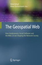
The Geospatial Web

How Geobrowsers, Social Software and the Web 2.0 are Shaping the Network Society

herausgegeben von: Prof. Arno Scharl, Prof. Klaus Tochtermann

Verlag: Springer London

Buchreihe : Advanced Information and Knowledge Processing

insite
SUCHEN

Über dieses Buch

The most important attribute of geospatial platforms is their unique potential to aggregate a multitude of public and private geographic data sets, providing access to data from government agencies, industry and the general public. NASA and other organizations have a wealth of planetary science data – representing the output from thousands of satellites in earth-orbit, and from dozens of costly missions to other planets. Benefits derived from both the data and visual interfaces to access the data represent a significant return on investment for the public. Integrating geospatial data with semantic and collaborative Web technology multiplies the public benefits and represents the main focus of this book. The user interfaces of geobrowsers are designed for the layperson, giving conv- ient access to all kinds of geographically referenced information. Geobrowsers hide the technical details related to finding, accessing and retrieving such information. The daunting challenge of the Geospatial Web is to seamlessly integrate and display vastly different information modes. Nowadays, it is not enough to simply display a map of some region; additional dynamic information modes need to be displayed and put into context – from weather sensor readings and live aerial video feeds to daily news updates, photo collections and video archives.
Inhaltsverzeichnis

Frontmatter

Foundations Of The Geospatial Web

1. Towards the Geospatial Web: Media Platforms for Managing Geotagged Knowledge Repositories
International media have recognized the visual appeal of geo-browsers such as NASA World Wind and Google Earth, for example, when Web and television coverage on Hurricane Katrina used interactive geospatial projections to illustrate its path and the scale of destruction in August 2005. Yet these early applications only hint at the true potential of geospatial technology to build and maintain virtual communities and to revolutionize the production, distribution and consumption of media products. This chapter investigates this potential by reviewing the literature and discussing the integration of geospatial and semantic reference systems, with an emphasis on extracting geospatial context from unstructured text. A content analysis of news coverage based on a suite of text mining tools (webLyzard) sheds light on the popularity and adoption of geospatial platforms.
Arno Scharl
2. Infrastructure for the Geospatial Web
Geospatial data and geoprocessing techniques are now directly linked to business processes in many areas. Commerce, transportation and logistics, planning, defense, emergency response, health care, asset management and many other domains leverage geospatial information and the ability to model these data to achieve increased efficiencies and to develop better, more comprehensive decisions. However, the ability to deliver geospatial data and the capacity to process geospatial information effectively in these domains are dependent on infrastructure technology that facilitates basic operations such as locating data, publishing data, keeping data current and notifying subscribers and others whose applications and decisions are dependent on this information when changes are made. This chapter introduces the notion of infrastructure technology for the Geospatial Web. Specifically, the Geography Markup Language (GML) and registry technology developed using the ebRIM specification delivered from the OASIS consortium are presented as atomic infrastructure components in a working Geospatial Web.
Ron Lake, Jim Farley
3. Imaging on the Geospatial Web Using JPEG 2000
As geospatial imagery becomes more available and more commonly in demand as an indispensable part of the geospatial community's workflows, new solutions must be found for overcoming the barriers that have marginalized image data in the past — in particular, the compression of massive image sets without loss of quality and inclusion of the geographic metadata that would make imagery “spatially aware”. The relatively new JPEG 2000 standard is ideally suited as a delivery technology for geo-referenced imagery, but a few features are still required for use in the Geospatial Web, including a mechanism for representing geo-spatial metadata and bandwidth-aware standards for client/server interchange of image data. This article discusses JPEG 2000 and gives examples of some of the emerging technologies surrounding it — largely from the Open Geospatial Consortium (OGC) — which together make it the right imaging format for the Geospatial Web.
Michael P. Gerlek, Matthew Fleagle
4. What's So Special about Spatial?
Geospatial information can act as a thread that can be used to integrate information from heterogeneous sources. It does so by exploiting common location information components that often exist across different domains. As such it has the potential to be a valuable resource in the implementation of the Semantic Web. This chapter examines the challenges of adding a geospatial component to the Web, with particular reference to doing so in a way that also supports the current initiatives to semantically enable the Web. It identifies those that are largely peculiar to geography and those that, whilst issues within geography, are also likely to occur in many other domains.
Glen Hart, Catherine Dolbear

Navigating The Geospatial Web

5. Conceptual Search: Incorporating Geospatial Data into Semantic Queries
Traditional queries require users to invoke specific data sources, manually integrate data across multiple sources and interpret the results. These costly operations are increased for geospatial data, which may have elaborate formats and require complex geospatial operations. Conceptual search solves these problems by leveraging semantic technologies to give a new paradigm for querying data sources. New semantic geospatial tools are also added to facilitate geospatial reasoning. Conceptual search can be implemented via a service-oriented architecture for further benefits.
William Kammersell, Mike Dean
6. Location-based Web Search
In recent years, the relation of Web information to a physical location has gained much attention. However, Web content today often carries only an implicit relation to a location. In this chapter, we present a novel location-based search engine that automatically derives spatial context from unstructured Web resources and allows for location-based search: our focused crawler applies heuristics to crawl and analyze Web pages that have a high probability of carrying a spatial relation to a certain region or place; the location extractor identifies the actual location information from the pages; our indexer assigns a geo-context to the pages and makes them available for a later spatial Web search. We illustrate the usage of our spatial Web search for location-based applications that provide information not only right-in-time but also right-on-the-spot.
Dirk Ahlers, Susanne Boll
7. Ubiquitous Browsing of the World
Pervasive computing technologies, together with the increasing participation of the Web community in feeding geo-located information within tools such as Google Earth, will soon make available a huge amount of real-time information about the physical world and its processes. This opens up the possibility of exploiting all such information for the ubiquitous provisioning of context-aware services for “browsing the world” around us. However, for this to occur, proper general-purpose data models and software infrastructures must be developed. In this chapter, we propose a simple, yet effective model for the representation of heterogeneous contextual information and the design and implementation of a general user-centric infrastructure for ubiquitous browsing of the world. The presentations of some exemplar services we have implemented over it and have made available to users via Google Earth interfacing complete the chapter.
Gabriella Castelli, Alberto Rosi, Marco Mamei, Franco Zambonelli
8. Spatiotemporal-Thematic Data Processing for the Semantic Web
This chapter presents practical approaches to data processing in the space, time and theme dimensions using existing Semantic Web technologies. It describes how we obtain geographic and event data from Internet sources and also how we integrate them into an RDF store. We briefly introduce a set of functionalities in space, time and semantics. These functionalities are implemented based on our existing technology for main-memory-based RDF data processing developed at the LSDIS Lab. A number of these functionalities are exposed as REST Web services. We present two sample client-side applications that are developed using a combination of our services with Google Maps service.
Farshad Hakimpour, Boanerges Aleman-Meza, Matthew Perry, Amit Sheth

Building The Geospatial Web

9. A Semantic Approach for Geospatial Information Extraction from Unstructured Documents
Local cultural heritage document collections are characterized by their content, which is strongly attached to a territory and its land history (i.e., geographical references). Our contribution aims at making the content retrieval process more efficient whenever a query includes geographic criteria. We propose a core model for a formal representation of geographic information. It takes into account characteristics of different modes of expression, such as written language, captures of drawings, maps, photographs, etc. We have developed a prototype that fully implements geographic information extraction (IE) and geographic information retrieval (IR) processes. All PIV prototype processing resources are designed as Web Services. We propose a geographic IE process based on semantic treatment as a supplement to classical IE approaches. We implement geographic IR by using intersection computing algorithms that seek out any intersection between formal geocoded representations of geographic information in a user query and similar representations in document collection indexes.
Christian Sallaberry, Mauro Gaio, Julien Lesbegueries, Pierre Loustau
10. Enhancing RSS Feeds with Extracted Geospatial Information for Further Processing and Visualization
Internet users are flooded with information and are thankful for help in categorizing and visualizing textual content. Geographical categorization is one of the most important criterion for filtering, grouping and prioritizing information as users are naturally more interested in local information. We describe a way to extract geographical information from textual content using natural language processing, and we display the information within a geographical context on maps and satellite images. Using the widely supported RSS format as the input format, this approach allows us to process content from nearly all online news sites and blogs.
Marc Wick, Torsten Becker
11. A Supervised Machine Learning Approach to Toponym Disambiguation
This chapter presents a toponym disambiguation approach based on supervised machine learning. The proposed approach uses a simple hierarchical geographic relationship model to describe geographic entities and geographic relationships among them. The disambiguation procedure begins with the identification of toponyms in documents by applying and extending the state-of-the-art named entity recognition technologies and then performs disambiguation as a supervised classification processes over a feature space of geographic relationships. A geographic knowledge base is modeled and constructed to support the whole disambiguation procedure. System performance is evaluated on a document collection consisting of 15,194 local Australian news articles. The experiment results show that the disambiguation accuracy ranges from 73.55 to 85.38 percent depending on the running parameters and the learning strategies used.
You-Heng Hu, Linlin Ge

Geospatial Communities

12. Geospatial Information Integration for Science Activity Planning at the Mars Desert Research Station
NASA's Mobile Agents project leads coordinated planetary exploration simulations at the Mars Desert Research Station. Through ScienceOrganizer, a Web-based tool for organizing and providing contextual information for scientific data sets, remote teams of scientists access and annotate data sets, images, documents and other forms of scientific information, applying predefined semantic links and metadata using a Web browser. We designed and developed an experimental geographic information server that integrates remotely sensed images of scientific activity areas with information regarding activity plans, actors and data that had been characterized semantically using ScienceOrganizer. The server automatically obtains remotely sensed photographs of geographic survey sites at various resolutions and combines these images with scientific survey data to generate “context maps” illustrating the paths of survey actors and the sequence and types of data collected during simulated surface “extra-vehicular activities.” The remotely located scientific team found the context maps were extremely valuable for achieving and conveying activity plan consensus.
Daniel C. Berrios, Maarten Sierhuis, Richard M. Keller
13. Inferences of Social and Spatial Communities over the World Wide Web
The research presented in this chapter introduces a graph-based and computational modeling approach to the analysis of Web-based networks. The aim is to derive a social network and compute its emerging spatial and thematic properties from the semantics embedded in a series of Web pages. We apply several graph-based operators and complement them with thematic, spatial and similarity operators. The principles of the modeling approach are applied to the study of research communities as they appear over the World Wide Web. This allows us to infer the degree of correlation between the different properties of the semantic networks that emerge from research communities on the World Wide Web.
Pragya Agarwal, Roderic Béra, Christophe Claramunt
14. Participating in the Geospatial Web: Collaborative Mapping, Social Networks and Participatory GIS
In 2005, Google, Microsoft and Yahoo! released free Web mapping applications that opened up digital mapping to mainstream Internet users. Importantly, these companies also released free APIs for their platforms, allowing users to geo-locate and map their own data. These initiatives have spurred the growth of the Geospatial Web and represent spatially aware online communities and new ways of enabling communities to share information from the bottom up. This chapter explores how the emerging Geospatial Web can meet some of the fundamental needs of Participatory GIS projects to incorporate local knowledge into GIS, as well as promote public access and collaborative mapping.
L. Jesse Rouse, Susan J. Bergeron, Trevor M. Harris
15. Sharing, Discovering and Browsing Geotagged Pictures on the World Wide Web
In recent years the availability of GPS devices and the development in Web technologies have produced a considerable growth in geographical applications available on the Web. In particular, the growing popularity of digital photography and photo sharing services has opened the way to a myriad of possible applications related to geotagged pictures. In this work we present an overview of the creation, sharing and use of geotagged pictures. We propose an approach to providing a new browsing experience of photo collections based on location and heading information metadata.
Carlo Torniai, Steve Battle, Steve Cayzer
16. Supporting Geo-Semantic Web Communities with the DBin Platform: Use Cases and Perspectives
The aim of this chapter is to show how the need for advanced cooperative annotation and information exchange can be addressed using a paradigm called “Interconnected Geo-Semantic Web Communities”. The use cases and its associated needs are highlighted, and then the base tool for this work, the DBin Semantic Web information manager, is focused on. DBin enables users to create and experience the Semantic Web by exchanging RDF knowledge in peer-to-peer (P2P) “topic” channels. Once sufficient information has been collected locally, rich and fast browsing of semantically structured knowledge becomes possible, even offline, without generating external traffic or computational load. DBin has a number of modules to support cooperative tagging and annotations of geographical objects. Different communities of users, e.g., concerned with different kinds of geographic objects, can each exploit DBin to cooperate in enriched geo-semantic spaces. Advanced users, e.g., cultural heritage agencies, can join multiple groups at the same time and use collective cross-domain knowledge.
Giovanni Tummarello, Christian Morbidoni, Michele Nucci, Ernesto Marcheggiani

Environmental Applications

17. A Geospatial Web Platform for Natural Hazard Exposure Assessment in the Insurance Sector
The work of natural hazard exposure assessment involves various geographic data sets (referential, hazard, assets) and various disciplines intended for insurance professionals (catastrophe modeling, prevention engineering). The emergence of Geospatial Web technology induces the emergence of new sets of online services. Mission Risques Naturels (MRN) is a French actor in the mutualization and diffusion of information on natural hazards knowledge and prevention for the general interest of insurance professionals. The MRN Web-GIS platform has been built to address these requirements. This chapter starts by presenting the role of MRN in the network of natural hazard assessment. It then presents Geospatial Web tools for natural hazard exposure assessment as well as the system architecture of the MRN Web-GIS platform, including all its services.
Julien Iris, JérÔme Chemitte, Aldo Napoli
18. Development, Implementation and Application of the WebGIS MossMet
Since 1990, “Heavy Metals in Mosses Surveys” have been performed every five years in at least 21 European countries, including Germany, in order to map spatial and temporal trends of the metal bioac-cumulation in terrestrial ecosystems. The monitoring data consist of measurement data on metal loads in ectohydrical mosses as well as site-specific metadata to characterize the sampling locations with regard to, e.g., vegetation, land use and the distance of the sites to emission sources. To optimize the data handling for the moss survey 2005/06, we developed the WebGIS MossMet with the help of open-source components. Thus, the metadata can be integrated with the information system via the Internet by the moss samplers. The WebGIS MossMet comprehensively documents the metadata, the measurement values and statistically derived metal bioaccumulation indices regionalized for ecoregions depicting the landscape coverage of Germany. In the German moss survey 2005/06, the WebGIS MossMet was applied routinely.
Roland Pesch, Gunther Schmidt, Winfried Schröder, Christian Aden, Lukas Kleppin, Marcel Holy
19. European Air Quality Mapping through Interpolation with Application to Exposure and Impact Assessment
An air quality information system should offer the most complete information about air quality in a given region. AirBase contains thousands of monitoring stations across Europe, but the density varies across regions. For both public information and assessments of the exposure on human health and ecosystems, which are important indicators for air quality policy developments, the situation between stations should be known. Traditionally, assessment is based on monitoring data, but information in between stations requires accurate interpolation methods. This chapter reviews, examines and applies interpolation methodologies with special attention to the differences between urban/suburban and rural data. The methodologies are applied to ozone and PM10 indicators. Maps of annual average PM 10 are shown to illustrate the recommended methodology in obtaining integrated rural- and urban-scale maps for Europe.
Peter A. M. de Smet, Jan Horálek, Bruce Denby
20. Introduction to Ubiquitous Cartography and Dynamic Geovisualization with Implications for Disaster and Crisis Management
Several large-scale data and information infrastructures (SDI) are being created (INSPIRE, GMES) to support management and decision-making processes, and they are also used for solving a wide range of problems, including crisis management. These solutions require updated, precise, interoperable and integrated spatial data and information equipped with metadata. Up-to-date information, their suitable structuring and easy access to them are necessary for supporting timely and correct decision making in emergency/crisis situations. Most such information is geo-referenced. Cartographic visualization plays an important role for a user's orientation. Visualization is not an isolated element of the information transfer process; it depends on the status of source databases, decision support models, and the behavior of users. Current solutions of crisis management employ static cartographic visualizations based on prepared models of crisis situations. The chapter concentrates on ubiquitous cartography and dynamic geovisualization of real-time models and on the project “Dynamic Geovisualization in Crisis Management” undertaken at Masaryk University in the Czech Republic.
Jirí Hrebícek, Milan Konecný
21. Fire Alerts for the Geospatial Web
The Advanced Fire Information System (AFIS) is a joint initiative between CSIR and Eskom, the South African electricity utility. AFIS infers fire occurrences from processed, remotely sensed data and triggers alarms to Eskom operators based on the proximity of fire events to Eskom's infrastructure. We intend on migrating AFIS from a narrowly focussed “black-box” application to one servicing users in multiple fire-related scenarios, enabling rapid development and deployment of new applications through concept-based queries of data and knowledge repositories. Future AFIS versions would supply highly tuned, meaningful and customized fire alerts to users based on an open framework of Geo-spatial Web services, ontologies and software agents. Other Geospatial Web applications may have to follow a similar path via Web services and standards-based architectures, thereby providing the foundation for the Geospatial Web.
Graeme McFerren, Stacey Roos, Andrew Terhorst

Geospatial Web Services

22. Geospatial Web Services: The Evolution of Geospatial Data Infrastructure
Geographic information is a valuable resource for applications and analysis where location of objects and events can enhance policy, land use and decision-making activities. Interoperability has been an ongoing activity of the geodata user community for decades, focusing on formats and standards. The recent popularity and adoption of the Internet and Web Services have provided a new means of interoperability for geodata, differing from previous approaches to information exchange. This chapter provides an overview of Geospatial Web Services as better methods to achieve efficient data exchange. The emerging Web 2.0 phenomenon is also discussed in the context of this approach.
Athanasios Tom Kralidis
23. SWING – A Semantic Framework for Geospatial Services
The ability to represent geospatial semantics is of great importance when building geospatial applications for the Web. The Semantic Web Service (SWS) technology provides solutions for intelligent service annotation, discovery, composition and invocation in distributed environments. Deploying this technology into geospatial Web applications has the potential to enhance discovery, retrieval and integration of geographic information, as well as its reuse in various contexts. This chapter gives an overview of the SWING research framework, which is aimed at investigating the applicability of semantic technologies in the area of geo-spatial services. The goal is to provide a semantic framework that facilitates the employment of geospatial services to solve a specific task in geo-spatial decision making. In this chapter, we emphasize the motivation and the challenges for such a framework, point out the main components and highlight its potential impact.
Dumitru Roman, Eva Klien
24. Similarity-based Retrieval for Geospatial Semantic Web Services Specified Using the Web Service Modeling Language (WSML-Core)
What prevents the Geospatial Web from taking off is not a missing architecture and protocol stack but, beside other aspects, the question of how Web services can be semi-automatically discovered and whether and to what degree they satisfy user requirements. Two approaches turned out to be useful for semantic-enabled geospatial information retrieval: subsumption reasoning and similarity measurement. However, while the former one can be applied to query service ontologies described in OWL-S or WSMO/WSML, most existing similarity theories are not able to cope with logic-based service descriptions. This chapter presents initial results in developing a directed and context-aware similarity measure that compares WSML concept descriptions for overlap and therefore supports retrieval within the upcoming Geospatial Web.
Krzysztof Janowicz
25. Geospatial Data Integration with Semantic Web Services: The eMerges Approach
Geographic space still lacks the semantics allowing a unified view of spatial data. Indeed, as a unique but all encompassing domain, it presents specificities that geospatial applications are still unable to handle. Moreover, to be useful, new spatial applications need to match human cognitive abilities of spatial representation and reasoning. In this context, eMerges, an approach to geospatial data integration based on Semantic Web Services (SWS), allows the unified representation and manipulation of heterogeneous spatial data sources. eMerges provides this integration by mediating legacy spatial data sources to high-level spatial ontologies through SWS and by presenting for each object context dependent affordances. This generic approach is applied here in the context of an emergency management use case developed in collaboration with emergency planners of public agencies.
Vlad Tanasescu, Alessio Gugliotta, John Domingue, Leticia Gutiérrez Villarías, Rob Davies, Mary Rowlatt, Marc Richardson, Sandra Stinčić
Backmatter
Metadaten
Titel
The Geospatial Web
herausgegeben von
Prof. Arno Scharl
Prof. Klaus Tochtermann
Copyright-Jahr
2007
Verlag
Springer London
Electronic ISBN
978-1-84628-827-2
Print ISBN
978-1-84628-826-5
DOI
https://doi.org/10.1007/978-1-84628-827-2

Premium Partner